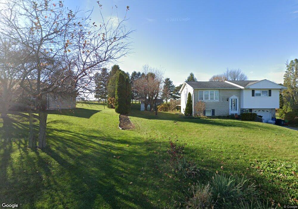
1675 Mill Rd Lebanon, PA 17042
North Cornwall NeighborhoodEstimated Value: $273,592 - $318,000
3
Beds
2
Baths
874
Sq Ft
$334/Sq Ft
Est. Value
About This Home
This home is located at 1675 Mill Rd, Lebanon, PA 17042 and is currently estimated at $292,148, approximately $334 per square foot. 1675 Mill Rd is a home located in Lebanon County with nearby schools including Cornwall Elementary School, Cedar Crest Middle School, and Cedar Crest High School.
Ownership History
Date
Name
Owned For
Owner Type
Purchase Details
Closed on
Oct 8, 2025
Sold by
Pence Gregory J and Wengert Carol L
Bought by
Pence Kathryn J
Current Estimated Value
Home Financials for this Owner
Home Financials are based on the most recent Mortgage that was taken out on this home.
Original Mortgage
$228,200
Outstanding Balance
$228,200
Interest Rate
6.56%
Mortgage Type
New Conventional
Estimated Equity
$63,948
Create a Home Valuation Report for This Property
The Home Valuation Report is an in-depth analysis detailing your home's value as well as a comparison with similar homes in the area
Home Values in the Area
Average Home Value in this Area
Purchase History
| Date | Buyer | Sale Price | Title Company |
|---|---|---|---|
| Pence Kathryn J | $285,270 | None Listed On Document |
Source: Public Records
Mortgage History
| Date | Status | Borrower | Loan Amount |
|---|---|---|---|
| Open | Pence Kathryn J | $228,200 |
Source: Public Records
Tax History Compared to Growth
Tax History
| Year | Tax Paid | Tax Assessment Tax Assessment Total Assessment is a certain percentage of the fair market value that is determined by local assessors to be the total taxable value of land and additions on the property. | Land | Improvement |
|---|---|---|---|---|
| 2025 | $3,805 | $154,200 | $53,300 | $100,900 |
| 2024 | $3,470 | $154,200 | $53,300 | $100,900 |
| 2023 | $3,470 | $154,200 | $53,300 | $100,900 |
| 2022 | $3,359 | $154,200 | $53,300 | $100,900 |
| 2021 | $3,181 | $154,200 | $53,300 | $100,900 |
| 2020 | $3,157 | $154,200 | $53,300 | $100,900 |
| 2019 | $3,031 | $154,200 | $53,300 | $100,900 |
| 2018 | $2,975 | $154,200 | $53,300 | $100,900 |
| 2017 | $739 | $154,200 | $53,300 | $100,900 |
| 2016 | $2,921 | $154,200 | $53,300 | $100,900 |
| 2015 | -- | $154,200 | $53,300 | $100,900 |
| 2014 | -- | $154,200 | $53,300 | $100,900 |
Source: Public Records
Map
Nearby Homes
- 932 Meadowood Cir
- 931 Meadowood Cir
- 840 Wheatfield Ln
- 836 Wheatfield Ln
- 706 Brookside Ln
- 117 Blackford Blvd Unit 209
- 117 OTB Unit 105. Plan at 117 On The Boulevard
- 117 Blackford Blvd Unit 307
- 117 Blackford Blvd Unit 111
- 117 Blackford Blvd Unit 110
- 117 Blackford Blvd Unit 205
- 117 Blackford Blvd Unit 211
- 117 OTB Unit 106. Plan at 117 On The Boulevard
- 117 Blackford Blvd Unit 309
- 117 OTB Units 102, 202, 302 Plan at 117 On The Boulevard
- 117 Blackford Blvd Unit 210
- 117 Blackford Blvd Unit 201
- 117 Blackford Blvd Unit 108
- 117 Blackford Blvd Unit 103
- 117 Blackford Blvd Unit 311
- 1665 Mill Rd
- 1685 Mill Rd
- 1695 Mill Rd
- 1655 Mill Rd
- 1705 Mill Rd
- 1645 Mill Rd
- 1635 Mill Rd
- 1625 Mill Rd
- 1775 Mill Rd
- 1657 Mill Rd
- 1615 Mill Rd
- 0 Ws Quentin Rd Unit PALN2012014
- 0 Ws Quentin Rd Unit PALN118514
- 541 Ns Hemlock Ln
- 0 Ws Lebanon Rd
- 0 Ws Quentin Rd Unit PALN111872
- 0 Ss Walnut St
- 100 Ss Phillip Dr
- 0 Ws N Cornwall Rd Unit 1000104528
- 0 Ss Foxchase Ln Unit 1000096918