Estimated Value: $231,997 - $305,000
3
Beds
2
Baths
1,434
Sq Ft
$191/Sq Ft
Est. Value
About This Home
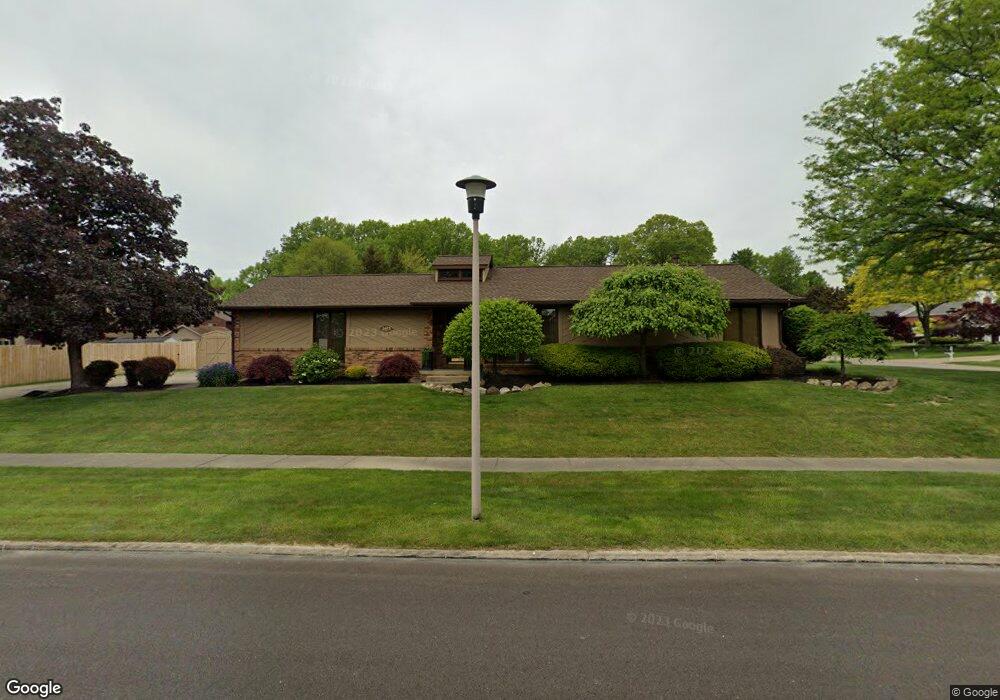
This home is located at 1675 Pheasant Run, Niles, OH 44446 and is currently estimated at $273,749, approximately $190 per square foot. 1675 Pheasant Run is a home located in Trumbull County with nearby schools including Niles Primary School, Niles Intermediate School, and Niles Middle School.
Ownership History
Date
Name
Owned For
Owner Type
Purchase Details
Closed on
Jun 29, 2005
Sold by
Reese Lynn
Bought by
Raymond Jack S and Raymond Diana E
Current Estimated Value
Home Financials for this Owner
Home Financials are based on the most recent Mortgage that was taken out on this home.
Original Mortgage
$148,590
Outstanding Balance
$77,716
Interest Rate
5.69%
Mortgage Type
New Conventional
Estimated Equity
$196,033
Purchase Details
Closed on
Jan 1, 1990
Bought by
Sandra L Cope
Create a Home Valuation Report for This Property
The Home Valuation Report is an in-depth analysis detailing your home's value as well as a comparison with similar homes in the area
Home Values in the Area
Average Home Value in this Area
Purchase History
| Date | Buyer | Sale Price | Title Company |
|---|---|---|---|
| Raymond Jack S | $165,000 | -- | |
| Sandra L Cope | -- | -- |
Source: Public Records
Mortgage History
| Date | Status | Borrower | Loan Amount |
|---|---|---|---|
| Open | Raymond Jack S | $148,590 |
Source: Public Records
Tax History
| Year | Tax Paid | Tax Assessment Tax Assessment Total Assessment is a certain percentage of the fair market value that is determined by local assessors to be the total taxable value of land and additions on the property. | Land | Improvement |
|---|---|---|---|---|
| 2024 | $2,610 | $60,310 | $9,730 | $50,580 |
| 2023 | $2,586 | $60,310 | $9,730 | $50,580 |
| 2022 | $2,304 | $45,890 | $8,790 | $37,100 |
| 2021 | $2,419 | $45,890 | $8,790 | $37,100 |
| 2020 | $2,441 | $45,890 | $8,790 | $37,100 |
| 2019 | $2,447 | $43,790 | $8,790 | $35,000 |
| 2018 | $2,440 | $43,790 | $8,790 | $35,000 |
| 2017 | $2,427 | $43,790 | $8,790 | $35,000 |
| 2016 | $2,376 | $42,460 | $8,790 | $33,670 |
| 2015 | $2,350 | $42,460 | $8,790 | $33,670 |
| 2014 | $2,359 | $42,460 | $8,790 | $33,670 |
| 2013 | $2,347 | $44,600 | $8,790 | $35,810 |
Source: Public Records
Map
Nearby Homes
- 1675 Roosevelt Ave
- 1804 Niles Vienna Rd
- 1919 Carnegie Heights Dr
- 1436 Clinton St
- 352 N Rhodes Ave
- 745 Youngstown Warren Rd
- 1486 Tripodi Cir
- 1442 Youll St
- 340 Mcevoy Ct
- 2243 N Glenwood Ave
- 924 Nob Hill Dr Unit 3
- 2153 Coates Dr
- 2620 Pine Oak Ct
- 2218 Crestmont Dr
- 0 James St
- 2139 Coates Dr
- 126 S Rhodes Ave
- 1236 Robbins Ave
- 820 Hartzell Ave
- 812 Hartzell Ave
- 1883 Cardinal Ct
- 1886 Taft Ave
- 1879 Cardinal Ct
- 1882 Taft Ave
- 1676 Pheasant Run
- 1672 Pheasant Run
- 1680 Pheasant Run
- 1668 Pheasant Run
- 1888 Cardinal Ct
- 1878 Taft Ave
- 1882 Cardinal Ct
- 1875 Cardinal Ct
- 1684 Pheasant Run
- 1664 Pheasant Run
- 1874 Taft Ave
- 0 Pheasant
- 1660 Pheasant Run
- 1881 Taft Ave
- 1874 Cardinal Ct
- 1871 Cardinal Ct
Your Personal Tour Guide
Ask me questions while you tour the home.