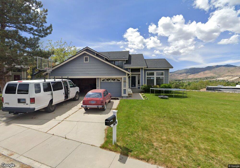
1675 Pinecrest Ct Reno, NV 89523
Mae Anne Avenue NeighborhoodEstimated Value: $808,000 - $1,052,000
4
Beds
4
Baths
3,366
Sq Ft
$266/Sq Ft
Est. Value
About This Home
This home is located at 1675 Pinecrest Ct, Reno, NV 89523 and is currently estimated at $894,843, approximately $265 per square foot. 1675 Pinecrest Ct is a home located in Washoe County with nearby schools including Sarah Winnemucca Elementary School, B D Billinghurst Middle School, and Robert McQueen High School.
Ownership History
Date
Name
Owned For
Owner Type
Purchase Details
Closed on
Sep 25, 1995
Sold by
Cooney Ronald F and Cooney Beth L
Bought by
Foote Raymon D and Foote Cynthia C
Current Estimated Value
Home Financials for this Owner
Home Financials are based on the most recent Mortgage that was taken out on this home.
Original Mortgage
$158,400
Interest Rate
7.62%
Create a Home Valuation Report for This Property
The Home Valuation Report is an in-depth analysis detailing your home's value as well as a comparison with similar homes in the area
Home Values in the Area
Average Home Value in this Area
Purchase History
| Date | Buyer | Sale Price | Title Company |
|---|---|---|---|
| Foote Raymon D | $198,000 | Western Title Company Inc |
Source: Public Records
Mortgage History
| Date | Status | Borrower | Loan Amount |
|---|---|---|---|
| Previous Owner | Foote Raymon D | $158,400 |
Source: Public Records
Tax History
| Year | Tax Paid | Tax Assessment Tax Assessment Total Assessment is a certain percentage of the fair market value that is determined by local assessors to be the total taxable value of land and additions on the property. | Land | Improvement |
|---|---|---|---|---|
| 2026 | $3,409 | $160,605 | $62,701 | $97,904 |
| 2025 | $4,424 | $159,987 | $59,724 | $100,263 |
| 2024 | $4,296 | $157,350 | $55,755 | $101,595 |
| 2023 | $4,296 | $156,085 | $59,204 | $96,881 |
| 2022 | $4,170 | $127,938 | $46,956 | $80,982 |
| 2021 | $4,050 | $113,035 | $32,078 | $80,957 |
| 2020 | $3,932 | $115,042 | $33,534 | $81,508 |
| 2019 | $3,710 | $107,708 | $30,667 | $77,041 |
| 2018 | $3,600 | $98,083 | $22,386 | $75,697 |
| 2017 | $3,504 | $96,239 | $20,081 | $76,158 |
| 2016 | $3,413 | $97,307 | $19,600 | $77,707 |
| 2015 | $858 | $96,439 | $18,251 | $78,188 |
| 2014 | $3,307 | $91,318 | $15,757 | $75,561 |
| 2013 | -- | $87,471 | $12,987 | $74,484 |
Source: Public Records
Map
Nearby Homes
- 0 Simons Dr
- 1705 Sierra Highlands Dr
- 1598 Grazer Way
- 1596 Grazer Way
- 1584 Grazer Way
- 5833 Altitude St
- 5857 Morgan Horse St
- 5861 Morgan Horse St
- 2224 Escalera Way
- 3320 Heights Dr
- 5722 Golden Eagle Dr
- 2130 Canyon Mesa Ct
- 5764 Golden Eagle Dr
- 3271 Heights Dr
- 3286 Heights Dr
- 6052 Bankside Way
- 3264 Barbara Cir
- 5132 Aspen View Dr
- 1155 Beldon Way
- 0000 Mccarran
- 1625 Pinecrest Ct
- 1619 Pinecrest Ct
- 1600 Pinecrest Ct
- 1640 Pinecrest Ct
- 1660 Pinecrest Ct
- 5331 Simons Dr
- 5351 Simons Dr
- 5321 Simons Dr
- 5380 Simons Dr
- 1620 Pinecrest Ct
- 1680 Pinecrest Ct
- 5371 Simons Dr
- 5410 Simons Dr
- 5301 Simons Dr
- 5391 Simons Dr
- 1575 Butterfly Dr
- 1585 Butterfly Dr
- 1565 Butterfly Dr
- 5310 Windwood Ln
- 5401 Simons Dr
Your Personal Tour Guide
Ask me questions while you tour the home.