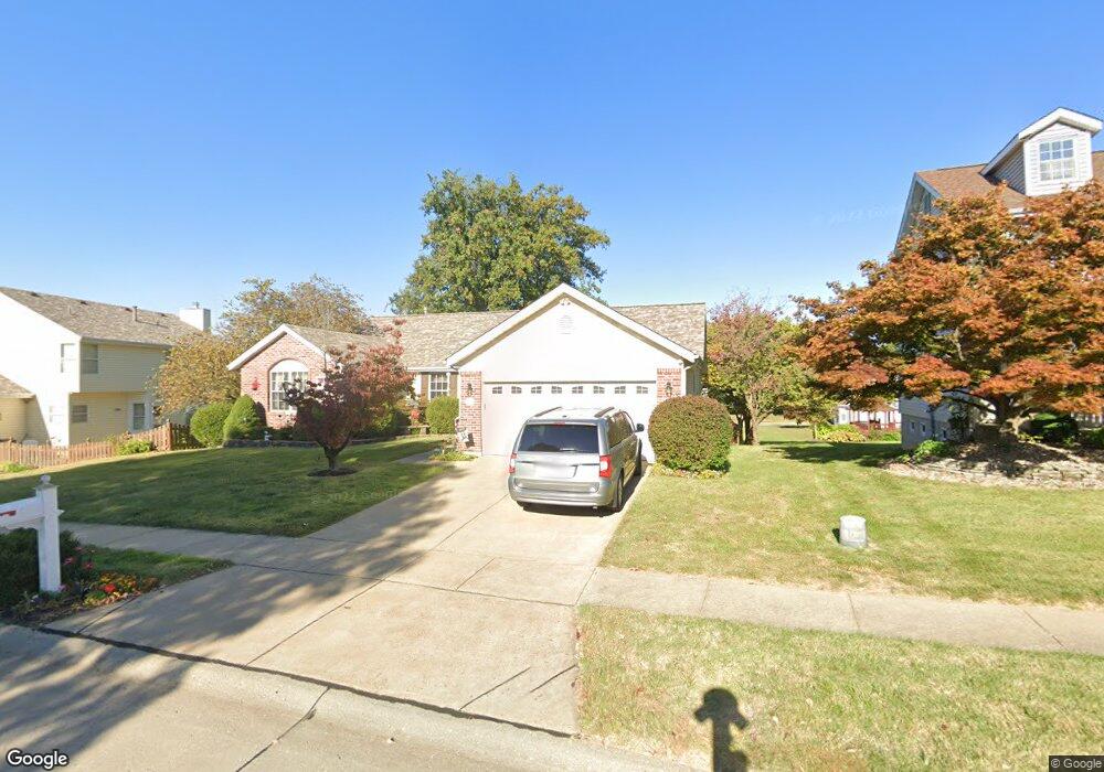
16751 N Fork Ridge Dr Florissant, MO 63034
Estimated Value: $281,000 - $333,000
3
Beds
2
Baths
1,851
Sq Ft
$160/Sq Ft
Est. Value
About This Home
This home is located at 16751 N Fork Ridge Dr, Florissant, MO 63034 and is currently estimated at $296,792, approximately $160 per square foot. 16751 N Fork Ridge Dr is a home located in St. Louis County with nearby schools including North Middle School, Hazelwood Central High School, and St Norbert School.
Ownership History
Date
Name
Owned For
Owner Type
Purchase Details
Closed on
Mar 21, 2024
Sold by
Kelly Judith A and Kelly Daniel P
Bought by
Revocable Living Trust Agreement Of Daniel An and Kelly
Current Estimated Value
Purchase Details
Closed on
Jul 23, 1999
Sold by
Kelly Daniel P and Kelly Judith H
Bought by
Kelly Daniel P and Kelly Judith A
Home Financials for this Owner
Home Financials are based on the most recent Mortgage that was taken out on this home.
Original Mortgage
$111,200
Interest Rate
7.63%
Mortgage Type
Balloon
Purchase Details
Closed on
Aug 7, 1998
Sold by
Kujawa Duane C and Kujawa Julia E
Bought by
Kelly Daniel P and Kelly Judith H
Home Financials for this Owner
Home Financials are based on the most recent Mortgage that was taken out on this home.
Original Mortgage
$110,300
Interest Rate
5.75%
Create a Home Valuation Report for This Property
The Home Valuation Report is an in-depth analysis detailing your home's value as well as a comparison with similar homes in the area
Home Values in the Area
Average Home Value in this Area
Purchase History
| Date | Buyer | Sale Price | Title Company |
|---|---|---|---|
| Revocable Living Trust Agreement Of Daniel An | -- | None Listed On Document | |
| Kelly Daniel P | -- | -- | |
| Kelly Daniel P | -- | -- |
Source: Public Records
Mortgage History
| Date | Status | Borrower | Loan Amount |
|---|---|---|---|
| Previous Owner | Kelly Daniel P | $111,200 | |
| Previous Owner | Kelly Daniel P | $110,300 |
Source: Public Records
Tax History Compared to Growth
Tax History
| Year | Tax Paid | Tax Assessment Tax Assessment Total Assessment is a certain percentage of the fair market value that is determined by local assessors to be the total taxable value of land and additions on the property. | Land | Improvement |
|---|---|---|---|---|
| 2025 | $3,960 | $50,020 | $6,950 | $43,070 |
| 2024 | $3,960 | $43,930 | $4,540 | $39,390 |
| 2023 | $3,946 | $43,930 | $4,540 | $39,390 |
| 2022 | $3,745 | $37,090 | $6,100 | $30,990 |
| 2021 | $3,543 | $37,090 | $6,100 | $30,990 |
| 2020 | $2,942 | $28,650 | $6,950 | $21,700 |
| 2019 | $2,919 | $28,650 | $6,950 | $21,700 |
| 2018 | $2,929 | $26,590 | $3,500 | $23,090 |
| 2017 | $2,926 | $26,590 | $3,500 | $23,090 |
| 2016 | $2,851 | $25,480 | $3,140 | $22,340 |
| 2015 | $2,743 | $25,480 | $3,140 | $22,340 |
| 2014 | $3,134 | $29,020 | $5,020 | $24,000 |
Source: Public Records
Map
Nearby Homes
- 3809 Albers Pointe Dr
- 3859 Sonora Stone Dr
- 3844 Rapids Dr
- 2 Aspen at Riverstone
- 3840 Sonora Stone Dr
- 3932 Secretariat Dr
- 3839 Sonora Stone Dr
- 2 Ashford at Riverstone
- 2 Maple at Riverstone
- 2 Aspen II at Riverstone
- 3828 Sonora Stone Dr
- 1273 Hermans Orchard Dr
- 1303 Topsider Ct
- 3819 Sonora Stone Dr
- 2 Berwick at Riverstone
- 16804 River Stone Dr
- 16787 River Stone Dr
- 3849 Secretariat Dr
- 3660 Woodman Dr
- 3645 Woodman Dr
- 16755 N Fork Ridge Dr
- 3800 Salida Ct
- 3812 Salida Ct
- 3824 Salida Ct
- 16759 N Fork Ridge Dr
- 3828 Salida Ct
- 16756 N Fork Ridge Dr
- 16752 N Fork Ridge Dr
- 16760 N Fork Ridge Dr
- 3832 Salida Ct
- 16763 N Fork Ridge Dr
- 16743 N Fork Ridge Dr
- 3807 Salida Ct
- 3813 Salida Ct
- 3819 Salida Ct
- 16764 N Fork Ridge Dr
- 16717 Stone Creek Ct
- 16744 N Fork Ridge Dr
- 16720 Stone Creek Ct
- 16767 N Fork Ridge Dr