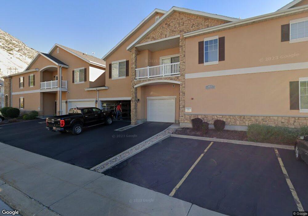
1676 E 1080 S Unit 1 Provo, UT 84606
Provost NeighborhoodEstimated Value: $361,000 - $374,000
3
Beds
2
Baths
1,311
Sq Ft
$282/Sq Ft
Est. Value
About This Home
This home is located at 1676 E 1080 S Unit 1, Provo, UT 84606 and is currently estimated at $370,129, approximately $282 per square foot. 1676 E 1080 S Unit 1 is a home located in Utah County with nearby schools including Provost School, Centennial Middle School, and Timpview High School.
Ownership History
Date
Name
Owned For
Owner Type
Purchase Details
Closed on
Nov 7, 2018
Sold by
Lebaron Milo R
Bought by
Parkin Dennis and Parkin Christine
Current Estimated Value
Purchase Details
Closed on
Apr 29, 2008
Sold by
C&M Holdings Llc
Bought by
Lebaron Milo R
Home Financials for this Owner
Home Financials are based on the most recent Mortgage that was taken out on this home.
Original Mortgage
$200,034
Interest Rate
5.88%
Mortgage Type
FHA
Purchase Details
Closed on
Aug 27, 2003
Sold by
Sgs Associates Inc
Bought by
Stratton Christopher A
Home Financials for this Owner
Home Financials are based on the most recent Mortgage that was taken out on this home.
Original Mortgage
$116,521
Interest Rate
5.87%
Mortgage Type
Stand Alone First
Create a Home Valuation Report for This Property
The Home Valuation Report is an in-depth analysis detailing your home's value as well as a comparison with similar homes in the area
Home Values in the Area
Average Home Value in this Area
Purchase History
| Date | Buyer | Sale Price | Title Company |
|---|---|---|---|
| Parkin Dennis | -- | Mountain View Title | |
| Lebaron Milo R | -- | Equity Title Orem Blvd | |
| C&M Holdings Llc | -- | Accommodation | |
| Stratton Christopher A | -- | Empire Land Title Company |
Source: Public Records
Mortgage History
| Date | Status | Borrower | Loan Amount |
|---|---|---|---|
| Previous Owner | Lebaron Milo R | $200,034 | |
| Previous Owner | Stratton Christopher A | $116,521 |
Source: Public Records
Tax History Compared to Growth
Tax History
| Year | Tax Paid | Tax Assessment Tax Assessment Total Assessment is a certain percentage of the fair market value that is determined by local assessors to be the total taxable value of land and additions on the property. | Land | Improvement |
|---|---|---|---|---|
| 2025 | $1,869 | $348,400 | $38,700 | $309,700 |
| 2024 | $1,869 | $183,975 | $0 | $0 |
| 2023 | $1,976 | $191,785 | $0 | $0 |
| 2022 | $1,783 | $174,460 | $0 | $0 |
| 2021 | $1,499 | $255,800 | $30,700 | $225,100 |
| 2020 | $1,478 | $236,500 | $28,400 | $208,100 |
| 2019 | $1,286 | $214,000 | $28,000 | $186,000 |
| 2018 | $1,209 | $204,000 | $25,000 | $179,000 |
| 2017 | $1,142 | $105,875 | $0 | $0 |
| 2016 | $1,114 | $96,250 | $0 | $0 |
| 2015 | $1,058 | $92,400 | $0 | $0 |
| 2014 | $948 | $86,350 | $0 | $0 |
Source: Public Records
Map
Nearby Homes
- 1145 Meadow Fork Rd Unit 4
- 1068 Canyon Meadow Dr Unit 6
- 1068 Canyon Meadow Dr Unit 8
- 1208 Meadow Fork Rd Unit 2
- 1077 Canyon Meadow Dr Unit 4
- 1128 S Slate Canyon Dr
- 1052 Canyon Meadow Dr Unit 4
- 1339 Alpine Way
- 970 S Aspen Way
- 924 S Aspen Summit Dr
- 1494 E 1300 S
- 914 S Aspen Cir Unit 49
- 1454 E 1370 S
- 778 S Slate Canyon Dr
- 1356 S 1400 E
- 1417 S 1420 E
- 1334 S 1370 E
- 1332 Cinnamon Ridge Way
- 1141 E 1320 S Unit A402
- 1417 E 700 S
- 1676 E 1080 S Unit 7
- 1676 E 1080 S
- 1676 E 1080 S Unit 4
- 1676 E 1080 S
- 1676 E 1080 S
- 1676 E 1080 S Unit 8
- 1676 E 1080 S
- 1676 E 1080 S Unit 2
- 1676 E 1080 S Unit 6
- 1676 E 1080 S Unit 3
- 1104 Meadow Fork Rd Unit 9
- 1104 Meadow Fork Rd
- 1104 Meadow Fork Rd Unit 7
- 1104 Meadow Fork Rd Unit 6
- 1104 Meadow Fork Rd Unit 5
- 1104 Meadow Fork Rd Unit 4
- 1104 Meadow Fork Rd Unit 3
- 1104 Meadow Fork Rd Unit 2
- 1104 Meadow Fork Rd
- 1104 Meadow Fork Rd Unit 8