Estimated Value: $141,000 - $202,000
3
Beds
1
Bath
1,008
Sq Ft
$162/Sq Ft
Est. Value
About This Home
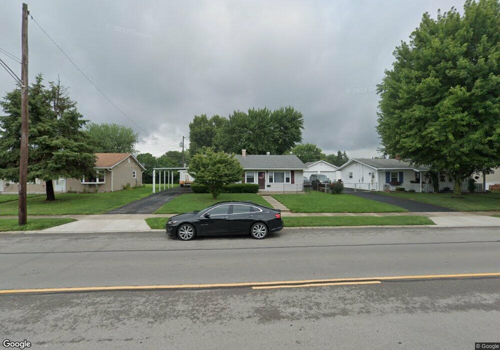
This home is located at 1676 W 2nd St, Xenia, OH 45385 and is currently estimated at $163,462, approximately $162 per square foot. 1676 W 2nd St is a home located in Greene County with nearby schools including Xenia High School, Summit Academy Community School for Alternative Learners - Xenia, and Legacy Christian Academy.
Ownership History
Date
Name
Owned For
Owner Type
Purchase Details
Closed on
May 30, 2012
Sold by
Bank Of America N A
Bought by
Capital Residential Equities Llc
Current Estimated Value
Purchase Details
Closed on
Jan 11, 2012
Sold by
Brown Michael and Brown Dawn
Bought by
Bank Of America Na
Purchase Details
Closed on
Aug 6, 2007
Sold by
Bennington Dawn and Brown Dawn
Bought by
Brown Michael and Brown Dawn
Home Financials for this Owner
Home Financials are based on the most recent Mortgage that was taken out on this home.
Original Mortgage
$131,720
Interest Rate
6.55%
Mortgage Type
New Conventional
Purchase Details
Closed on
Oct 7, 2005
Sold by
Mcfall Bonnie E
Bought by
Bennington Dawn
Home Financials for this Owner
Home Financials are based on the most recent Mortgage that was taken out on this home.
Original Mortgage
$80,000
Interest Rate
7.49%
Mortgage Type
Fannie Mae Freddie Mac
Create a Home Valuation Report for This Property
The Home Valuation Report is an in-depth analysis detailing your home's value as well as a comparison with similar homes in the area
Home Values in the Area
Average Home Value in this Area
Purchase History
| Date | Buyer | Sale Price | Title Company |
|---|---|---|---|
| Capital Residential Equities Llc | $38,000 | None Available | |
| Bank Of America Na | $52,000 | None Available | |
| Brown Michael | -- | Federated Land Title Agency | |
| Bennington Dawn | $80,000 | -- |
Source: Public Records
Mortgage History
| Date | Status | Borrower | Loan Amount |
|---|---|---|---|
| Previous Owner | Brown Michael | $131,720 | |
| Previous Owner | Bennington Dawn | $80,000 |
Source: Public Records
Tax History Compared to Growth
Tax History
| Year | Tax Paid | Tax Assessment Tax Assessment Total Assessment is a certain percentage of the fair market value that is determined by local assessors to be the total taxable value of land and additions on the property. | Land | Improvement |
|---|---|---|---|---|
| 2024 | $1,680 | $39,260 | $9,740 | $29,520 |
| 2023 | $1,680 | $39,260 | $9,740 | $29,520 |
| 2022 | $1,389 | $27,690 | $6,950 | $20,740 |
| 2021 | $1,408 | $27,690 | $6,950 | $20,740 |
| 2020 | $1,349 | $27,690 | $6,950 | $20,740 |
| 2019 | $1,062 | $20,530 | $4,680 | $15,850 |
| 2018 | $1,066 | $20,530 | $4,680 | $15,850 |
| 2017 | $1,006 | $20,530 | $4,680 | $15,850 |
| 2016 | $1,006 | $19,010 | $4,680 | $14,330 |
| 2015 | $1,009 | $19,010 | $4,680 | $14,330 |
| 2014 | $966 | $19,010 | $4,680 | $14,330 |
Source: Public Records
Map
Nearby Homes
- 1144 Rockwell Dr
- 1568 Cheyenne Dr
- 1342 Kylemore Dr
- 1618 Navajo Dr
- 121 S Progress Dr
- 1391 June Dr
- 1653 Seneca Dr
- 1283 June Dr
- 1233 June Dr
- 1223 June Dr
- 1208 Bellbrook Ave
- 1778 Arapaho Dr
- 2758 Wyoming Dr
- 1272 Bellbrook Ave
- 219 Kansas Dr
- 1769 Gayhart Dr
- 1351 Omard Dr
- 343 Sheelin Rd
- 1829 Gayhart Dr
- 414 Whisper Ln