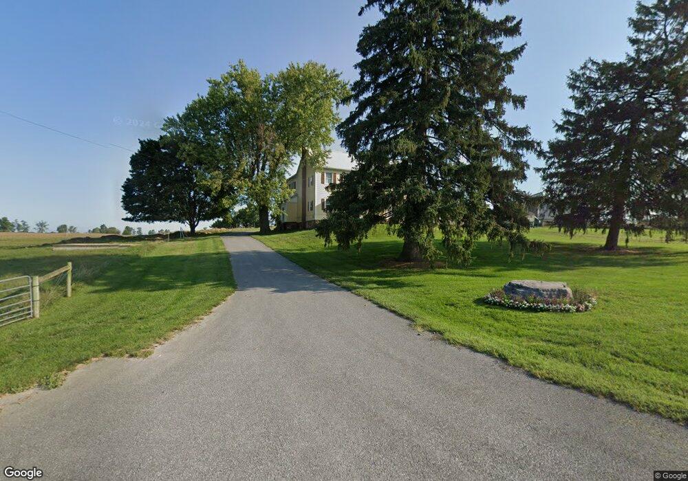
1677 Clay Hill Rd Chambersburg, PA 17202
Estimated Value: $421,000 - $444,708
--
Bed
--
Bath
3,238
Sq Ft
$134/Sq Ft
Est. Value
About This Home
This home is located at 1677 Clay Hill Rd, Chambersburg, PA 17202 and is currently estimated at $432,854, approximately $133 per square foot. 1677 Clay Hill Rd is a home located in Franklin County with nearby schools including Greencastle-Antrim Primary School, Greencastle-Antrim Elementary School, and Greencastle-Antrim Middle School.
Ownership History
Date
Name
Owned For
Owner Type
Purchase Details
Closed on
Mar 28, 2025
Sold by
Rudolph Steven M and Rudolph Marilyn D
Bought by
Diller Brendle Lee and Diller Marlyssa Kate
Current Estimated Value
Home Financials for this Owner
Home Financials are based on the most recent Mortgage that was taken out on this home.
Original Mortgage
$300,000
Outstanding Balance
$298,464
Interest Rate
6.87%
Mortgage Type
Credit Line Revolving
Estimated Equity
$134,390
Purchase Details
Closed on
Oct 20, 2014
Sold by
Martin Neil R and Martin Alta L
Bought by
Rudolph Steven M and Rudolph Marilyn D
Purchase Details
Closed on
Dec 17, 2007
Sold by
Diller Frances H
Bought by
Martin Neil R and Martin Alta L
Home Financials for this Owner
Home Financials are based on the most recent Mortgage that was taken out on this home.
Original Mortgage
$265,000
Interest Rate
6.3%
Mortgage Type
Unknown
Create a Home Valuation Report for This Property
The Home Valuation Report is an in-depth analysis detailing your home's value as well as a comparison with similar homes in the area
Home Values in the Area
Average Home Value in this Area
Purchase History
| Date | Buyer | Sale Price | Title Company |
|---|---|---|---|
| Diller Brendle Lee | $425,000 | None Listed On Document | |
| Rudolph Steven M | $400,000 | None Available | |
| Martin Neil R | $270,000 | None Available |
Source: Public Records
Mortgage History
| Date | Status | Borrower | Loan Amount |
|---|---|---|---|
| Open | Diller Brendle Lee | $300,000 | |
| Previous Owner | Martin Neil R | $265,000 |
Source: Public Records
Tax History Compared to Growth
Tax History
| Year | Tax Paid | Tax Assessment Tax Assessment Total Assessment is a certain percentage of the fair market value that is determined by local assessors to be the total taxable value of land and additions on the property. | Land | Improvement |
|---|---|---|---|---|
| 2025 | $5,798 | $34,660 | $3,470 | $31,190 |
| 2024 | $5,260 | $34,660 | $3,470 | $31,190 |
| 2023 | $5,198 | $34,660 | $3,470 | $31,190 |
| 2022 | $5,198 | $34,660 | $3,470 | $31,190 |
| 2021 | $5,097 | $34,660 | $3,470 | $31,190 |
| 2020 | $4,965 | $34,660 | $3,470 | $31,190 |
| 2019 | $4,852 | $34,660 | $3,470 | $31,190 |
| 2018 | $4,800 | $34,660 | $3,470 | $31,190 |
| 2017 | $4,679 | $34,660 | $3,470 | $31,190 |
| 2016 | $993 | $34,660 | $3,470 | $31,190 |
| 2015 | $925 | $34,660 | $3,470 | $31,190 |
| 2014 | $925 | $34,660 | $3,470 | $31,190 |
Source: Public Records
Map
Nearby Homes
- 9227 Grindstone Hill Rd
- 790 Antrim Ln
- 7290 Angle Rd
- 1631 Buchanan Trail E
- 823 Buchanan Trail E
- 602 Brookview Dr
- 8655 Wayne Hwy
- 560 Meadowview Cir
- 1921 Hartzok Rd
- 231 N Allison St Unit 1
- 5490 Honey Rock Ct
- 148 E Madison St
- 271 E Baltimore St
- 64 W Walter Ave
- 373 Craig Rd
- 90 W Walter Ave
- 148 N Carlisle St
- 101 N Carlisle St
- 6456 Wayne Hwy
- 140 Williamson Ave
- 1376 Clay Hill Rd
- 1554 Clay Hill Rd
- 1724 Clay Hill Rd
- 1718 Clay Hill Rd
- 1416 Clay Hill Rd
- 1340 Clay Hill Rd
- 1428 Clay Hill Rd
- 8800 Lorford Dr
- 1442 Clay Hill Rd
- 1296 Clay Hill Rd
- 8805 Lorford Dr
- 1464 Clay Hill Rd
- 8816 Lorford Dr
- 8841 Lorford Dr
- 1478 Clay Hill Rd
- 1262 Clay Hill Rd
- 8832 Lorford Dr
- 8979 Grindstone Hill Rd
- 1248 Clay Hill Rd
- 8835 Lorford Dr