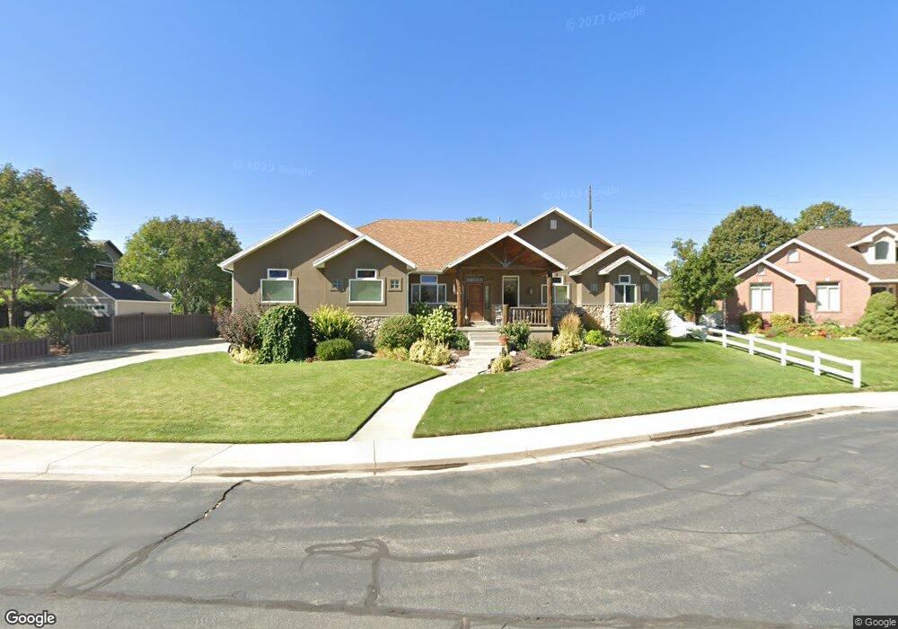
1677 N 1100 W Mapleton, UT 84664
Estimated Value: $824,000 - $977,000
5
Beds
4
Baths
2,173
Sq Ft
$407/Sq Ft
Est. Value
About This Home
This home is located at 1677 N 1100 W, Mapleton, UT 84664 and is currently estimated at $884,877, approximately $407 per square foot. 1677 N 1100 W is a home located in Utah County with nearby schools including Mapleton School, Mapleton Junior High School, and Maple Mountain High School.
Ownership History
Date
Name
Owned For
Owner Type
Purchase Details
Closed on
May 21, 2024
Sold by
Jones Brian Harold
Bought by
Jones Alice Rachel
Current Estimated Value
Home Financials for this Owner
Home Financials are based on the most recent Mortgage that was taken out on this home.
Original Mortgage
$310,000
Outstanding Balance
$305,653
Interest Rate
6.88%
Mortgage Type
New Conventional
Estimated Equity
$579,224
Purchase Details
Closed on
Mar 17, 2021
Sold by
Saxton Kallie L
Bought by
Saxton Kallie L and Saxton Mark
Home Financials for this Owner
Home Financials are based on the most recent Mortgage that was taken out on this home.
Original Mortgage
$168,000
Interest Rate
2.7%
Mortgage Type
New Conventional
Purchase Details
Closed on
Feb 4, 2010
Sold by
Wilson Craig L and Wilson Susan M
Bought by
Jones Brian Harold
Create a Home Valuation Report for This Property
The Home Valuation Report is an in-depth analysis detailing your home's value as well as a comparison with similar homes in the area
Home Values in the Area
Average Home Value in this Area
Purchase History
| Date | Buyer | Sale Price | Title Company |
|---|---|---|---|
| Jones Alice Rachel | -- | Traveling Title | |
| Saxton Kallie L | -- | Utah First Title Ins Agency | |
| Jones Brian Harold | -- | None Available |
Source: Public Records
Mortgage History
| Date | Status | Borrower | Loan Amount |
|---|---|---|---|
| Open | Jones Alice Rachel | $310,000 | |
| Previous Owner | Saxton Kallie L | $168,000 |
Source: Public Records
Tax History
| Year | Tax Paid | Tax Assessment Tax Assessment Total Assessment is a certain percentage of the fair market value that is determined by local assessors to be the total taxable value of land and additions on the property. | Land | Improvement |
|---|---|---|---|---|
| 2025 | $4,055 | $455,840 | -- | -- |
| 2024 | $4,055 | $397,265 | $0 | $0 |
| 2023 | $4,084 | $402,600 | $0 | $0 |
| 2022 | $4,478 | $436,535 | $0 | $0 |
| 2021 | $3,797 | $568,300 | $182,800 | $385,500 |
| 2020 | $3,781 | $547,300 | $161,800 | $385,500 |
| 2019 | $3,423 | $505,800 | $155,200 | $350,600 |
| 2018 | $3,284 | $461,900 | $130,700 | $331,200 |
| 2017 | $3,220 | $240,350 | $0 | $0 |
| 2016 | $3,131 | $232,375 | $0 | $0 |
| 2015 | $2,809 | $207,185 | $0 | $0 |
| 2014 | -- | $196,075 | $0 | $0 |
Source: Public Records
Map
Nearby Homes
- 1121 W 1800 N
- 1410 W 1200 N
- 1403 S 625 E
- 405 W 1200 N Unit 4
- 487 W 1200 N Unit 1
- 598 W 1600 N
- 1518 S 600 E
- 1697 N 500 W
- 1264 E 1150 S
- 1525 S 400 E Unit 36
- 949 S 1060 E
- 1853 S 375 E
- 899 E 800 S
- 145 W Carnesecca Ct
- 1446 W 600 N Unit 5
- 1836 W 800 N
- 1512 W 600 N Unit 4
- 667 N 550 W
- 677 E 800 South St
- 1896 W 800 N
- 1643 N 1100 W
- 1705 N 1100 W
- 1730 N 1250 W Unit 12
- 1120 W 1700 N
- 1678 N 1100 W
- 1613 N 1100 W
- 1642 N 1100 W
- 1210 W 1600 N
- 1760 N 1250 W Unit 13
- 1088 W 1700 N
- 1612 N 1100 W
- 1248 W 1600 N
- 1615 W 1600 N
- 1057 W 1700 N
- 1089 W 1800 N
- 1790 N 1250 W
- 1733 N 1250 W Unit 10
- 1286 W 1600 N
- 1052 W 1700 N
- 1056 W 1600 N
Your Personal Tour Guide
Ask me questions while you tour the home.