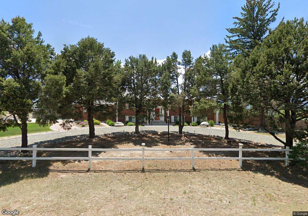
1677 Shrider Rd Colorado Springs, CO 80920
Falcon Estates NeighborhoodEstimated Value: $668,128 - $738,000
4
Beds
3
Baths
1,320
Sq Ft
$536/Sq Ft
Est. Value
About This Home
This home is located at 1677 Shrider Rd, Colorado Springs, CO 80920 and is currently estimated at $707,532, approximately $536 per square foot. 1677 Shrider Rd is a home located in El Paso County with nearby schools including Pioneer Elementary School, Mountain Ridge Middle School, and Rampart High School.
Ownership History
Date
Name
Owned For
Owner Type
Purchase Details
Closed on
Feb 20, 2018
Sold by
Andres Valerie L
Bought by
Andrews Valerie L and Andrews Mark
Current Estimated Value
Home Financials for this Owner
Home Financials are based on the most recent Mortgage that was taken out on this home.
Original Mortgage
$367,200
Outstanding Balance
$310,672
Interest Rate
3.95%
Mortgage Type
New Conventional
Estimated Equity
$396,860
Purchase Details
Closed on
Oct 17, 2017
Sold by
Wasson Mary Jo
Bought by
L J C Llc and Stroup Hartsel Properties Inc
Home Financials for this Owner
Home Financials are based on the most recent Mortgage that was taken out on this home.
Original Mortgage
$322,500
Interest Rate
3.78%
Mortgage Type
Credit Line Revolving
Purchase Details
Closed on
May 17, 1993
Bought by
L J C Llc
Create a Home Valuation Report for This Property
The Home Valuation Report is an in-depth analysis detailing your home's value as well as a comparison with similar homes in the area
Home Values in the Area
Average Home Value in this Area
Purchase History
| Date | Buyer | Sale Price | Title Company |
|---|---|---|---|
| Andrews Valerie L | -- | Empire Title Of Colorado Spr | |
| Andrews Valerie L | $459,000 | Empire Title Of Colorado Spr | |
| L J C Llc | $299,300 | Land Title Guarantee Co | |
| L J C Llc | -- | -- |
Source: Public Records
Mortgage History
| Date | Status | Borrower | Loan Amount |
|---|---|---|---|
| Open | Andrews Valerie L | $367,200 | |
| Previous Owner | L J C Llc | $322,500 |
Source: Public Records
Tax History Compared to Growth
Tax History
| Year | Tax Paid | Tax Assessment Tax Assessment Total Assessment is a certain percentage of the fair market value that is determined by local assessors to be the total taxable value of land and additions on the property. | Land | Improvement |
|---|---|---|---|---|
| 2025 | $2,869 | $45,810 | -- | -- |
| 2024 | $2,859 | $51,510 | $13,300 | $38,210 |
| 2023 | $2,859 | $51,510 | $13,300 | $38,210 |
| 2022 | $2,192 | $33,130 | $7,350 | $25,780 |
| 2021 | $2,435 | $34,080 | $7,560 | $26,520 |
| 2020 | $2,545 | $33,060 | $6,580 | $26,480 |
| 2019 | $2,518 | $33,060 | $6,580 | $26,480 |
| 2018 | $1,735 | $22,380 | $5,760 | $16,620 |
| 2017 | $1,172 | $22,380 | $5,760 | $16,620 |
| 2016 | $1,164 | $23,020 | $6,370 | $16,650 |
| 2015 | $1,162 | $23,020 | $6,370 | $16,650 |
| 2014 | $987 | $20,740 | $5,970 | $14,770 |
Source: Public Records
Map
Nearby Homes
- 7191 Ross Dr
- 1884 Fuller Rd
- 7424 Bell Dr
- 1275 Berglind Rd
- 1907 Independence Dr
- 1510 York Rd Unit 101
- 7137 Murdoch Dr
- 1871 Brookwood Dr
- 1880 Independence Dr
- 1160 Berglind Rd
- 6699 Bethesda Point Unit B
- 6598 Bethesda Point Unit B
- 6633 Dublin Loop W Unit 4
- 6632 Dublin Loop W
- 6678 Bethesda Point Unit C
- 1263 York Rd
- 6602 Dublin Loop W
- 2110 Whitehorn Dr N
- 6812 Snowbird Terrace
- 6530 Brook Park Dr
- 7186 Grashio Dr
- 1674 Shrider Rd
- 1707 Berglind Rd
- 1667 Berglind Rd
- 7225 Grashio Dr
- 7271 Grashio Dr
- 7191 Grashio Dr
- 1634 Shrider Rd
- 7295 Grashio Dr
- 7140 Grashio Dr
- 1629 Berglind Rd
- 1765 Shrider Rd
- 1598 Shrider Rd
- 7325 Grashio Dr
- 1724 Copley Rd
- 1674 Collins Rd
- 7264 Ross Dr
- 7216 Ross Dr
- 1564 Shrider Rd
- 7353 Grashio Dr