Estimated Value: $773,516 - $840,000
Studio
--
Bath
2,198
Sq Ft
$366/Sq Ft
Est. Value
About This Home
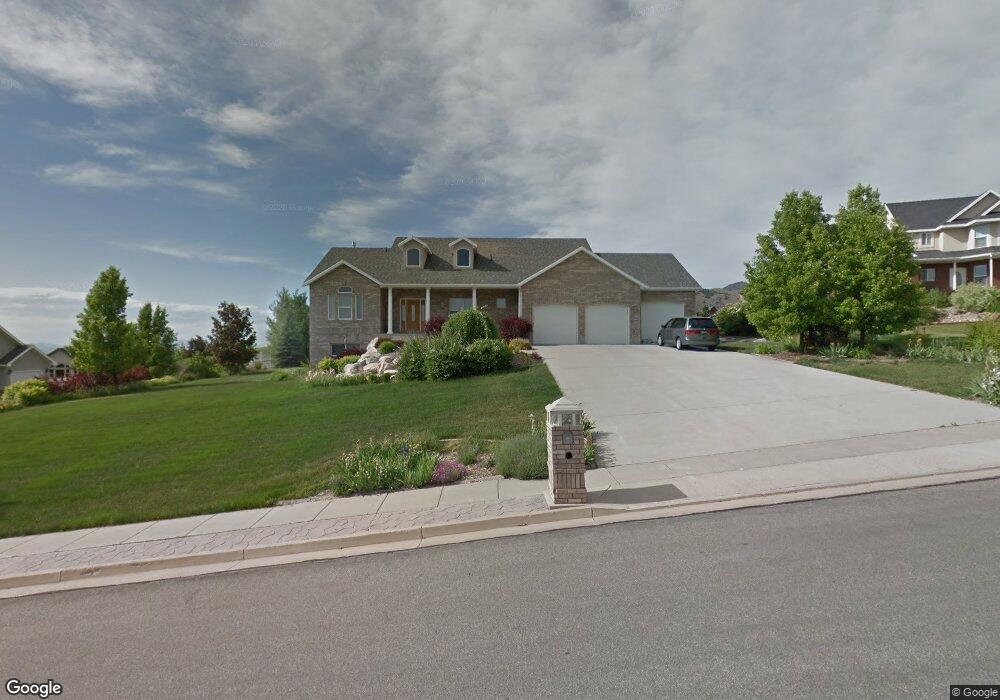
This home is located at 1679 E 3450 N, Logan, UT 84341 and is currently estimated at $803,629, approximately $365 per square foot. 1679 E 3450 N is a home with nearby schools including Greenville School, Cedar Ridge School, and North Cache Middle School.
Ownership History
Date
Name
Owned For
Owner Type
Purchase Details
Closed on
Jun 26, 2006
Sold by
Nordgren Gregory N and Nordgren Pamela G
Bought by
Szorik Mark S and Szorik Mary M
Current Estimated Value
Home Financials for this Owner
Home Financials are based on the most recent Mortgage that was taken out on this home.
Original Mortgage
$50,000
Outstanding Balance
$40,086
Interest Rate
6.66%
Mortgage Type
Credit Line Revolving
Estimated Equity
$763,543
Create a Home Valuation Report for This Property
The Home Valuation Report is an in-depth analysis detailing your home's value as well as a comparison with similar homes in the area
Home Values in the Area
Average Home Value in this Area
Purchase History
| Date | Buyer | Sale Price | Title Company |
|---|---|---|---|
| Szorik Mark S | -- | Summit Title & Escrow |
Source: Public Records
Mortgage History
| Date | Status | Borrower | Loan Amount |
|---|---|---|---|
| Open | Szorik Mark S | $50,000 | |
| Open | Szorik Mark S | $308,000 |
Source: Public Records
Tax History
| Year | Tax Paid | Tax Assessment Tax Assessment Total Assessment is a certain percentage of the fair market value that is determined by local assessors to be the total taxable value of land and additions on the property. | Land | Improvement |
|---|---|---|---|---|
| 2025 | $3,244 | $454,100 | $0 | $0 |
| 2024 | $3,471 | $452,095 | $0 | $0 |
| 2023 | $3,740 | $450,290 | $0 | $0 |
| 2022 | $3,437 | $395,505 | $0 | $0 |
| 2021 | $334 | $595,285 | $100,000 | $495,285 |
| 2020 | $3,031 | $506,445 | $100,000 | $406,445 |
| 2019 | $3,174 | $506,444 | $100,000 | $406,444 |
| 2018 | $2,936 | $453,430 | $100,000 | $353,430 |
| 2017 | $2,716 | $220,715 | $0 | $0 |
| 2016 | $2,759 | $220,715 | $0 | $0 |
| 2015 | $2,713 | $216,155 | $0 | $0 |
| 2014 | $2,652 | $216,155 | $0 | $0 |
| 2013 | -- | $216,155 | $0 | $0 |
Source: Public Records
Map
Nearby Homes
- 1697 E 3450 N
- 1655 E 3450 N
- 1696 E 3550 N Unit 4
- 1674 E 3550 N
- 1615 N Bronco Rd Unit 5
- 1684 E 3450 N
- 1658 E 3450 N
- 1718 E 3550 N Unit 5
- 1718 E 3550 N Unit 5
- 1718 E Mahogany Dr
- 3501 N 1800 E Unit 6
- 3501 N 1800 E
- 1635 E 3450 N Unit 6
- 1635 E 3450 N
- 1650 E 3550 N
- 1715 E 3450 N Unit 7
- 1715 E 3450 N
- 1715 N Bronco Rd
- 1708 Bronco Rd Unit 8
- 1708 E 3450 N
Your Personal Tour Guide
Ask me questions while you tour the home.