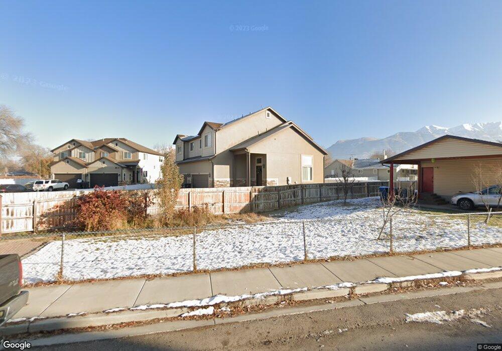
168 S 340 West Cir American Fork, UT 84003
Estimated Value: $394,390 - $469,000
3
Beds
2
Baths
1,436
Sq Ft
$291/Sq Ft
Est. Value
About This Home
This home is located at 168 S 340 West Cir, American Fork, UT 84003 and is currently estimated at $417,848, approximately $290 per square foot. 168 S 340 West Cir is a home with nearby schools including Greenwood Elementary School, American Fork Junior High School, and American Fork High School.
Ownership History
Date
Name
Owned For
Owner Type
Purchase Details
Closed on
Jul 28, 2015
Sold by
Tbs Live Oak Estates Sub Llc
Bought by
Tbs Live Oak Estates Sub 402 Llc
Current Estimated Value
Purchase Details
Closed on
Apr 2, 2013
Sold by
Safford C Bryant
Bought by
Tbs Live Oaks Estates Sub Llc
Create a Home Valuation Report for This Property
The Home Valuation Report is an in-depth analysis detailing your home's value as well as a comparison with similar homes in the area
Home Values in the Area
Average Home Value in this Area
Purchase History
| Date | Buyer | Sale Price | Title Company |
|---|---|---|---|
| Tbs Live Oak Estates Sub 402 Llc | -- | Accommodation | |
| Tbs Live Oaks Estates Sub Llc | -- | Affiliated First Title Co |
Source: Public Records
Tax History Compared to Growth
Tax History
| Year | Tax Paid | Tax Assessment Tax Assessment Total Assessment is a certain percentage of the fair market value that is determined by local assessors to be the total taxable value of land and additions on the property. | Land | Improvement |
|---|---|---|---|---|
| 2025 | $2,024 | $216,205 | $98,800 | $294,300 |
| 2024 | $2,024 | $224,895 | $0 | $0 |
| 2023 | $1,801 | $212,135 | $0 | $0 |
| 2022 | $1,759 | $204,490 | $0 | $0 |
| 2021 | $1,575 | $286,000 | $82,700 | $203,300 |
| 2020 | $1,532 | $269,800 | $82,700 | $187,100 |
| 2019 | $1,374 | $250,300 | $82,700 | $167,600 |
| 2018 | $1,437 | $250,300 | $82,700 | $167,600 |
| 2017 | $1,447 | $136,015 | $0 | $0 |
| 2016 | $1,284 | $112,145 | $0 | $0 |
| 2015 | $1,307 | $108,350 | $0 | $0 |
| 2014 | $1,204 | $98,450 | $0 | $0 |
Source: Public Records
Map
Nearby Homes
- 351 Washington Ave
- 82 S Lincoln Ave
- 271 S Barratt Cir
- 55 Roosevelt Ave
- 382 W 330 S
- 55 S 200 W
- 217 W Main St
- 365 W 370 S
- 316 W 390 S
- 120 N 350 W Unit 127
- 120 N 350 W Unit 133
- 120 N 350 W Unit 130
- 424 S 340 W
- 429 S Storrs Ave
- Evergreen Plan at Storrs Court
- Juniper Plan at Storrs Court
- Redwood Plan at Storrs Court
- Ashwood Plan at Storrs Court
- 228 W 470 S
- 129 W Pacific Dr
- 322 Mahogany Dr
- 132 S 340 West Cir
- 146 S 300 W
- 144 S 300 W
- 162 S 300 W
- 134 S 300 W Unit & 138
- 134 S 300 W
- 167 S 340 West Cir
- 130 S 300 W
- 155 S 340 West Cir
- 360 Mahogany Dr
- 153 S 300 W
- 143 S 300 W
- 183 S 300 W
- 108 S 300 W
- 163 S 300 W
- 372 Mahogany Dr
- 174 S 270 West Cir Unit 101
- 174 S 270 West Cir
- 162 S 270 West Cir Unit 102