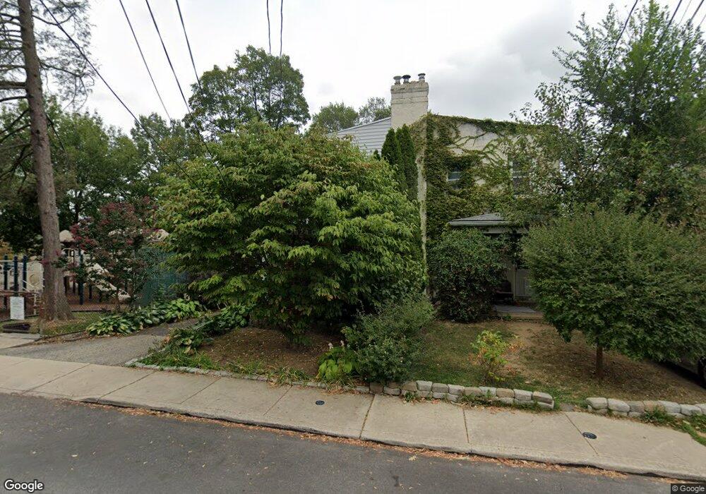
168 Saint Pauls Rd Ardmore, PA 19003
Estimated Value: $329,000 - $410,000
3
Beds
1
Bath
1,292
Sq Ft
$300/Sq Ft
Est. Value
About This Home
This home is located at 168 Saint Pauls Rd, Ardmore, PA 19003 and is currently estimated at $388,012, approximately $300 per square foot. 168 Saint Pauls Rd is a home located in Montgomery County with nearby schools including Penn Valley School, Welsh Valley Middle School, and Lower Merion High School.
Ownership History
Date
Name
Owned For
Owner Type
Purchase Details
Closed on
Dec 14, 2002
Sold by
Palomino Cassandra V
Bought by
Connelly Daniel R and Connelly Joy C
Current Estimated Value
Purchase Details
Closed on
Jun 18, 1998
Sold by
Gray Pauline R and Bonasi Joseph G
Bought by
Palomino Cassandra
Purchase Details
Closed on
May 17, 1997
Sold by
Bonasi Joseph G and Bonasi Marie Kelly
Bought by
Bonasi Joseph G
Create a Home Valuation Report for This Property
The Home Valuation Report is an in-depth analysis detailing your home's value as well as a comparison with similar homes in the area
Home Values in the Area
Average Home Value in this Area
Purchase History
| Date | Buyer | Sale Price | Title Company |
|---|---|---|---|
| Connelly Daniel R | $155,000 | -- | |
| Palomino Cassandra | $87,500 | -- | |
| Bonasi Joseph G | -- | -- |
Source: Public Records
Tax History Compared to Growth
Tax History
| Year | Tax Paid | Tax Assessment Tax Assessment Total Assessment is a certain percentage of the fair market value that is determined by local assessors to be the total taxable value of land and additions on the property. | Land | Improvement |
|---|---|---|---|---|
| 2025 | $4,467 | $106,960 | $36,620 | $70,340 |
| 2024 | $4,467 | $106,960 | $36,620 | $70,340 |
| 2023 | $4,281 | $106,960 | $36,620 | $70,340 |
| 2022 | $4,201 | $106,960 | $36,620 | $70,340 |
| 2021 | $4,106 | $106,960 | $36,620 | $70,340 |
| 2020 | $4,005 | $106,960 | $36,620 | $70,340 |
| 2019 | $3,935 | $106,960 | $36,620 | $70,340 |
| 2018 | $3,935 | $106,960 | $36,620 | $70,340 |
| 2017 | $3,790 | $106,960 | $36,620 | $70,340 |
| 2016 | $3,748 | $106,960 | $36,620 | $70,340 |
| 2015 | $3,495 | $106,960 | $36,620 | $70,340 |
| 2014 | $3,495 | $106,960 | $36,620 | $70,340 |
Source: Public Records
Map
Nearby Homes
- 64 E Spring Ave
- 140 Walnut Ave
- 222 Lippincott Ave
- 2814 Saint Marys Rd
- 818 Clifford Ave
- 221 Ardmore Ave
- 761 Hathaway Ln
- 754 Oak View Rd
- 101 Grandview Rd
- 2939 Berkley Rd
- 14 Simpson Rd
- 1525 W Wynnewood Rd
- 236 W Spring Ave
- 2321 Bryn Mawr Ave
- 2409 Belmont Ave
- 2528 Rosemont Ave
- 1968 W Montgomery Ave
- 442 E Spring Ave
- 103 W Montgomery Ave Unit 1A
- 264 W Montgomery Ave Unit 304
- 166 Saint Pauls Rd
- 164 Saint Pauls Rd
- 162 Saint Pauls Rd
- 160 Saint Pauls Rd
- 167 Simpson Rd
- 161 Simpson Rd
- 117 E Spring Ave
- 158 Saint Pauls Rd
- 159 Simpson Rd
- 163 Simpson Rd
- 126 Arnold Rd
- 169 Simpson Rd
- 157 Simpson Rd
- 171 Simpson Rd
- 119 E Spring Ave
- 156 Saint Pauls Rd
- 155 Simpson Rd
- 128 Arnold Rd
- 173 Simpson Rd Unit 2
- 173 Simpson Rd Unit 4