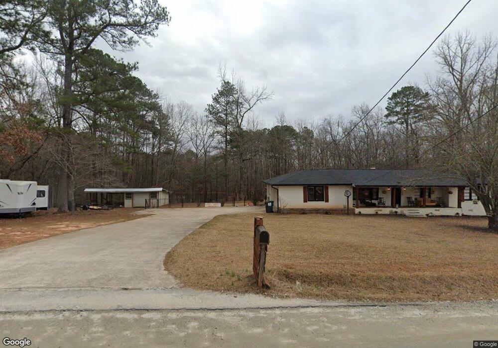
168 Sandy Ridge Rd McDonough, GA 30252
Estimated Value: $268,895 - $282,000
3
Beds
2
Baths
1,563
Sq Ft
$177/Sq Ft
Est. Value
About This Home
This home is located at 168 Sandy Ridge Rd, McDonough, GA 30252 and is currently estimated at $276,974, approximately $177 per square foot. 168 Sandy Ridge Rd is a home located in Henry County with nearby schools including Rock Spring Elementary School, Ola Middle School, and Ola High School.
Ownership History
Date
Name
Owned For
Owner Type
Purchase Details
Closed on
Jul 28, 2017
Sold by
Haring Kelly
Bought by
Boggess Caleb
Current Estimated Value
Home Financials for this Owner
Home Financials are based on the most recent Mortgage that was taken out on this home.
Original Mortgage
$131,313
Outstanding Balance
$109,333
Interest Rate
3.88%
Mortgage Type
New Conventional
Estimated Equity
$167,641
Purchase Details
Closed on
Aug 24, 2007
Sold by
Campbell Lawrence M
Bought by
Haring Kelly
Home Financials for this Owner
Home Financials are based on the most recent Mortgage that was taken out on this home.
Original Mortgage
$135,932
Interest Rate
6.65%
Mortgage Type
FHA
Create a Home Valuation Report for This Property
The Home Valuation Report is an in-depth analysis detailing your home's value as well as a comparison with similar homes in the area
Home Values in the Area
Average Home Value in this Area
Purchase History
| Date | Buyer | Sale Price | Title Company |
|---|---|---|---|
| Boggess Caleb | $130,000 | -- | |
| Haring Kelly | $138,000 | -- |
Source: Public Records
Mortgage History
| Date | Status | Borrower | Loan Amount |
|---|---|---|---|
| Open | Boggess Caleb | $131,313 | |
| Previous Owner | Haring Kelly | $135,932 |
Source: Public Records
Tax History Compared to Growth
Tax History
| Year | Tax Paid | Tax Assessment Tax Assessment Total Assessment is a certain percentage of the fair market value that is determined by local assessors to be the total taxable value of land and additions on the property. | Land | Improvement |
|---|---|---|---|---|
| 2024 | $3,054 | $109,720 | $16,080 | $93,640 |
| 2023 | $2,594 | $108,720 | $15,480 | $93,240 |
| 2022 | $2,537 | $84,920 | $14,280 | $70,640 |
| 2021 | $2,169 | $69,320 | $12,240 | $57,080 |
| 2020 | $2,047 | $64,160 | $11,560 | $52,600 |
| 2019 | $1,955 | $60,240 | $10,960 | $49,280 |
| 2018 | $1,759 | $52,000 | $9,412 | $42,588 |
| 2016 | $1,735 | $44,200 | $6,760 | $37,440 |
| 2015 | $1,464 | $36,000 | $7,640 | $28,360 |
| 2014 | $1,430 | $34,720 | $7,640 | $27,080 |
Source: Public Records
Map
Nearby Homes
- 106 Loam Dr
- 209 Amber Ct
- 180 Mackey Rd
- 170 Mackey Rd
- 0 Mackey Rd Unit 10539146
- 41 Giles Dr
- 6830 Peeksville Rd
- 2001 Jefferson Way
- 507 Judith Ct Unit 3
- 415 Pamela Ct
- 227 Aves Ct
- 1908 Munford Place
- 2082 Stroud Rd
- 518 Gallantry Trail
- 4075 O Henry Ct
- 88 Maddox Dr
- 78 Maddox Dr
- 68 Maddox Dr
- 58 Maddox Dr
- 393 Stallsworth Rd
- 197 Sandy Ridge Rd
- 228 Sandy Ridge Rd
- 133 Makayla Dr
- 260 Sandy Ridge Rd
- 155 Loam Dr
- 129 Makayla Dr
- 129 Makayla Dr Unit 8
- 151 Loam Dr
- 800 Stallsworth Rd
- 125 Makayla Dr
- 135 Makayla Dr
- 159 Loam Dr
- 159 Loam Dr
- 74 Sandy Ridge Rd
- 147 Loam Dr
- 270 Sandy Ridge Rd
- 121 Makayla Dr
- 150 Loam Dr
- 143 Loam Dr
- 154 Loam Dr