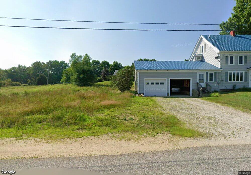
168 Watson Rd Norway, ME 04268
Estimated Value: $308,000 - $404,000
2
Beds
2
Baths
1,344
Sq Ft
$272/Sq Ft
Est. Value
About This Home
This home is located at 168 Watson Rd, Norway, ME 04268 and is currently estimated at $366,120, approximately $272 per square foot. 168 Watson Rd is a home located in Oxford County with nearby schools including Guy E. Rowe School, Oxford Hills Middle School, and Oxford Hills Comprehensive High School.
Ownership History
Date
Name
Owned For
Owner Type
Purchase Details
Closed on
Jul 23, 2021
Sold by
Brown Michelle E
Bought by
Cervone Edmund J
Current Estimated Value
Home Financials for this Owner
Home Financials are based on the most recent Mortgage that was taken out on this home.
Original Mortgage
$129,466
Outstanding Balance
$117,578
Interest Rate
2.96%
Mortgage Type
Purchase Money Mortgage
Estimated Equity
$248,542
Purchase Details
Closed on
Jun 9, 2011
Sold by
Brown Wesley O
Bought by
Countrywide Bank Fsb
Create a Home Valuation Report for This Property
The Home Valuation Report is an in-depth analysis detailing your home's value as well as a comparison with similar homes in the area
Home Values in the Area
Average Home Value in this Area
Purchase History
| Date | Buyer | Sale Price | Title Company |
|---|---|---|---|
| Cervone Edmund J | -- | None Available | |
| Countrywide Bank Fsb | $160,000 | -- |
Source: Public Records
Mortgage History
| Date | Status | Borrower | Loan Amount |
|---|---|---|---|
| Open | Cervone Edmund J | $129,466 |
Source: Public Records
Tax History Compared to Growth
Tax History
| Year | Tax Paid | Tax Assessment Tax Assessment Total Assessment is a certain percentage of the fair market value that is determined by local assessors to be the total taxable value of land and additions on the property. | Land | Improvement |
|---|---|---|---|---|
| 2024 | $3,298 | $185,096 | $47,256 | $137,840 |
| 2023 | $2,721 | $185,100 | $47,300 | $137,800 |
| 2022 | $2,610 | $185,100 | $47,300 | $137,800 |
| 2021 | $2,848 | $163,200 | $43,000 | $120,200 |
| 2020 | $2,864 | $163,200 | $43,000 | $120,200 |
| 2019 | $2,864 | $163,200 | $43,000 | $120,200 |
| 2018 | $2,807 | $163,200 | $43,000 | $120,200 |
| 2017 | $2,807 | $163,200 | $43,000 | $120,200 |
| 2015 | $2,595 | $163,200 | $43,000 | $120,200 |
| 2013 | $2,399 | $163,200 | $43,000 | $120,200 |
Source: Public Records
Map
Nearby Homes
- 23 Boondock Ln
- Lot 6 Silver Ridge
- 519 Greenwood Rd
- 37 Wiley Rd
- 59 Bobcat Way
- Map6Lot55 Sandy Shore Ln
- 19 Lydia Ln
- 25 Lydia Ln
- 248 Morse Rd
- 21 Wood Duck Way
- 24 Chickadee Way
- 0 French Rd
- 52 High Ridge Rd
- 206 Ralph Richardson Rd
- 152 Ralph Richardson Rd
- 49-51 Pleasant St
- 33 Old Pulp Mill Ln
- 133 Lake Rd
- 49 Penn Rd
- 976 Crockett Ridge Rd
- 178 Watson Rd
- 0 Mcintyre Rd Unit 865438
- 0 Mcintyre Rd Unit 922700
- 00 Jack Heath
- 6 Skilling Ave
- Lot 13 Silver Ridge Estates
- Lot 12 Silver Ridge Estates
- Lot 5 Silver Ridge Estates
- Lot 3 Silver Ridge Estates
- Lot 4 Silver Ridge Estates
- Lot 2 Silver Ridge Estates
- Lot 7 Silver Ridge Estates
- Lot 6 Silver Ridge Estates
- Lot #7 Crockett Ridge Sunset Ridge Rd
- 139 Kahkonen
- 88 Baxer Lane (Lane 15)
- Lot 11 Silver Ridge Estates
- Lot 9 Silver Ridge Estates
- 0 Charles St Unit 1067721
- Lot #`10 Silver Ridge Estates