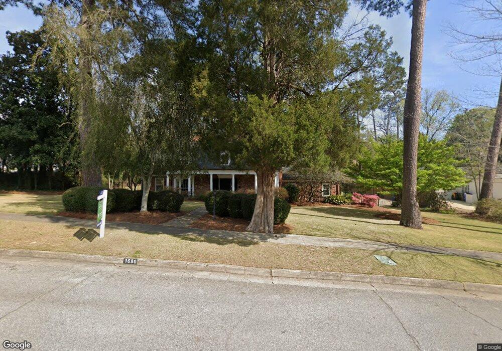
1680 Flournoy Dr Columbus, GA 31906
Peacock Woods-Dimon Circle NeighborhoodEstimated Value: $531,000 - $583,000
6
Beds
5
Baths
3,816
Sq Ft
$145/Sq Ft
Est. Value
About This Home
This home is located at 1680 Flournoy Dr, Columbus, GA 31906 and is currently estimated at $554,352, approximately $145 per square foot. 1680 Flournoy Dr is a home located in Muscogee County with nearby schools including Richards Middle School, Hardaway High School, and Wynnton Elementary School.
Ownership History
Date
Name
Owned For
Owner Type
Purchase Details
Closed on
Nov 11, 2009
Sold by
Moore Charles A and Moore Charles
Bought by
Zacharias James S and Zacharias Darla S
Current Estimated Value
Home Financials for this Owner
Home Financials are based on the most recent Mortgage that was taken out on this home.
Original Mortgage
$304,000
Outstanding Balance
$197,890
Interest Rate
4.94%
Mortgage Type
New Conventional
Estimated Equity
$356,462
Purchase Details
Closed on
Apr 24, 2007
Sold by
Moore Catherine C
Bought by
Moore Catherine C and Moore Charles
Home Financials for this Owner
Home Financials are based on the most recent Mortgage that was taken out on this home.
Original Mortgage
$217,805
Interest Rate
5.86%
Mortgage Type
New Conventional
Create a Home Valuation Report for This Property
The Home Valuation Report is an in-depth analysis detailing your home's value as well as a comparison with similar homes in the area
Home Values in the Area
Average Home Value in this Area
Purchase History
| Date | Buyer | Sale Price | Title Company |
|---|---|---|---|
| Zacharias James S | $380,000 | None Available | |
| Moore Catherine C | -- | None Available |
Source: Public Records
Mortgage History
| Date | Status | Borrower | Loan Amount |
|---|---|---|---|
| Open | Zacharias James S | $304,000 | |
| Previous Owner | Moore Catherine C | $217,805 |
Source: Public Records
Tax History Compared to Growth
Tax History
| Year | Tax Paid | Tax Assessment Tax Assessment Total Assessment is a certain percentage of the fair market value that is determined by local assessors to be the total taxable value of land and additions on the property. | Land | Improvement |
|---|---|---|---|---|
| 2025 | $6,376 | $196,768 | $27,984 | $168,784 |
| 2024 | $6,374 | $196,768 | $27,984 | $168,784 |
| 2023 | $5,720 | $196,768 | $27,984 | $168,784 |
| 2022 | $6,649 | $153,540 | $27,984 | $125,556 |
| 2021 | $6,642 | $126,668 | $27,984 | $98,684 |
| 2020 | $6,644 | $126,668 | $27,984 | $98,684 |
| 2019 | $6,666 | $126,668 | $27,984 | $98,684 |
| 2018 | $6,666 | $126,668 | $27,984 | $98,684 |
| 2017 | $6,689 | $126,668 | $27,984 | $98,684 |
| 2016 | $6,715 | $176,055 | $15,642 | $160,413 |
| 2015 | $6,724 | $176,055 | $15,642 | $160,413 |
| 2014 | $6,732 | $176,055 | $15,642 | $160,413 |
| 2013 | -- | $176,055 | $15,642 | $160,413 |
Source: Public Records
Map
Nearby Homes
- 1809 Carter Ave
- 1717 Stark Ave
- 2016 Poplar Dr
- 1806 Stark Ave
- 1400 Eberhart Ave
- 1706 Stark Ave
- 1700 Stark Ave
- 2227 15th St
- 2104 Cherokee Ave
- 1557 18th Ave
- 1917 Dimon St
- 2125 13th St Unit 12
- 2133 13th St
- 1315 Eberhart Ave
- 1525 19th St
- 1641 16th Ave
- 2230 Cherokee Ave Unit 10
- 1227 Forest Ave Unit 4
- 1319 Hilton Ave
- 1622 14th Ave
- 1660 Flournoy Dr
- 1687 Flournoy Dr
- 1661 Forest Ave
- 2011 Brookside Dr
- 1929 Flournoy Dr
- 1700 Forest Ave
- 1710 Forest Ave
- 1672 Forest Ave
- 1714 Forest Ave
- 1720 Forest Ave
- 1920 17th St
- 2021 Brookside Dr
- 1724 Forest Ave
- 1925 Flournoy Dr
- 1711 Wildwood Ave
- 1715 Wildwood Ave
- 1717 Wildwood Ave
- 1930 Flournoy Dr
- 1801 Wildwood Ave
- 1804 Forest Ave