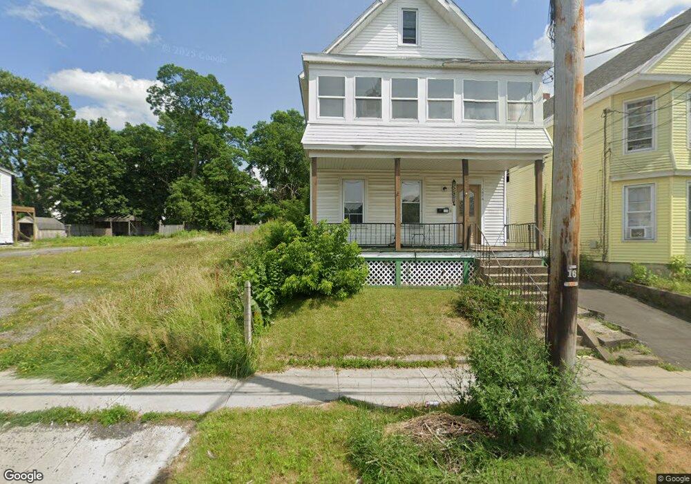
1680 Foster Ave Schenectady, NY 12308
Estimated Value: $19,758 - $497,000
Studio
--
Bath
--
Sq Ft
6,621
Sq Ft Lot
About This Home
This home is located at 1680 Foster Ave, Schenectady, NY 12308 and is currently estimated at $184,190. 1680 Foster Ave is a home located in Schenectady County with nearby schools including Jessie T Zoller School, Oneida Middle School, and Schenectady High School.
Ownership History
Date
Name
Owned For
Owner Type
Purchase Details
Closed on
May 15, 2023
Sold by
Tanneal Green-Riccitello
Bought by
Riccitello Lewis and Riccitello Donna
Current Estimated Value
Purchase Details
Closed on
Mar 21, 2016
Sold by
Riccitello John L and Green Tanneal
Bought by
Green Riccitello Tanneal
Purchase Details
Closed on
May 18, 2006
Sold by
Maddalone Christopher
Bought by
Riccitello John L
Purchase Details
Closed on
Nov 8, 2001
Sold by
City Of Schenectady Ny
Bought by
Maddalone Christopher
Purchase Details
Closed on
Oct 19, 2001
Purchase Details
Closed on
Jun 29, 2000
Sold by
Faucett Faucett W and Faucett Collins, E
Bought by
Hackstadt Gerald
Create a Home Valuation Report for This Property
The Home Valuation Report is an in-depth analysis detailing your home's value as well as a comparison with similar homes in the area
Purchase History
| Date | Buyer | Sale Price | Title Company |
|---|---|---|---|
| Riccitello Lewis | $11,000 | None Listed On Document | |
| Green Riccitello Tanneal | -- | None Available | |
| Riccitello John L | $10,870 | Neil W Moynihan | |
| Maddalone Christopher | -- | -- | |
| -- | -- | -- | |
| Hackstadt Gerald | -- | -- |
Source: Public Records
Tax History
| Year | Tax Paid | Tax Assessment Tax Assessment Total Assessment is a certain percentage of the fair market value that is determined by local assessors to be the total taxable value of land and additions on the property. | Land | Improvement |
|---|---|---|---|---|
| 2024 | $766 | $18,700 | $18,700 | $0 |
| 2023 | $8 | $18,700 | $18,700 | $0 |
| 2022 | $768 | $18,700 | $18,700 | $0 |
| 2021 | $766 | $18,700 | $18,700 | $0 |
| 2020 | $757 | $18,700 | $18,700 | $0 |
| 2019 | $369 | $18,700 | $18,700 | $0 |
| 2018 | $766 | $18,700 | $18,700 | $0 |
| 2017 | $812 | $18,700 | $18,700 | $0 |
| 2016 | $797 | $18,700 | $18,700 | $0 |
| 2014 | -- | $18,700 | $18,700 | $0 |
Source: Public Records
Map
Nearby Homes
- 1616 Foster Ave
- 1606 Foster Ave
- 1712 Foster Ave
- 1602 Foster Ave
- 1594 Carrie St
- 1732 Carrie St
- 531 Hattie St
- 1723 van Vranken Ave
- 1725 van Vranken Ave
- 506 Hattie St
- 431 Clarendon St
- 905 Mason St
- 435 Manhattan St
- L3 Maxon Rd
- 1593 Randolph Rd
- L1 Lenox Rd
- 1818 Lenox Rd
- 2004 Foster Ave
- 1614 Wendell Ave
- 910 Gerling St
- 1686 Foster Ave
- 1676 Foster Ave
- 1672 Foster Ave
- 1694 Foster Ave
- 1668 Foster Ave
- 1698 Foster Ave
- 1664 Foster Ave
- 1658 Foster Ave
- 1702 Foster Ave
- 1693 Carrie St
- 1671 Carrie St
- 1701 Carrie St Unit 3
- 1701 Carrie St
- 1663 Foster Ave
- 1683 Foster Ave
- 1683 Foster Ave
- 1691 Foster Ave
- 1708 Foster Ave
- 1707 Carrie St
- 1677 Carrie St
Your Personal Tour Guide
Ask me questions while you tour the home.