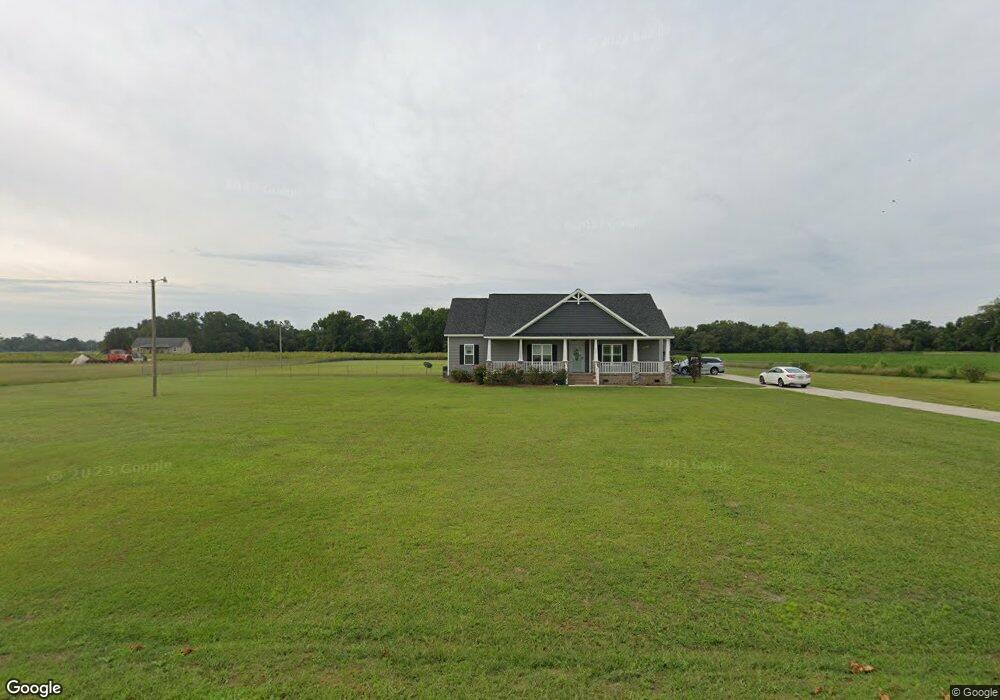
1680 Jenny Lind Rd La Grange, NC 28551
Estimated Value: $313,000 - $347,000
4
Beds
4
Baths
2,533
Sq Ft
$130/Sq Ft
Est. Value
About This Home
This home is located at 1680 Jenny Lind Rd, La Grange, NC 28551 and is currently estimated at $330,361, approximately $130 per square foot. 1680 Jenny Lind Rd is a home with nearby schools including La Grange Elementary School, E.B. Frink Middle School, and North Lenoir High School.
Ownership History
Date
Name
Owned For
Owner Type
Purchase Details
Closed on
Oct 27, 2021
Sold by
Rogers Stephen R
Bought by
Rogers Brittney C
Current Estimated Value
Home Financials for this Owner
Home Financials are based on the most recent Mortgage that was taken out on this home.
Original Mortgage
$237,600
Outstanding Balance
$216,669
Interest Rate
2.8%
Mortgage Type
New Conventional
Estimated Equity
$113,692
Purchase Details
Closed on
Oct 3, 2014
Sold by
Herring John B
Bought by
Rogers Stephen R and Rogers Brittney C
Create a Home Valuation Report for This Property
The Home Valuation Report is an in-depth analysis detailing your home's value as well as a comparison with similar homes in the area
Home Values in the Area
Average Home Value in this Area
Purchase History
| Date | Buyer | Sale Price | Title Company |
|---|---|---|---|
| Rogers Brittney C | -- | None Available | |
| Rogers Brittney C | -- | None Listed On Document | |
| Rogers Stephen R | $22,500 | None Available |
Source: Public Records
Mortgage History
| Date | Status | Borrower | Loan Amount |
|---|---|---|---|
| Open | Rogers Brittney C | $237,600 | |
| Closed | Rogers Brittney C | $237,600 |
Source: Public Records
Tax History Compared to Growth
Tax History
| Year | Tax Paid | Tax Assessment Tax Assessment Total Assessment is a certain percentage of the fair market value that is determined by local assessors to be the total taxable value of land and additions on the property. | Land | Improvement |
|---|---|---|---|---|
| 2025 | $3,325 | $453,502 | $29,736 | $423,766 |
| 2024 | $1,831 | $197,988 | $19,000 | $178,988 |
| 2023 | $1,752 | $197,988 | $19,000 | $178,988 |
| 2022 | $1,752 | $197,988 | $19,000 | $178,988 |
| 2021 | $1,842 | $197,988 | $19,000 | $178,988 |
| 2020 | $1,842 | $197,988 | $19,000 | $178,988 |
| 2019 | $1,842 | $197,988 | $19,000 | $178,988 |
| 2018 | $1,813 | $197,988 | $19,000 | $178,988 |
| 2017 | $1,816 | $197,988 | $19,000 | $178,988 |
| 2014 | -- | $19,000 | $19,000 | $0 |
Source: Public Records
Map
Nearby Homes
- 5301 Barber Rd
- 5517 Bulltown Rd
- 6272 Highway 70 E
- 3619 S Caswell St
- 4725 Packhouse Rd
- 805 Madison Ann Dr
- Lot #2 Albert Sugg Rd
- 614 S Caswell St
- 210 Wood St
- 201 Wood St
- 202 Wood St
- 208 Wood St
- 217 Wood St
- 204 Wood St
- 205 Wood St
- 206 Wood St
- Hayden Plan at Blair Ridge
- Freeport Plan at Blair Ridge
- Cali Plan at Blair Ridge
- Belhaven Plan at Blair Ridge
- 1675 Jenny Lind Rd
- 1759 Jenny Lind Rd
- 1668 Jenny Lind Rd
- 1743 Jenny Lind Rd
- 1794 Jenny Lind Rd
- 1823 Hardy Bridge Rd
- 1862 Jenny Lind Rd
- 1861 Jenny Lind Rd
- 1399 Ben F Herring Rd
- 4401 Ben E Sutton Rd
- 1933 Jenny Lind Rd
- 1428 Ben F Herring Rd
- 1525 Ben F Herring Rd
- 1400 Ben F Herring Rd
- 4438 Ben E Sutton Rd
- 2100 Hardy Bridge Rd
- 1961 Jenny Lind Rd
- 1510 Ben F Herring Rd
- 2138 Hardy Bridge Rd
- 1634 Hardy Bridge Rd