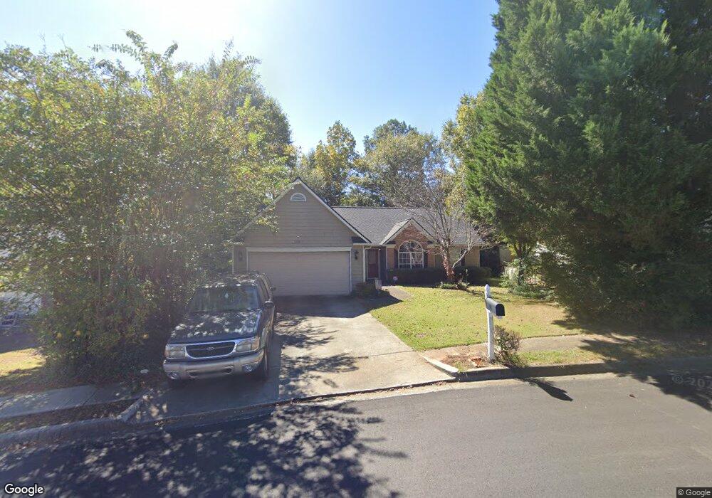
1680 Westfield Ct Unit 1 Lawrenceville, GA 30043
Estimated Value: $350,000 - $369,000
3
Beds
2
Baths
1,606
Sq Ft
$222/Sq Ft
Est. Value
About This Home
This home is located at 1680 Westfield Ct Unit 1, Lawrenceville, GA 30043 and is currently estimated at $357,107, approximately $222 per square foot. 1680 Westfield Ct Unit 1 is a home located in Gwinnett County with nearby schools including Jackson Elementary School, Northbrook Middle School, and Peachtree Ridge High School.
Ownership History
Date
Name
Owned For
Owner Type
Purchase Details
Closed on
Aug 30, 2002
Sold by
Cheney Elizabeth
Bought by
Reynolds Danny M and Reynolds Rita B
Current Estimated Value
Home Financials for this Owner
Home Financials are based on the most recent Mortgage that was taken out on this home.
Original Mortgage
$133,250
Interest Rate
6.21%
Mortgage Type
FHA
Purchase Details
Closed on
May 19, 1995
Sold by
West Palm Assoc Lp
Bought by
Judson Cheney Elizabeth and Judson Mccrance
Create a Home Valuation Report for This Property
The Home Valuation Report is an in-depth analysis detailing your home's value as well as a comparison with similar homes in the area
Home Values in the Area
Average Home Value in this Area
Purchase History
| Date | Buyer | Sale Price | Title Company |
|---|---|---|---|
| Reynolds Danny M | $145,900 | -- | |
| Judson Cheney Elizabeth | $109,500 | -- |
Source: Public Records
Mortgage History
| Date | Status | Borrower | Loan Amount |
|---|---|---|---|
| Previous Owner | Reynolds Danny M | $133,250 | |
| Closed | Judson Cheney Elizabeth | $0 |
Source: Public Records
Tax History Compared to Growth
Tax History
| Year | Tax Paid | Tax Assessment Tax Assessment Total Assessment is a certain percentage of the fair market value that is determined by local assessors to be the total taxable value of land and additions on the property. | Land | Improvement |
|---|---|---|---|---|
| 2024 | $885 | $104,800 | $24,800 | $80,000 |
| 2023 | $885 | $104,800 | $24,800 | $80,000 |
| 2022 | $2,137 | $108,880 | $24,800 | $84,080 |
| 2021 | $2,293 | $69,640 | $16,200 | $53,440 |
| 2020 | $2,307 | $69,640 | $16,200 | $53,440 |
| 2019 | $2,249 | $69,640 | $16,200 | $53,440 |
| 2018 | $2,138 | $64,600 | $14,960 | $49,640 |
| 2016 | $1,938 | $54,320 | $15,200 | $39,120 |
| 2015 | $1,955 | $54,320 | $15,200 | $39,120 |
| 2014 | $1,720 | $45,160 | $8,400 | $36,760 |
Source: Public Records
Map
Nearby Homes
- 1923 Thomas Pointe Trace
- 1789 Springhouse Ct
- 1952 Farmwood Dr Unit 1
- 1694 Herrington Rd
- 1702 Herrington Rd
- 1771 Kristi Dr
- 2350 Laurel Pointe Ln
- 2115 Glynmoore Dr
- 1587 Herrington Rd
- 1601 Signal Flag Way
- 2163 Pebble Beach Dr
- 1858 de Winton Place Unit 1
- 1131 Brading Place
- 2116 Tidal Cove
- 1877 de Winton Place
- 1602 Telfair Chase Way
- 1646 Sandy Beach Point
- 1557 High Sierra Dr
- 1690 Westfield Ct
- 1670 Westfield Ct Unit 1
- 1700 Westfield Ct
- 1660 Westfield Ct
- 1685 Atkinson Rd
- 0 Atkinson Rd NW Unit 3153289
- 0 Atkinson Rd NW Unit 3213691
- 0 Atkinson Rd NW Unit 8597836
- 1671 Atkinson Rd
- 1675 Westfield Ct
- 1710 Westfield Ct Unit 60
- 1710 Westfield Ct
- 1695 Westfield Ct Unit 1
- 1650 Westfield Ct
- 1655 Westfield Ct
- 1705 Westfield Ct
- 1659 Atkinson Rd
- 1720 Westfield Ct Unit 1
- 1640 Westfield Ct
- 1645 Westfield Ct