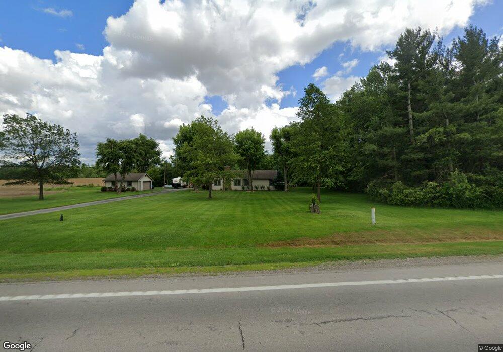
1681 State Route 4 Bucyrus, OH 44820
Estimated Value: $186,000 - $351,000
2
Beds
2
Baths
1,248
Sq Ft
$197/Sq Ft
Est. Value
About This Home
This home is located at 1681 State Route 4, Bucyrus, OH 44820 and is currently estimated at $245,991, approximately $197 per square foot. 1681 State Route 4 is a home located in Crawford County with nearby schools including Wynford Elementary School, Wynford High School, and CENTER FOR AUTISM / DYSLEXIA - BUCYRUS.
Ownership History
Date
Name
Owned For
Owner Type
Purchase Details
Closed on
Jul 13, 2021
Sold by
Carmean Victoria L and Caldwell Victoria L
Bought by
Knecht Shaun P and Caldwell Samuel L
Current Estimated Value
Purchase Details
Closed on
Mar 25, 2015
Sold by
Gulley Rick and Gulley Susan G
Bought by
Carmean Victoria L
Home Financials for this Owner
Home Financials are based on the most recent Mortgage that was taken out on this home.
Original Mortgage
$118,000
Outstanding Balance
$90,343
Interest Rate
3.67%
Mortgage Type
Future Advance Clause Open End Mortgage
Estimated Equity
$155,648
Purchase Details
Closed on
Jan 22, 2013
Sold by
Schiefer James Kai and Schiefer Alan Kirk
Bought by
Gulley Ricky
Purchase Details
Closed on
Feb 27, 2008
Sold by
Blicke William J and Rhode Judy Ann
Bought by
Schiefer James Kai and Schiefer Alan Kirk
Create a Home Valuation Report for This Property
The Home Valuation Report is an in-depth analysis detailing your home's value as well as a comparison with similar homes in the area
Home Values in the Area
Average Home Value in this Area
Purchase History
| Date | Buyer | Sale Price | Title Company |
|---|---|---|---|
| Knecht Shaun P | -- | None Available | |
| Carmean Victoria L | $140,000 | Attorney | |
| Gulley Ricky | $62,000 | Acs Title Bucyrus | |
| Schiefer James Kai | -- | -- |
Source: Public Records
Mortgage History
| Date | Status | Borrower | Loan Amount |
|---|---|---|---|
| Open | Carmean Victoria L | $118,000 |
Source: Public Records
Tax History Compared to Growth
Tax History
| Year | Tax Paid | Tax Assessment Tax Assessment Total Assessment is a certain percentage of the fair market value that is determined by local assessors to be the total taxable value of land and additions on the property. | Land | Improvement |
|---|---|---|---|---|
| 2024 | $1,646 | $44,400 | $5,160 | $39,240 |
| 2023 | $1,646 | $28,160 | $4,230 | $23,930 |
| 2022 | $1,256 | $28,160 | $4,230 | $23,930 |
| 2021 | $1,348 | $28,160 | $4,230 | $23,930 |
| 2020 | $975 | $21,980 | $4,230 | $17,750 |
| 2019 | $1,002 | $21,980 | $4,230 | $17,750 |
| 2018 | $1,024 | $21,980 | $4,230 | $17,750 |
| 2017 | $921 | $20,070 | $4,230 | $15,840 |
| 2016 | $768 | $20,070 | $4,230 | $15,840 |
| 2015 | $798 | $20,070 | $4,230 | $15,840 |
| 2014 | -- | $21,240 | $4,230 | $17,010 |
| 2013 | -- | $21,240 | $4,230 | $17,010 |
Source: Public Records
Map
Nearby Homes
- 1123 Hillcrest Dr
- 1315 Lynne Ave
- 2440 Wyandot Rd
- 1112 Hillcrest Dr
- 1149 Farmview Dr
- 0 Lynne Ave
- 275 Brentwood St
- 1145 Lynne Ave
- 130 Brentwood St
- 452 Pleasant Ln
- 2273 Kerstetter Rd
- 182 Williams St
- 1211 S Sandusky Ave
- 1021 S Sandusky Ave
- 900 S Spring St
- 318 Charlotte St
- 325 W Liberty St
- 708 S Sandusky Ave
- 419 Short St
- 583 Rogers St
- 1603 State Route 4
- 1601 State Route 4
- 1523 Street
- 1811 State Route 4
- 1539 State Route 4
- 1523 State Route 4
- 1875 State Route 4
- 1723 Denzer Rd
- 1723 Denzer Rd
- 1600 State Route 98
- 1610 Denzer Rd
- 2090 Mount Zion Rd
- 2108 Mount Zion Rd
- 2215 Mount Zion Rd
- 2010 Mount Zion Rd
- 1941 Mount Zion Rd
- 2080 Mount Zion Rd
- 1930 State Route 4
- 2176 Mount Zion Rd
- 2202 Mount Zion Rd