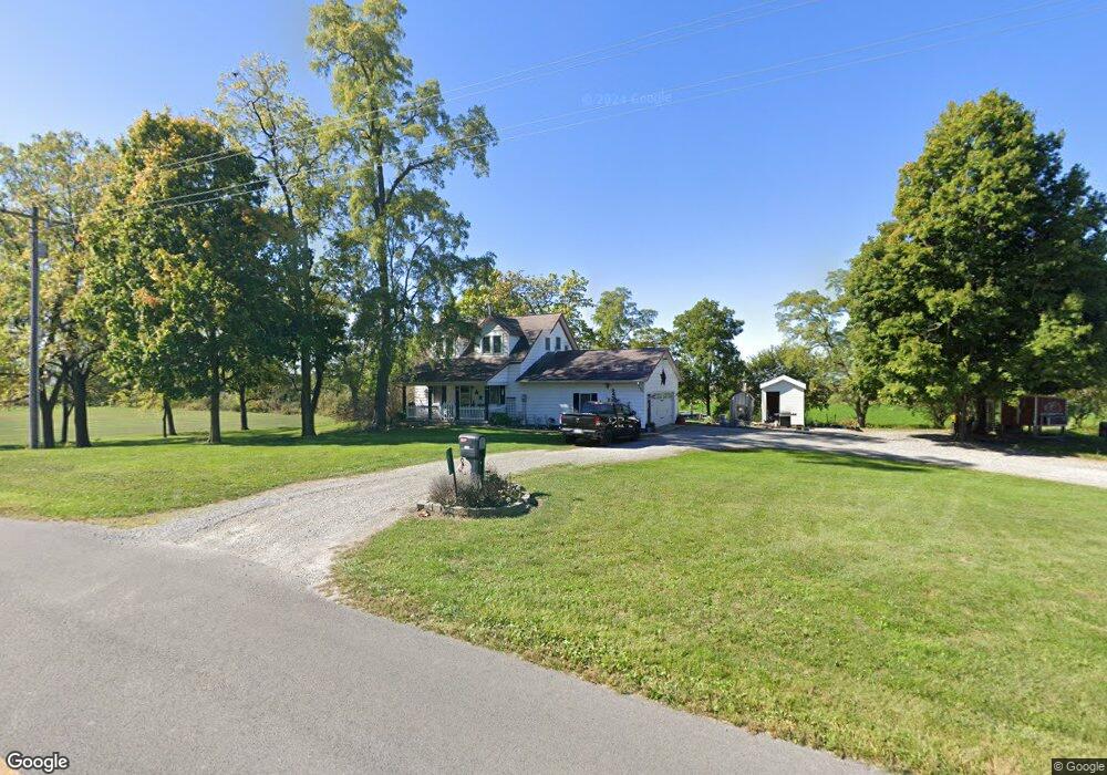
16811 Boundry Rd Wapakoneta, OH 45895
Estimated Value: $178,541 - $220,000
3
Beds
2
Baths
1,176
Sq Ft
$169/Sq Ft
Est. Value
About This Home
This home is located at 16811 Boundry Rd, Wapakoneta, OH 45895 and is currently estimated at $199,135, approximately $169 per square foot. 16811 Boundry Rd is a home located in Auglaize County with nearby schools including Waynesfield-Goshen Local Elementary School and Waynesfield-Goshen Local High School.
Ownership History
Date
Name
Owned For
Owner Type
Purchase Details
Closed on
Oct 30, 2018
Sold by
Gill Alvin E and Gill Susan K
Bought by
Gill Matthew R and Gill Amy I
Current Estimated Value
Home Financials for this Owner
Home Financials are based on the most recent Mortgage that was taken out on this home.
Original Mortgage
$95,300
Outstanding Balance
$83,453
Interest Rate
4.6%
Mortgage Type
Purchase Money Mortgage
Estimated Equity
$115,682
Purchase Details
Closed on
Sep 17, 2013
Sold by
Coil Edward L and Coil Jody D
Bought by
Gill Alvin E and Gill Susan K
Home Financials for this Owner
Home Financials are based on the most recent Mortgage that was taken out on this home.
Original Mortgage
$79,050
Interest Rate
4.38%
Mortgage Type
Purchase Money Mortgage
Purchase Details
Closed on
Aug 1, 1989
Purchase Details
Closed on
May 1, 1987
Create a Home Valuation Report for This Property
The Home Valuation Report is an in-depth analysis detailing your home's value as well as a comparison with similar homes in the area
Home Values in the Area
Average Home Value in this Area
Purchase History
| Date | Buyer | Sale Price | Title Company |
|---|---|---|---|
| Gill Matthew R | $120,000 | None Available | |
| Gill Alvin E | $93,000 | Nw Title Agency | |
| -- | $48,000 | -- | |
| -- | $31,000 | -- |
Source: Public Records
Mortgage History
| Date | Status | Borrower | Loan Amount |
|---|---|---|---|
| Open | Gill Matthew R | $95,300 | |
| Closed | Gill Alvin E | $79,050 |
Source: Public Records
Tax History Compared to Growth
Tax History
| Year | Tax Paid | Tax Assessment Tax Assessment Total Assessment is a certain percentage of the fair market value that is determined by local assessors to be the total taxable value of land and additions on the property. | Land | Improvement |
|---|---|---|---|---|
| 2024 | $2,481 | $39,640 | $12,340 | $27,300 |
| 2023 | $716 | $39,640 | $12,340 | $27,300 |
| 2022 | $1,220 | $28,210 | $11,820 | $16,390 |
| 2021 | $592 | $28,210 | $11,820 | $16,390 |
| 2020 | $1,209 | $28,210 | $11,823 | $16,387 |
| 2019 | $993 | $23,601 | $9,856 | $13,745 |
| 2018 | $949 | $23,601 | $9,856 | $13,745 |
| 2017 | $932 | $23,601 | $9,856 | $13,745 |
| 2016 | $858 | $22,352 | $9,384 | $12,968 |
| 2015 | $859 | $22,352 | $9,384 | $12,968 |
| 2014 | $860 | $22,352 | $9,384 | $12,968 |
| 2013 | $946 | $22,352 | $9,384 | $12,968 |
Source: Public Records
Map
Nearby Homes
- 20630 State Route 67
- 21015 Fairmount Rd
- 17 E Walnut St
- 80 Main St
- 37 N Main St
- 0 Ohio 67
- 18258 Graham Rd
- 202 W Mulberry St
- 25836 Ohio 67
- 202 Karen St
- 5065 Amherst Rd
- 17946 National Rd
- 212 S Oak St
- 17092 Hauss Rd
- 8150 Amherst Rd
- 1805 Huntington Dr
- 1835 Huntington Dr
- 5116 S Dixie Hwy
- 1200 E Breese Rd
- 4850 Bowdle Rd
- 16863 Boundry Rd
- 16941 Boundry Rd
- 21084 State Route 67
- 16339 Boundry Rd
- 16272 Boundry Rd
- 16271 Boundry Rd
- 20777 State Route 67
- 21759 State Route 67
- 16268 Boundry Rd
- 16104 Boundry Rd
- 20574 State Route 67
- 21865 State Route 67
- 16093 Boundry Rd
- 17446 Boundry Rd
- 21219 Blank Pike
- 21151 Blank Pike
- 21237 Blank Pike
- 21084 Blank Pike