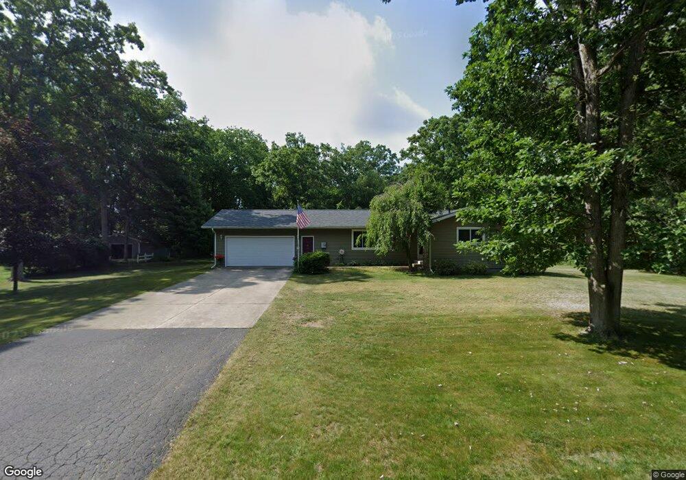
1682 Oak St Otsego, MI 49078
Estimated Value: $239,539 - $293,000
3
Beds
2
Baths
1,264
Sq Ft
$205/Sq Ft
Est. Value
About This Home
This home is located at 1682 Oak St, Otsego, MI 49078 and is currently estimated at $259,385, approximately $205 per square foot. 1682 Oak St is a home located in Allegan County with nearby schools including Otsego High School, St. Margaret School, and Otsego Christian Academy.
Ownership History
Date
Name
Owned For
Owner Type
Purchase Details
Closed on
Jul 21, 2010
Sold by
Mcleod Catherine and Mcleod Schmitt Nancy
Bought by
Cook Dawn K
Current Estimated Value
Home Financials for this Owner
Home Financials are based on the most recent Mortgage that was taken out on this home.
Original Mortgage
$123,339
Outstanding Balance
$81,054
Interest Rate
4.5%
Mortgage Type
FHA
Estimated Equity
$178,331
Purchase Details
Closed on
Apr 18, 1996
Sold by
Fayellen Horton
Bought by
"Kingsnorth
Create a Home Valuation Report for This Property
The Home Valuation Report is an in-depth analysis detailing your home's value as well as a comparison with similar homes in the area
Home Values in the Area
Average Home Value in this Area
Purchase History
| Date | Buyer | Sale Price | Title Company |
|---|---|---|---|
| Cook Dawn K | $125,000 | Devon Title Agency | |
| "Kingsnorth | $110,000 | -- |
Source: Public Records
Mortgage History
| Date | Status | Borrower | Loan Amount |
|---|---|---|---|
| Open | Cook Dawn K | $123,339 |
Source: Public Records
Tax History Compared to Growth
Tax History
| Year | Tax Paid | Tax Assessment Tax Assessment Total Assessment is a certain percentage of the fair market value that is determined by local assessors to be the total taxable value of land and additions on the property. | Land | Improvement |
|---|---|---|---|---|
| 2025 | $2,527 | $100,500 | $17,000 | $83,500 |
| 2024 | $1,910 | $98,400 | $17,000 | $81,400 |
| 2023 | $1,944 | $85,400 | $17,000 | $68,400 |
| 2022 | $1,910 | $82,000 | $17,500 | $64,500 |
| 2021 | $1,803 | $81,000 | $17,000 | $64,000 |
| 2020 | $1,782 | $71,500 | $14,900 | $56,600 |
| 2019 | $1,722 | $64,100 | $10,200 | $53,900 |
| 2018 | $1,685 | $62,500 | $10,200 | $52,300 |
| 2017 | $0 | $58,100 | $9,500 | $48,600 |
| 2016 | $0 | $53,500 | $9,500 | $44,000 |
| 2015 | -- | $53,500 | $9,500 | $44,000 |
| 2014 | $3,295 | $51,600 | $8,100 | $43,500 |
| 2013 | $3,295 | $60,500 | $12,800 | $47,700 |
Source: Public Records
Map
Nearby Homes
- 0 Briarwood St Unit 25002251
- 1651 Aspen Trail
- 1643 Aspen Trail
- 1647 Aspen Trail
- 1635 Aspen Trail
- 233 W Hammond St
- Elements 1870 Plan at Southpointe Trails
- Integrity 1605 Plan at Southpointe Trails
- Elements 2070 Plan at Southpointe Trails
- Integrity 2000 Plan at Southpointe Trails
- Elements 1680 Plan at Southpointe Trails
- integrity 2280 Plan at Southpointe Trails
- Integrity 1910 Plan at Southpointe Trails
- integrity 1800 Plan at Southpointe Trails
- Integrity 2061 V8.1a Plan at Southpointe Trails
- Elements 2390 Plan at Southpointe Trails
- Integrity 2190 Plan at Southpointe Trails
- Elements 2100 Plan at Southpointe Trails
- Elements 1800 Plan at Southpointe Trails
- Integrity 1610 Plan at Southpointe Trails