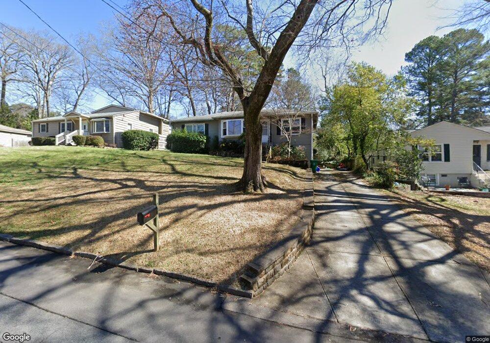
1683 Bridgeport Dr NE Atlanta, GA 30329
Briarcliff Heights NeighborhoodEstimated Value: $395,000 - $443,000
2
Beds
1
Bath
1,097
Sq Ft
$376/Sq Ft
Est. Value
About This Home
This home is located at 1683 Bridgeport Dr NE, Atlanta, GA 30329 and is currently estimated at $412,164, approximately $375 per square foot. 1683 Bridgeport Dr NE is a home located in DeKalb County with nearby schools including Sagamore Hills Elementary School, Henderson Middle School, and Lakeside High School.
Ownership History
Date
Name
Owned For
Owner Type
Purchase Details
Closed on
May 20, 2005
Sold by
Eisenhardt Robert D and Eisenhardt Lois A
Bought by
Tirtawidjaja Ratna D
Current Estimated Value
Home Financials for this Owner
Home Financials are based on the most recent Mortgage that was taken out on this home.
Original Mortgage
$172,500
Interest Rate
5.8%
Mortgage Type
New Conventional
Purchase Details
Closed on
Jun 25, 1996
Sold by
Kinard Shirley
Bought by
Eisenhardt Lois A
Create a Home Valuation Report for This Property
The Home Valuation Report is an in-depth analysis detailing your home's value as well as a comparison with similar homes in the area
Home Values in the Area
Average Home Value in this Area
Purchase History
| Date | Buyer | Sale Price | Title Company |
|---|---|---|---|
| Tirtawidjaja Ratna D | $230,000 | -- | |
| Eisenhardt Lois A | $35,000 | -- |
Source: Public Records
Mortgage History
| Date | Status | Borrower | Loan Amount |
|---|---|---|---|
| Closed | Tirtawidjaja Ratna D | $172,500 | |
| Closed | Eisenhardt Lois A | $0 |
Source: Public Records
Tax History Compared to Growth
Tax History
| Year | Tax Paid | Tax Assessment Tax Assessment Total Assessment is a certain percentage of the fair market value that is determined by local assessors to be the total taxable value of land and additions on the property. | Land | Improvement |
|---|---|---|---|---|
| 2025 | $4,738 | $145,520 | $69,850 | $75,670 |
| 2024 | $4,963 | $145,520 | $69,850 | $75,670 |
| 2023 | $4,963 | $145,520 | $69,520 | $76,000 |
| 2022 | $3,810 | $112,320 | $59,120 | $53,200 |
| 2021 | $3,821 | $112,640 | $58,000 | $54,640 |
| 2020 | $3,850 | $113,320 | $58,000 | $55,320 |
| 2019 | $3,655 | $108,880 | $58,000 | $50,880 |
| 2018 | $3,026 | $102,400 | $58,000 | $44,400 |
| 2017 | $3,035 | $87,440 | $36,000 | $51,440 |
| 2016 | $2,615 | $77,480 | $28,000 | $49,480 |
| 2014 | $2,323 | $69,520 | $28,000 | $41,520 |
Source: Public Records
Map
Nearby Homes
- 1680 Bristol Dr NE
- 1660 Bristol Dr NE
- 1789 Beacon Hill Blvd NE
- 1777 Rosalind Dr NE
- 2634 Portbury Place NE
- 1749 Breyerton Dr NE
- 1838 Bruce Rd NE
- 1851 Fern Creek Ln NE
- 1108 Westchester Ridge NE
- 1401 Westchester Ridge NE
- 1463 Edgebrook Ct NE Unit 14
- 1660 Woodbridge Ln NE
- 1514 Woodbridge Way NE
- 1234 Westchester Ridge NE
- 2211 Westchester Ridge NE
- 1740 Childerlee Ln NE
- 1679 Bridgeport Dr NE
- 1689 Bridgeport Dr NE
- 1673 Bridgeport Dr NE
- 1693 Bridgeport Dr NE
- 0 Bridgeport Dr NE Unit 7172489
- 0 Bridgeport Dr NE Unit 8972185
- 0 Bridgeport Dr NE Unit 8989774
- 0 Bridgeport Dr NE Unit 8874329
- 0 Bridgeport Dr NE Unit 3207079
- 0 Bridgeport Dr NE Unit 7411691
- 0 Bridgeport Dr NE Unit 8165575
- 0 Bridgeport Dr NE Unit 8322371
- 0 Bridgeport Dr NE Unit 8416499
- 0 Bridgeport Dr NE Unit 8642423
- 0 Bridgeport Dr NE
- 1686 Bristol Dr NE
- 1676 Bristol Dr NE
- 1690 Bristol Dr NE
- 1699 Bridgeport Dr NE
- 1669 Bridgeport Dr NE