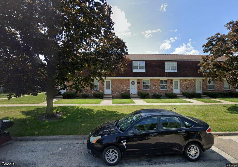
1683 Colonial Dr Unit H11 Bucyrus, OH 44820
Estimated Value: $87,000 - $100,000
2
Beds
1
Bath
432
Sq Ft
$221/Sq Ft
Est. Value
About This Home
This home is located at 1683 Colonial Dr Unit H11, Bucyrus, OH 44820 and is currently estimated at $95,478, approximately $221 per square foot. 1683 Colonial Dr Unit H11 is a home located in Crawford County with nearby schools including Wynford Elementary School, Wynford High School, and CENTER FOR AUTISM / DYSLEXIA - BUCYRUS.
Ownership History
Date
Name
Owned For
Owner Type
Purchase Details
Closed on
Jul 15, 2019
Sold by
Hulsmeyer Richard L and Hulsmeyer Kathleen J
Bought by
S & B Land Holdings Ltd
Current Estimated Value
Home Financials for this Owner
Home Financials are based on the most recent Mortgage that was taken out on this home.
Original Mortgage
$108,500
Outstanding Balance
$98,066
Interest Rate
5.5%
Mortgage Type
Adjustable Rate Mortgage/ARM
Estimated Equity
-$2,588
Create a Home Valuation Report for This Property
The Home Valuation Report is an in-depth analysis detailing your home's value as well as a comparison with similar homes in the area
Home Values in the Area
Average Home Value in this Area
Purchase History
| Date | Buyer | Sale Price | Title Company |
|---|---|---|---|
| S & B Land Holdings Ltd | $155,000 | Acs Title Bucyrus |
Source: Public Records
Mortgage History
| Date | Status | Borrower | Loan Amount |
|---|---|---|---|
| Open | S & B Land Holdings Ltd | $108,500 |
Source: Public Records
Tax History Compared to Growth
Tax History
| Year | Tax Paid | Tax Assessment Tax Assessment Total Assessment is a certain percentage of the fair market value that is determined by local assessors to be the total taxable value of land and additions on the property. | Land | Improvement |
|---|---|---|---|---|
| 2024 | $516 | $14,490 | $1,050 | $13,440 |
| 2023 | $516 | $8,430 | $1,160 | $7,270 |
| 2022 | $369 | $8,430 | $1,160 | $7,270 |
| 2021 | $384 | $8,430 | $1,160 | $7,270 |
| 2020 | $366 | $8,430 | $1,160 | $7,270 |
| 2019 | $377 | $8,430 | $1,160 | $7,270 |
| 2018 | $386 | $8,430 | $1,160 | $7,270 |
| 2017 | $375 | $8,430 | $1,160 | $7,270 |
| 2016 | $311 | $8,430 | $1,160 | $7,270 |
| 2015 | $315 | $8,430 | $1,160 | $7,270 |
| 2014 | $339 | $8,430 | $1,160 | $7,270 |
| 2013 | $339 | $8,430 | $1,160 | $7,270 |
Source: Public Records
Map
Nearby Homes
- 1555 Rosedale Ave
- 452 Pleasant Ln
- 1315 Lynne Ave
- 1211 S Sandusky Ave
- 0 Lynne Ave
- 1145 Lynne Ave
- 1021 S Sandusky Ave
- 900 S Spring St
- 1123 Hillcrest Dr
- 1149 Farmview Dr
- 1112 Hillcrest Dr
- 318 Charlotte St
- 2440 Wyandot Rd
- 708 S Sandusky Ave
- 419 Short St
- 130 Brentwood St
- 275 Brentwood St
- 325 W Liberty St
- 583 Rogers St
- 550 S Walnut St
- 1685 Colonial Dr Unit H12
- 1681 Colonial Dr Unit H10
- 1679 Colonial Dr
- 1677 Colonial Dr Unit H8
- 1675 Colonial Dr Unit H7
- 408 Heritage Cir Unit H16
- 406 Heritage Cir Unit H17
- 410 Heritage Cir Unit H13
- 400 Heritage Cir Unit H14
- 402 Heritage Cir Unit H15
- 404 Heritage Cir Unit H18
- 311 Heritage Cir
- 430 Heritage Cir Unit H19
- 420 Heritage Cir Unit H20
- 422 Heritage Cir Unit H21
- 428 Heritage Cir Unit H22
- 440 Heritage Cir Unit H25
- 484 Heritage Cir Unit H34
- 426 Heritage Cir Unit H23
- 442 Heritage Cir Unit H26