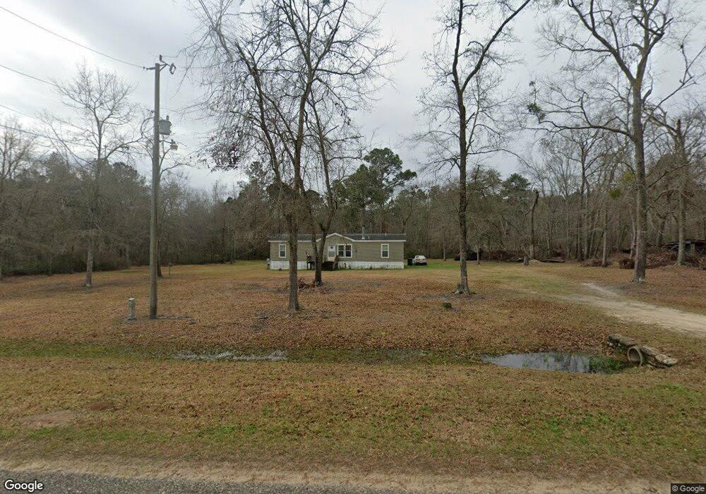
1683 Crosbytown Rd Quitman, GA 31643
Estimated Value: $61,240 - $240,000
Studio
--
Bath
1,568
Sq Ft
$87/Sq Ft
Est. Value
About This Home
This home is located at 1683 Crosbytown Rd, Quitman, GA 31643 and is currently estimated at $137,060, approximately $87 per square foot. 1683 Crosbytown Rd is a home with nearby schools including North Brooks Elementary School.
Ownership History
Date
Name
Owned For
Owner Type
Purchase Details
Closed on
Nov 26, 2008
Sold by
Burnham Debra Kim
Bought by
Burnham Christopher Matthew
Current Estimated Value
Purchase Details
Closed on
Sep 23, 2008
Sold by
Burnham Debra Kim
Bought by
Burnham Christopher Matthew
Create a Home Valuation Report for This Property
The Home Valuation Report is an in-depth analysis detailing your home's value as well as a comparison with similar homes in the area
Purchase History
We collect this data history from publicly available records. To have your information removed, we recommend requesting removal directly through your county’s website.
| Date | Buyer | Sale Price | Title Company |
|---|---|---|---|
| Burnham Christopher Matthew | -- | -- | |
| Burnham Christopher Matthew | -- | -- |
Source: Public Records
Tax History
| Year | Tax Paid | Tax Assessment Tax Assessment Total Assessment is a certain percentage of the fair market value that is determined by local assessors to be the total taxable value of land and additions on the property. | Land | Improvement |
|---|---|---|---|---|
| 2025 | $388 | $5,200 | $3,880 | $1,320 |
| 2024 | $388 | $5,200 | $3,880 | $1,320 |
| 2023 | $365 | $4,288 | $3,360 | $928 |
| 2022 | $372 | $4,140 | $3,200 | $940 |
| 2021 | $709 | $16,768 | $3,320 | $13,448 |
| 2020 | $475 | $17,088 | $3,320 | $13,768 |
| 2019 | $697 | $17,524 | $3,200 | $14,324 |
| 2018 | $526 | $18,003 | $3,200 | $14,803 |
| 2017 | $690 | $14,636 | $0 | $14,636 |
| 2016 | $732 | $44,540 | $0 | $0 |
| 2015 | -- | $31,160 | $0 | $0 |
| 2014 | -- | $19,400 | $2,880 | $16,520 |
| 2013 | -- | $19,720 | $3,200 | $16,520 |
Source: Public Records
Map
Nearby Homes
- 376 Jamar Trail
- 832 Ramblin Rd
- 890 Ramblin Rd
- 521 Sunflower Trail
- 90 Trail of Hawk Rd
- 34 Jamar Trail
- 149 Sunflower Trail
- 19 Sunflower Trail
- 2080 Rizer Rd
- 95 Kelly Dr
- 2075 Ellenberg Rd
- 8266 Troupeville Rd
- 8262 Troupeville Rd
- 1019 Fodie Rd
- 2430 Spain Rd
- 1521 Mount Carmel Chuch Rx
- 16891 Valdosta Hwy
- 535 Pinebrook Dr
- 51 Quail Dr
- 56 Greenridge St
- 2384 Studstill Rd
- 2410 Studstill Rd
- 2325 Studstill Rd
- 2255 Studstill Rd
- 2636 Tom Lodge Rd
- 2687 Tom Lodge Rd
- 2186 Studstill Rd
- 2190 Studstill Rd
- 2536 Tom Lodge Rd
- 2591 Tom Lodge Rd
- 2482 Tom Lodge Rd
- 2517 Tom Lodge Rd
- 2022 Studstill Rd
- 2455 Tom Lodge Rd
- 1257 Crosbytown Rd
- 1253 Crosbytown Rd
- 0 Studstill Rd
- 2429 Tom Lodge Rd
- 1202 Crosbytown Rd
- 2418 Tom Lodge Rd
Your Personal Tour Guide
Ask me questions while you tour the home.