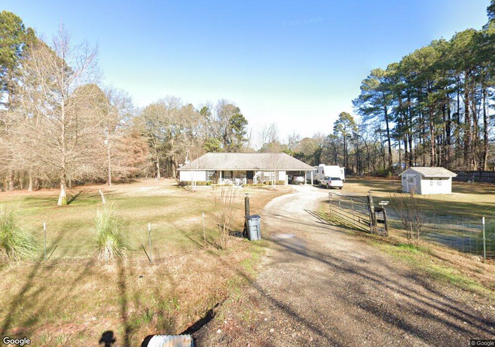
1683 Cummings Ln Texarkana, TX 75501
Estimated Value: $169,132 - $265,000
--
Bed
--
Bath
1,275
Sq Ft
$173/Sq Ft
Est. Value
About This Home
This home is located at 1683 Cummings Ln, Texarkana, TX 75501 and is currently estimated at $221,033, approximately $173 per square foot. 1683 Cummings Ln is a home located in Bowie County with nearby schools including Liberty-Eylau Early Childhood Center, Liberty-Eylau Primary School, and Liberty-Eylau C.K. Bender Elementary Campus.
Ownership History
Date
Name
Owned For
Owner Type
Purchase Details
Closed on
Dec 16, 2005
Sold by
Underwood Tracy and Underwood Brian
Bought by
Thompson Pamela
Current Estimated Value
Home Financials for this Owner
Home Financials are based on the most recent Mortgage that was taken out on this home.
Original Mortgage
$71,920
Interest Rate
6.29%
Mortgage Type
New Conventional
Create a Home Valuation Report for This Property
The Home Valuation Report is an in-depth analysis detailing your home's value as well as a comparison with similar homes in the area
Home Values in the Area
Average Home Value in this Area
Purchase History
| Date | Buyer | Sale Price | Title Company |
|---|---|---|---|
| Thompson Pamela | -- | None Available |
Source: Public Records
Mortgage History
| Date | Status | Borrower | Loan Amount |
|---|---|---|---|
| Closed | Thompson Pamela | $71,920 |
Source: Public Records
Tax History Compared to Growth
Tax History
| Year | Tax Paid | Tax Assessment Tax Assessment Total Assessment is a certain percentage of the fair market value that is determined by local assessors to be the total taxable value of land and additions on the property. | Land | Improvement |
|---|---|---|---|---|
| 2025 | $1,265 | $162,504 | $16,500 | $146,004 |
| 2024 | $1,265 | $158,389 | $16,500 | $141,889 |
| 2023 | $2,209 | $147,872 | $0 | $0 |
| 2022 | $2,316 | $144,799 | $14,500 | $130,299 |
| 2021 | $2,239 | $122,208 | $14,500 | $107,708 |
| 2020 | $2,163 | $117,189 | $14,500 | $102,689 |
| 2019 | $2,184 | $112,414 | $14,500 | $97,914 |
| 2018 | $2,112 | $108,734 | $14,500 | $94,234 |
| 2017 | $2,117 | $109,427 | $14,500 | $94,927 |
| 2016 | $2,108 | $108,927 | $14,000 | $94,927 |
| 2015 | $1,678 | $108,029 | $14,000 | $94,029 |
| 2014 | $1,678 | $105,510 | $14,000 | $91,510 |
Source: Public Records
Map
Nearby Homes
- 3088 Buchanan Loop Rd
- 2043 Randall Rd
- 0 Randall Rd
- 403 Brookfield St
- 115 Krobot Cir
- 1 Starlite Dr
- 6514 Buchanan Loop Rd
- 310 Springridge Dr
- 101 Redwood Dr
- 2 S Pineview Dr
- 0 Urban Dr
- 39 Quail Brook Dr
- 144 Joe Tyl Rd
- 6815 Buchanan Loop Rd
- 5789 U S 59
- 6 Southridge St
- 194 W Starlite Dr
- 327 Crudip Ln
- TBD Lp Frontage Wallace Pkwy
- 280 Patriot Way
- 1711 Cummings Ln
- 1613 Cummings Ln
- 61 Orangewood Rd
- 1611 Cummings Ln
- 81 Orangewood Rd
- 20 Orangewood Rd
- 36 Orangewood Rd
- 1563 Cummings Ln
- 56 Orangewood Rd
- 4628 S Kings Hwy
- 162 Lemontree Cir
- 4632 S Kings Hwy
- 4630 S Kings Hwy
- 180 Lemontree Cir
- 4618 S Kings Hwy
- 4612 S Kings Hwy
- 225 Lemontree Cir
- 4732 S Kings Hwy
- 4802 S Kings Hwy
- 4623 S Kings Hwy