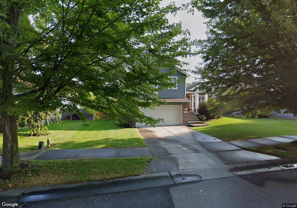
1683 W Tullis Dr Coeur D Alene, ID 83815
Ramsey-Woodland NeighborhoodEstimated Value: $489,000 - $528,000
4
Beds
2
Baths
1,813
Sq Ft
$281/Sq Ft
Est. Value
About This Home
This home is located at 1683 W Tullis Dr, Coeur D Alene, ID 83815 and is currently estimated at $508,992, approximately $280 per square foot. 1683 W Tullis Dr is a home located in Kootenai County with nearby schools including Skyway Elementary School, Woodland Middle School, and Lake City High School.
Ownership History
Date
Name
Owned For
Owner Type
Purchase Details
Closed on
Apr 23, 2019
Sold by
Robinson Nicole R
Bought by
Johnson Linda M
Current Estimated Value
Home Financials for this Owner
Home Financials are based on the most recent Mortgage that was taken out on this home.
Original Mortgage
$285,000
Outstanding Balance
$250,056
Interest Rate
4.2%
Mortgage Type
New Conventional
Estimated Equity
$258,936
Purchase Details
Closed on
Jul 1, 2015
Sold by
Engelhardt Engelhardt R and Engelhardt Cynthia L
Bought by
Robinson Nicole R
Home Financials for this Owner
Home Financials are based on the most recent Mortgage that was taken out on this home.
Original Mortgage
$195,753
Interest Rate
3.81%
Mortgage Type
VA
Create a Home Valuation Report for This Property
The Home Valuation Report is an in-depth analysis detailing your home's value as well as a comparison with similar homes in the area
Home Values in the Area
Average Home Value in this Area
Purchase History
| Date | Buyer | Sale Price | Title Company |
|---|---|---|---|
| Johnson Linda M | -- | Alliance Ttl Coeur D Alene O | |
| Robinson Nicole R | -- | Pioneer Title Kootenai Count |
Source: Public Records
Mortgage History
| Date | Status | Borrower | Loan Amount |
|---|---|---|---|
| Open | Johnson Linda M | $285,000 | |
| Previous Owner | Robinson Nicole R | $195,753 |
Source: Public Records
Tax History Compared to Growth
Tax History
| Year | Tax Paid | Tax Assessment Tax Assessment Total Assessment is a certain percentage of the fair market value that is determined by local assessors to be the total taxable value of land and additions on the property. | Land | Improvement |
|---|---|---|---|---|
| 2025 | $1,599 | $440,704 | $185,000 | $255,704 |
| 2024 | $1,599 | $440,990 | $185,000 | $255,990 |
| 2023 | $1,599 | $454,910 | $184,500 | $270,410 |
| 2022 | $2,031 | $503,145 | $205,000 | $298,145 |
| 2021 | $1,690 | $316,060 | $107,525 | $208,535 |
| 2020 | $1,596 | $275,646 | $93,500 | $182,146 |
| 2019 | $1,616 | $246,368 | $85,000 | $161,368 |
| 2018 | $1,381 | $210,581 | $77,963 | $132,618 |
| 2017 | $1,219 | $177,569 | $64,969 | $112,600 |
| 2016 | $1,219 | $168,455 | $61,875 | $106,580 |
| 2015 | $1,221 | $164,040 | $56,250 | $107,790 |
| 2013 | $1,150 | $140,710 | $37,800 | $102,910 |
Source: Public Records
Map
Nearby Homes
- 5880 N Magellan Ct
- 1815 W Dartmouth Cir
- 1686 W Dartmouth Cir
- 2122 W Windermere Ave
- 2154 W Windermere Ave
- 1710 Westminster Ave
- 2187 W Windermere Ave
- 1840 Westminster Ave
- 2099 W Plymouth Cir
- 5887 N Harcourt Dr
- 5723 N Christopher Dr
- 2055 W Dartmouth Cir
- 2189 W Yorkshire Ave
- 2214 W Windermere Ave
- 1615 W Marlborough Ave
- 5513 N Atlantic Dr
- 1630 W Windsor Ave
- 4838 W Cougar Cir
- 2243 W Oxford Cir
- 2489 W Plymouth Cir
- 1675 W Tullis Dr
- 1705 Tullis Dr
- 1663 Tullis Dr
- 1711 W Tullis Dr
- 1672 W Durham Dr
- 1710 W Durham Dr
- 1664 W Durham Dr
- 1682 W Tullis Dr
- 1682 Tullis Dr
- 1712 W Durham Dr
- 1694 W Tullis Dr
- 1674 W Tullis Dr
- 1702 W Tullis Dr
- 1660 W Tullis Dr
- 1637 W Tullis Dr
- 1725 Tullis Dr
- 1640 W Durham Dr
- 1720 W Durham Dr
- 1714 Tullis Dr
- 1652 W Tullis Dr