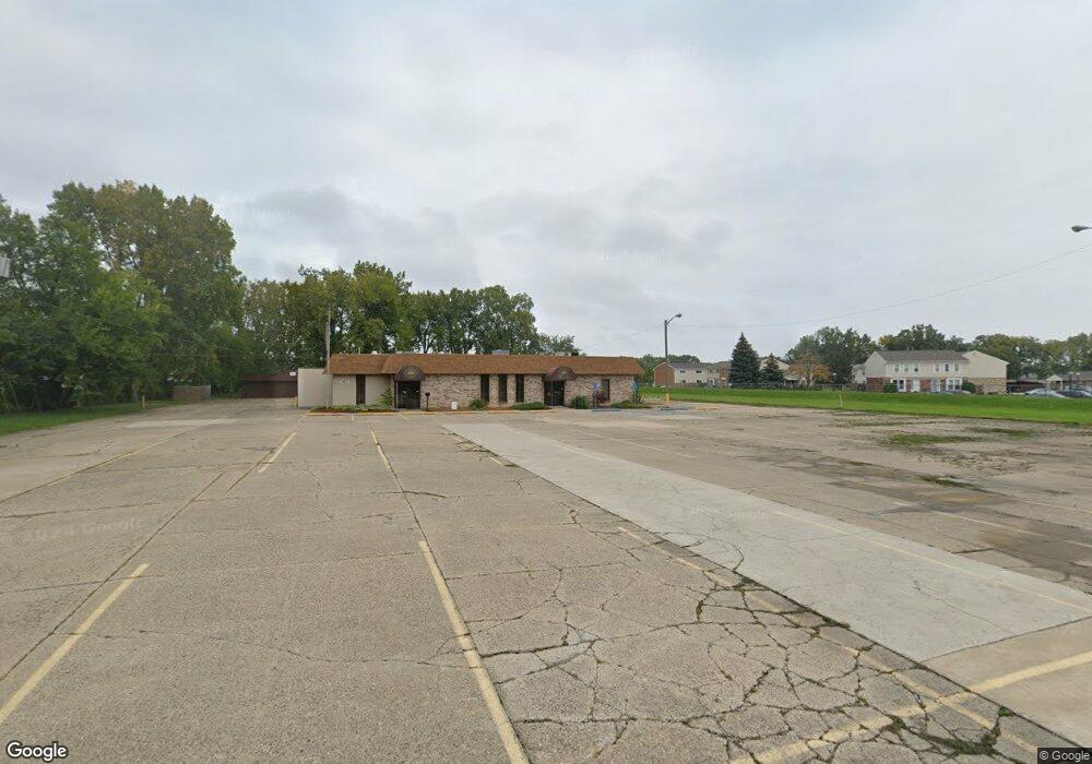
16831 E 12 Mile Rd Roseville, MI 48066
Estimated Value: $560,611
--
Bed
1
Bath
8,984
Sq Ft
$62/Sq Ft
Est. Value
About This Home
This home is located at 16831 E 12 Mile Rd, Roseville, MI 48066 and is currently estimated at $560,611, approximately $62 per square foot. 16831 E 12 Mile Rd is a home located in Macomb County with nearby schools including Fountain Elementary School, Eastland Middle School, and Roseville High School.
Ownership History
Date
Name
Owned For
Owner Type
Purchase Details
Closed on
Apr 25, 2017
Sold by
Roseville 97 Building Corp
Bought by
Hmong American Baptist Church
Current Estimated Value
Home Financials for this Owner
Home Financials are based on the most recent Mortgage that was taken out on this home.
Original Mortgage
$159,250
Outstanding Balance
$31,312
Interest Rate
4.14%
Mortgage Type
Commercial
Estimated Equity
$529,299
Create a Home Valuation Report for This Property
The Home Valuation Report is an in-depth analysis detailing your home's value as well as a comparison with similar homes in the area
Home Values in the Area
Average Home Value in this Area
Purchase History
| Date | Buyer | Sale Price | Title Company |
|---|---|---|---|
| Hmong American Baptist Church | $245,000 | None Available |
Source: Public Records
Mortgage History
| Date | Status | Borrower | Loan Amount |
|---|---|---|---|
| Open | Hmong American Baptist Church | $159,250 |
Source: Public Records
Tax History Compared to Growth
Tax History
| Year | Tax Paid | Tax Assessment Tax Assessment Total Assessment is a certain percentage of the fair market value that is determined by local assessors to be the total taxable value of land and additions on the property. | Land | Improvement |
|---|---|---|---|---|
| 2025 | $225 | $0 | $0 | $0 |
| 2024 | $225 | $0 | $0 | $0 |
| 2023 | -- | $0 | $0 | $0 |
| 2022 | $227 | $0 | $0 | $0 |
| 2021 | $207 | $0 | $0 | $0 |
| 2020 | $8,381 | $0 | $0 | $0 |
| 2019 | $8,381 | $0 | $0 | $0 |
| 2018 | $0 | $0 | $0 | $0 |
| 2017 | $8,615 | $288,346 | $93,305 | $195,041 |
| 2016 | $8,381 | $288,346 | $0 | $0 |
| 2015 | $11,208 | $288,785 | $0 | $0 |
| 2013 | -- | $265,739 | $0 | $0 |
| 2011 | -- | $251,936 | $0 | $0 |
Source: Public Records
Map
Nearby Homes
- 29152 W Brittany Ct
- 29294 E Brittany Ct Unit 39
- 16804 E 12 Mile Rd
- 16488 Benmar Ct
- 28703 Groveland St
- 28824 Bohn St
- 28633 Citation Dr
- 17350 E Pointe Dr
- 29573 Gregg Dr
- 29257 Commonwealth St
- 28410 Bohn St
- 16067 Secretariat Ave
- 17356 Eastland St
- 29217 Dembs Dr
- 28212 Floral St
- 29761 Rosemont St
- 28767 Maple St
- 28908 Maple St
- 28919 Essex St
- 28222 Bohn St
- 29168 W Brittany Ct
- 29160 W Brittany Ct
- 29144 W Brittany Ct
- 29176 W Brittany Ct Unit 26
- 29101 Brittany Ct Unit Building 3, Apt 11
- 29187 E Brittany Ct Unit 21
- 29179 E Brittany Ct Unit 20
- 29171 E Brittany Ct
- 29163 E Brittany Ct
- 29151 E Brittany Ct
- 29127 E Brittany Ct Unit 14
- 29111 Brittany Ct Unit 12
- 29101 Brittany Ct Unit 11
- 29101 Brittany Ct Unit 3 Apartment 11
- 29143 E Brittany Ct Unit 16
- 29111 Brittany Ct Unit 3-12
- 29101 Brittany Ct Unit 3 Ap
- 29101 Brittany Ct Unit Build
- 29021 Brittany Ct
- 29021 Brittany Ct Unit 9