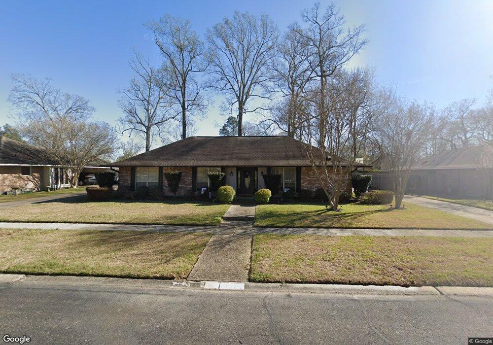
16832 Harpers Ferry Ave Baton Rouge, LA 70817
Shenandoah NeighborhoodEstimated Value: $273,000 - $292,000
4
Beds
2
Baths
2,068
Sq Ft
$136/Sq Ft
Est. Value
About This Home
This home is located at 16832 Harpers Ferry Ave, Baton Rouge, LA 70817 and is currently estimated at $281,210, approximately $135 per square foot. 16832 Harpers Ferry Ave is a home located in East Baton Rouge Parish with nearby schools including Shenandoah Elementary School, Woodlawn Middle School, and Woodlawn High School.
Ownership History
Date
Name
Owned For
Owner Type
Purchase Details
Closed on
Jun 30, 2009
Sold by
Whitlow Susan Z
Bought by
Hodges Douglas W
Current Estimated Value
Home Financials for this Owner
Home Financials are based on the most recent Mortgage that was taken out on this home.
Original Mortgage
$182,631
Outstanding Balance
$116,317
Interest Rate
4.84%
Mortgage Type
FHA
Estimated Equity
$164,893
Create a Home Valuation Report for This Property
The Home Valuation Report is an in-depth analysis detailing your home's value as well as a comparison with similar homes in the area
Home Values in the Area
Average Home Value in this Area
Purchase History
| Date | Buyer | Sale Price | Title Company |
|---|---|---|---|
| Hodges Douglas W | $186,000 | -- |
Source: Public Records
Mortgage History
| Date | Status | Borrower | Loan Amount |
|---|---|---|---|
| Open | Hodges Douglas W | $182,631 |
Source: Public Records
Tax History Compared to Growth
Tax History
| Year | Tax Paid | Tax Assessment Tax Assessment Total Assessment is a certain percentage of the fair market value that is determined by local assessors to be the total taxable value of land and additions on the property. | Land | Improvement |
|---|---|---|---|---|
| 2024 | $2,192 | $25,700 | $2,000 | $23,700 |
| 2023 | $2,192 | $20,700 | $2,000 | $18,700 |
| 2022 | $2,429 | $20,700 | $2,000 | $18,700 |
| 2021 | $2,384 | $20,700 | $2,000 | $18,700 |
| 2020 | $2,414 | $20,700 | $2,000 | $18,700 |
| 2019 | $2,271 | $18,650 | $2,000 | $16,650 |
| 2018 | $2,243 | $18,650 | $2,000 | $16,650 |
| 2017 | $2,243 | $18,650 | $2,000 | $16,650 |
| 2016 | $1,326 | $18,650 | $2,000 | $16,650 |
| 2015 | $1,326 | $18,650 | $2,000 | $16,650 |
| 2014 | $1,298 | $18,650 | $2,000 | $16,650 |
| 2013 | -- | $18,650 | $2,000 | $16,650 |
Source: Public Records
Map
Nearby Homes
- 16825 Chadsford Ave
- 16756 Merrimac Ave
- 5534 Round Forrest Dr
- 5821 Fort Sumpter Dr
- 16067 Chantilly Ave
- 16039 Haynes Bluff Ave
- 15844 Chantilly Ave
- 16849 Monitor Ave
- 4830 Kennesaw Dr Unit A
- 16849 Mill Grove Ln
- 17845 Coffee Rd
- 16225 Chadsford Ave
- 16025 Parkside Ct
- 6335 Antioch Blvd
- 6246 Petersburg Dr
- 6374 Muir St
- Lot 41A Carnifix Ct
- 17237 Monitor Ave
- 16255 White Rose Dr
- 15946 Ferrell Ave
- 16822 Harpers Ferry Ave
- 16842 Harpers Ferry Ave
- 16803 Fort Pulaski Ave
- 16751 Fort Pulaski Ave
- 16812 Harpers Ferry Ave
- 16812 Harpers Ferry Ave
- 16812 Harpers Ferry Ave
- 16904 Harpers Ferry Ave
- 16813 Fort Pulaski Ave
- 16741 Fort Pulaski Ave
- 16831 Harpers Ferry Ave
- 16821 Harpers Ferry Ave
- 16823 Fort Pulaski Ave
- 16841 Harpers Ferry Ave
- 16731 Fort Pulaski Ave
- 16914 Harpers Ferry Ave
- 16913 Harper's Ferry Ave
- 5323 Port Hudson Dr
- 16833 Fort Pulaski Ave
- 16913 Harpers Ferry Ave