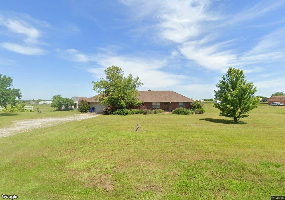
16835 SW 27th St El Reno, OK 73036
Estimated Value: $343,000 - $479,000
3
Beds
2
Baths
2,089
Sq Ft
$184/Sq Ft
Est. Value
About This Home
This home is located at 16835 SW 27th St, El Reno, OK 73036 and is currently estimated at $383,406, approximately $183 per square foot. 16835 SW 27th St is a home with nearby schools including Banner School.
Ownership History
Date
Name
Owned For
Owner Type
Purchase Details
Closed on
Jan 30, 2025
Sold by
Brown Michael A and Brown Sherry J
Bought by
Ms Brown Living Trust and Brown
Current Estimated Value
Purchase Details
Closed on
Apr 29, 2022
Sold by
Beth Roles Sharon
Bought by
Sharon Beth Roles Revocable Trust
Purchase Details
Closed on
Oct 2, 2003
Sold by
Roles Gaylen Ron and Roles Darlene~Ann
Bought by
Brown Michael A and Brown Sherry J
Purchase Details
Closed on
May 20, 2003
Sold by
Roles Glenn Dean
Purchase Details
Closed on
Mar 12, 1999
Sold by
Roles Glen Dean and Roles Bobbi L
Purchase Details
Closed on
Nov 20, 1998
Sold by
Roles Galen and Roles Darlene
Purchase Details
Closed on
Aug 31, 1998
Sold by
Roles Glenn D and Roles Bobbi L
Purchase Details
Closed on
Dec 17, 1991
Sold by
Conversion
Create a Home Valuation Report for This Property
The Home Valuation Report is an in-depth analysis detailing your home's value as well as a comparison with similar homes in the area
Home Values in the Area
Average Home Value in this Area
Purchase History
| Date | Buyer | Sale Price | Title Company |
|---|---|---|---|
| Ms Brown Living Trust | -- | None Listed On Document | |
| Sharon Beth Roles Revocable Trust | -- | None Listed On Document | |
| Brown Michael A | -- | -- | |
| -- | -- | -- | |
| -- | $130,000 | -- | |
| -- | -- | -- | |
| -- | -- | -- | |
| -- | $2,000 | -- |
Source: Public Records
Tax History Compared to Growth
Tax History
| Year | Tax Paid | Tax Assessment Tax Assessment Total Assessment is a certain percentage of the fair market value that is determined by local assessors to be the total taxable value of land and additions on the property. | Land | Improvement |
|---|---|---|---|---|
| 2024 | $1,648 | $23,276 | $4,524 | $18,752 |
| 2023 | $1,648 | $22,598 | $4,333 | $18,265 |
| 2022 | $1,612 | $21,940 | $4,135 | $17,805 |
| 2021 | $1,570 | $21,301 | $3,607 | $17,694 |
| 2020 | $1,504 | $20,681 | $3,460 | $17,221 |
| 2019 | $1,466 | $20,079 | $3,339 | $16,740 |
| 2018 | $1,442 | $19,494 | $3,228 | $16,266 |
| 2017 | $1,409 | $18,927 | $3,043 | $15,884 |
| 2016 | $1,339 | $18,926 | $3,030 | $15,896 |
| 2015 | -- | $17,548 | $2,651 | $14,897 |
| 2014 | -- | $17,038 | $2,441 | $14,597 |
Source: Public Records
Map
Nearby Homes
- 2858 Fields Rd
- 3850 S Banner Rd
- 15821 SW 26th St
- 4800 Old Farm Rd
- 4850 Old Farm Rd
- 3490 Manning St
- 15821 SW 15th St
- 000 SW 15th St
- 920 S Gregory Rd
- 15900 SW 44th St
- 6220 S Banner Rd
- 7465 Legacy Pointe Cir
- 3530 S Manning Rd
- 19250 SW 44th St
- 6401 Lois Ln
- 300 S Richland Rd
- 7025 S Cimarron Rd
- 17910 Highway 152
- 12915 SW 44th St
- 14209 SW 50th Ct
- 16832 SW 27th St
- 16785 SW 27th St
- 16810 SW 27th St
- 16885 SW 27th St
- 16880 SW 27th St
- 16745 SW 27th St
- 16825 SW 29th St
- 16875 SW 29th St
- 16930 SW 27th St
- 16724 SW 27th St
- 16905 SW 29th St
- 16701 SW 27th St
- 16701 SW 27th St
- 2450 Lindsay Ln
- 16745 SW 29th St
- 2451 Lindsay Ln
- 16820 SW 29th St
- 16820 SW 29th St
- 2640 S Banner Rd
- 16945 SW 29th St