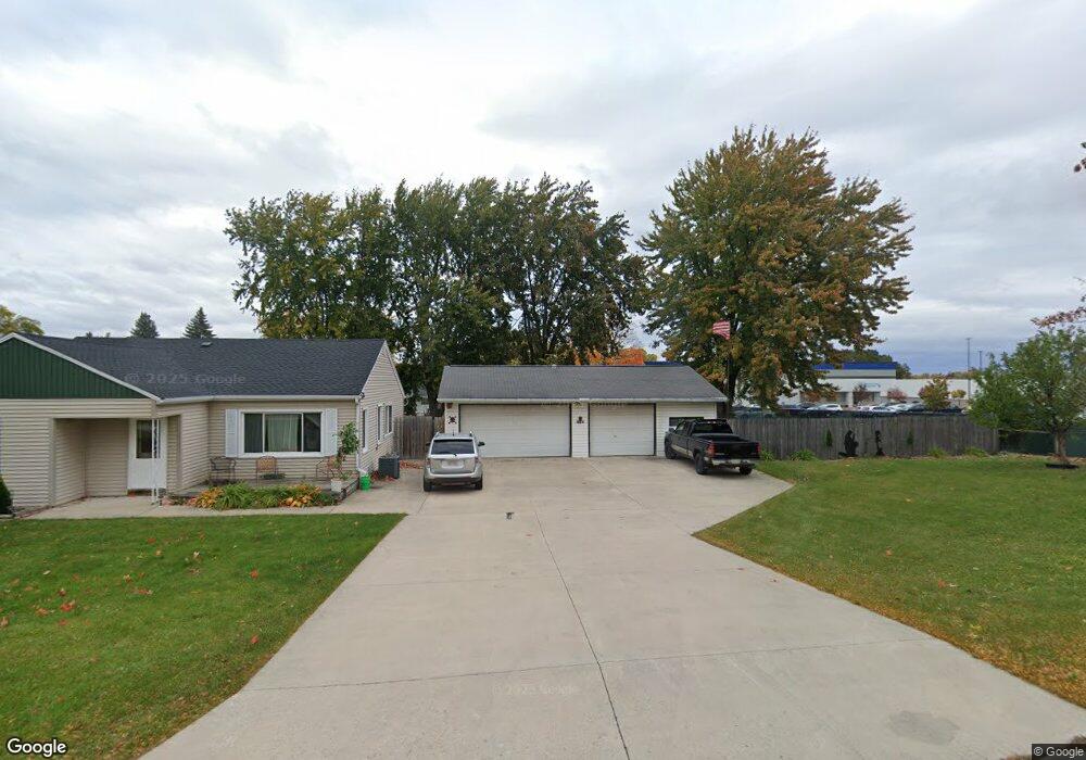
1684 Burns Ave Green Bay, WI 54303
Westside NeighborhoodEstimated Value: $254,000 - $317,000
3
Beds
1
Bath
1,149
Sq Ft
$245/Sq Ft
Est. Value
About This Home
This home is located at 1684 Burns Ave, Green Bay, WI 54303 and is currently estimated at $281,711, approximately $245 per square foot. 1684 Burns Ave is a home located in Brown County with nearby schools including Kennedy Elementary School, Lombardi Middle School, and Southwest High School.
Ownership History
Date
Name
Owned For
Owner Type
Purchase Details
Closed on
Nov 2, 2005
Sold by
Hansen David R and Hansen Barbara L
Bought by
Vanlanen Rick J
Current Estimated Value
Home Financials for this Owner
Home Financials are based on the most recent Mortgage that was taken out on this home.
Original Mortgage
$92,800
Outstanding Balance
$50,544
Interest Rate
6.04%
Mortgage Type
Fannie Mae Freddie Mac
Estimated Equity
$231,167
Purchase Details
Closed on
Jul 15, 2005
Sold by
Hansen David R and Hansen Barbara L
Bought by
Vanstraten Daniel J
Create a Home Valuation Report for This Property
The Home Valuation Report is an in-depth analysis detailing your home's value as well as a comparison with similar homes in the area
Home Values in the Area
Average Home Value in this Area
Purchase History
| Date | Buyer | Sale Price | Title Company |
|---|---|---|---|
| Vanlanen Rick J | $116,000 | Liberty Title | |
| Vanstraten Daniel J | $29,900 | Liberty Title |
Source: Public Records
Mortgage History
| Date | Status | Borrower | Loan Amount |
|---|---|---|---|
| Open | Vanlanen Rick J | $92,800 |
Source: Public Records
Tax History Compared to Growth
Tax History
| Year | Tax Paid | Tax Assessment Tax Assessment Total Assessment is a certain percentage of the fair market value that is determined by local assessors to be the total taxable value of land and additions on the property. | Land | Improvement |
|---|---|---|---|---|
| 2024 | $3,525 | $191,700 | $61,900 | $129,800 |
| 2023 | $3,356 | $191,700 | $61,900 | $129,800 |
| 2022 | $3,290 | $191,700 | $61,900 | $129,800 |
| 2021 | $2,696 | $121,100 | $42,300 | $78,800 |
| 2020 | $2,912 | $121,100 | $42,300 | $78,800 |
| 2019 | $2,845 | $121,100 | $42,300 | $78,800 |
| 2018 | $2,762 | $121,100 | $42,300 | $78,800 |
| 2017 | $2,691 | $121,100 | $42,300 | $78,800 |
| 2016 | $2,656 | $121,100 | $42,300 | $78,800 |
| 2015 | $2,633 | $121,100 | $42,300 | $78,800 |
| 2014 | $2,782 | $121,100 | $42,300 | $78,800 |
| 2013 | $2,782 | $121,100 | $42,300 | $78,800 |
Source: Public Records
Map
Nearby Homes
- 806 Sunny Ln Unit 808
- 1753 Western Ave
- 809 Mitchell St
- 1527 N Mennen Ct
- 1159 Michaline Dr
- 838 S Fisk St
- 1779 9th St
- 510 Lambeau St
- 1306 Nelson St Unit 1308
- 1123 S Fisk St
- 1825 Parkland Way
- 1201 S Fisk St
- 1411 Shawano Ave
- 1428 Argonne Dr
- 1716 Nancy Ave
- 1526 Rockdale St
- 1255 Loch Dr
- 1053 Ernst Dr
- 1522 Argonne Dr
- 1427 Russell St
- 1687 Bentwood Dr
- 1685 Bentwood Dr
- 1691 Bentwood Dr
- 1700 Burns Ave
- 1713 Bentwood Dr
- 1709 Bentwood Dr
- 1723 Bentwood Dr
- 1708 Burns Ave
- 1677 W Mason St
- 1671 W Mason St
- 1684 Bentwood Dr
- 0 W Mason St Unit 10808447
- 1690 Bentwood Dr
- 1704 W Mason St
- 1676 Spruce St
- 1694 Bentwood Dr
- 1700 Bentwood Dr
- 1668 Spruce St
- 1716 Bentwood Dr
- 1726 Bentwood Dr