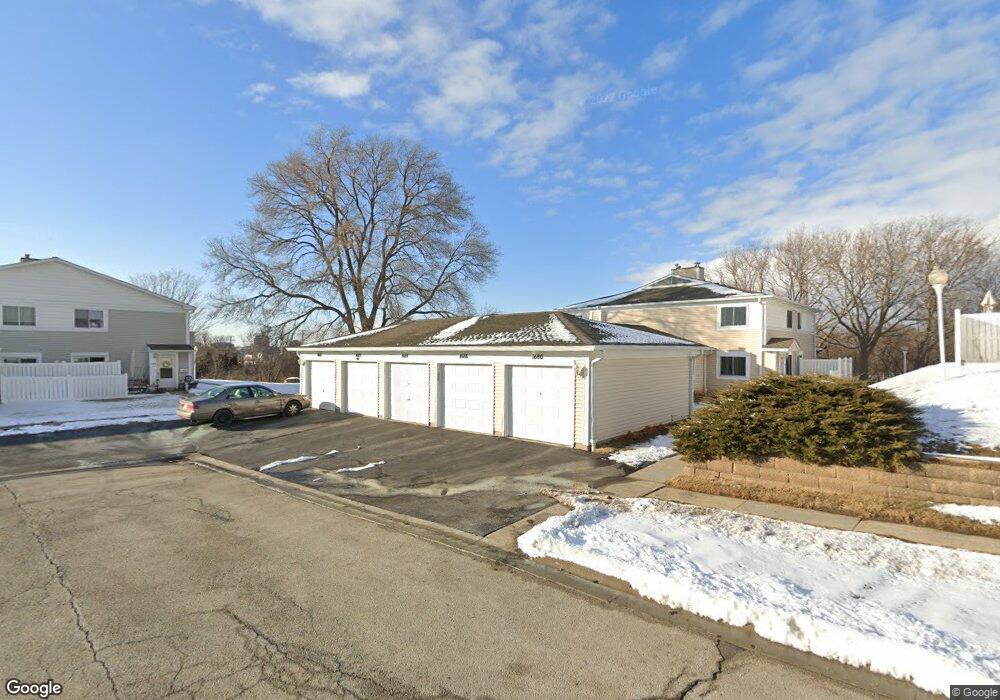
1684 Cornell Dr Unit 25C Hoffman Estates, IL 60169
South Hoffman Estates NeighborhoodEstimated Value: $210,304 - $244,000
2
Beds
--
Bath
1,000
Sq Ft
$228/Sq Ft
Est. Value
About This Home
This home is located at 1684 Cornell Dr Unit 25C, Hoffman Estates, IL 60169 and is currently estimated at $228,076, approximately $228 per square foot. 1684 Cornell Dr Unit 25C is a home located in Cook County with nearby schools including Neil Armstrong Elementary School, Dwight D Eisenhower Junior High School, and Hoffman Estates High School.
Ownership History
Date
Name
Owned For
Owner Type
Purchase Details
Closed on
May 22, 2003
Sold by
Kelley Deanna L
Bought by
Milligan Louisa M
Current Estimated Value
Home Financials for this Owner
Home Financials are based on the most recent Mortgage that was taken out on this home.
Original Mortgage
$117,900
Interest Rate
5.37%
Mortgage Type
Stand Alone First
Purchase Details
Closed on
Nov 5, 1999
Sold by
Yoon Jackie M
Bought by
Kelley Deanna L
Home Financials for this Owner
Home Financials are based on the most recent Mortgage that was taken out on this home.
Original Mortgage
$75,150
Interest Rate
7.97%
Purchase Details
Closed on
Jun 24, 1998
Sold by
Lee James C
Bought by
Yoon Jackie M
Home Financials for this Owner
Home Financials are based on the most recent Mortgage that was taken out on this home.
Original Mortgage
$76,000
Interest Rate
7.03%
Create a Home Valuation Report for This Property
The Home Valuation Report is an in-depth analysis detailing your home's value as well as a comparison with similar homes in the area
Home Values in the Area
Average Home Value in this Area
Purchase History
| Date | Buyer | Sale Price | Title Company |
|---|---|---|---|
| Milligan Louisa M | $131,000 | Atgf Inc | |
| Kelley Deanna L | $83,500 | -- | |
| Yoon Jackie M | $82,000 | -- |
Source: Public Records
Mortgage History
| Date | Status | Borrower | Loan Amount |
|---|---|---|---|
| Previous Owner | Milligan Louisa M | $117,900 | |
| Previous Owner | Kelley Deanna L | $75,150 | |
| Previous Owner | Yoon Jackie M | $76,000 |
Source: Public Records
Tax History
| Year | Tax Paid | Tax Assessment Tax Assessment Total Assessment is a certain percentage of the fair market value that is determined by local assessors to be the total taxable value of land and additions on the property. | Land | Improvement |
|---|---|---|---|---|
| 2025 | $2,392 | $20,112 | $4,492 | $15,620 |
| 2024 | $2,392 | $14,210 | $4,083 | $10,127 |
| 2023 | $2,392 | $14,210 | $4,083 | $10,127 |
| 2022 | $2,392 | $14,210 | $4,083 | $10,127 |
| 2021 | $333 | $10,852 | $6,430 | $4,422 |
| 2020 | $333 | $10,852 | $6,430 | $4,422 |
| 2019 | $0 | $12,120 | $6,430 | $5,690 |
| 2018 | $0 | $8,291 | $5,614 | $2,677 |
| 2017 | $183 | $8,291 | $5,614 | $2,677 |
| 2016 | $333 | $8,291 | $5,614 | $2,677 |
| 2015 | $377 | $5,684 | $4,899 | $785 |
| 2014 | $362 | $5,684 | $4,899 | $785 |
| 2013 | -- | $5,684 | $4,899 | $785 |
Source: Public Records
Map
Nearby Homes
- 1612 Islandview Ct
- 1659 Islandview Ct
- 1587 Brookside Dr
- 1880 Bonnie Ln Unit 416
- 1933 Williamsburg Dr Unit 1
- 1724 Fayette Walk Unit J
- 1769 Sessions Walk Unit C
- 1800 Huntington Blvd Unit 208
- 1712 Fayette Walk Unit D
- 1986 Brighton Ln Unit 2
- 2021 Kensington Ln Unit 3004
- 2027 Kensington Ln Unit 3001
- 2025 Kensington Ln Unit 3002
- 2023 Kensington Ln Unit 3003
- 1700 Robin Ln Unit 1D
- 2267 Briar Ct Unit 65
- 1975 Windsong Dr Unit 333E1
- 1938 Huntington Blvd
- 1026 Denham Place Unit 1
- 1930 Kenilworth Cir Unit E
- 1686 Cornell Dr Unit 25D
- 1688 Cornell Dr Unit 25A
- 1682 Cornell Dr Unit 25B
- 1680 Cornell Dr Unit 25E
- 1687 Cornell Dr Unit 24A
- 1687 Cornell Dr Unit 1687
- 1685 Cornell Dr Unit 24D
- 1685 Cornell Dr Unit 24B
- 1681 Cornell Dr Unit 1681
- 1683 Cornell Dr Unit 24C
- 1672 Cornell Dr Unit 26C
- 1675 Cornell Dr Unit 23C
- 1677 Cornell Dr Unit 23D
- 1674 Cornell Dr
- 1673 Cornell Dr Unit 23B
- 1671 Cornell Dr Unit 23A
- 1670 Cornell Dr Unit 26B
- 1676 Cornell Dr Unit 26A
- 1660 Cornell Dr Unit 27A
- 1666 Cornell Dr Unit 27D