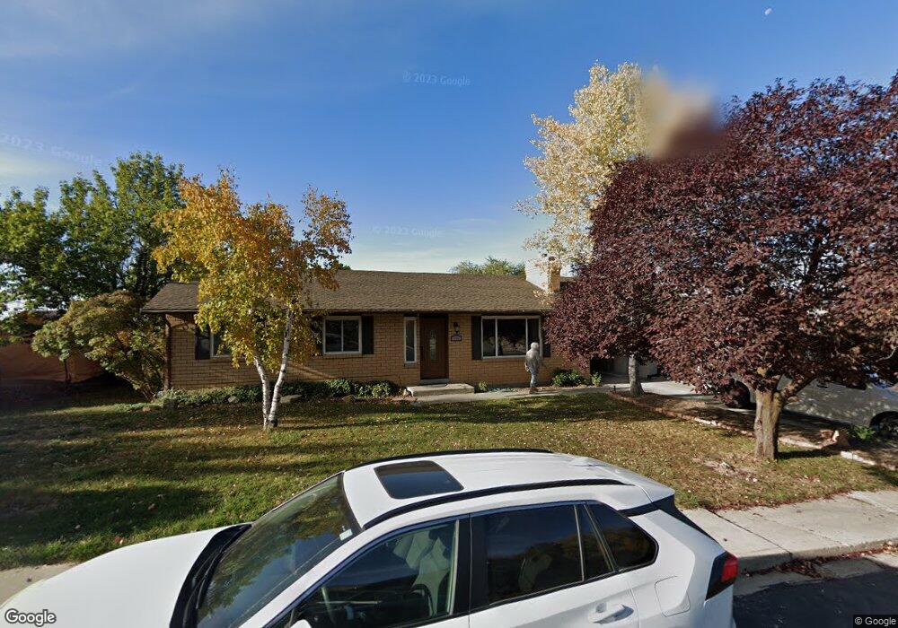
1684 E Blackhawk Dr Pleasant Grove, UT 84062
Estimated Value: $533,000 - $573,993
5
Beds
3
Baths
2,672
Sq Ft
$205/Sq Ft
Est. Value
About This Home
This home is located at 1684 E Blackhawk Dr, Pleasant Grove, UT 84062 and is currently estimated at $547,248, approximately $204 per square foot. 1684 E Blackhawk Dr is a home located in Utah County with nearby schools including Valley View Elementary, Central Elementary School, and Oak Canyon Junior High School.
Ownership History
Date
Name
Owned For
Owner Type
Purchase Details
Closed on
Jan 19, 2023
Sold by
H Steven Anderson Revocable Trust
Bought by
Benson Frederick and Benson Myrl
Current Estimated Value
Purchase Details
Closed on
Mar 28, 2014
Sold by
Anderson Harold S and Anderson Julie H
Bought by
Anderson H Steven
Purchase Details
Closed on
Nov 16, 2011
Sold by
Anderson Harold S
Bought by
Anderson Harold S and Anderson Julie H
Home Financials for this Owner
Home Financials are based on the most recent Mortgage that was taken out on this home.
Original Mortgage
$165,407
Interest Rate
3%
Mortgage Type
VA
Purchase Details
Closed on
Sep 30, 2004
Sold by
Caras Christopher and Caras Marie A
Bought by
Caras Jimmy J and Caras Jacqueline H
Purchase Details
Closed on
Dec 31, 1999
Sold by
Smith Ben H and Smith Lee Ann
Bought by
Anderson Harold S and Anderson Mary
Home Financials for this Owner
Home Financials are based on the most recent Mortgage that was taken out on this home.
Original Mortgage
$149,940
Interest Rate
7.68%
Mortgage Type
VA
Create a Home Valuation Report for This Property
The Home Valuation Report is an in-depth analysis detailing your home's value as well as a comparison with similar homes in the area
Home Values in the Area
Average Home Value in this Area
Purchase History
| Date | Buyer | Sale Price | Title Company |
|---|---|---|---|
| Benson Frederick | -- | Inwest Title | |
| Anderson H Steven | -- | None Available | |
| Anderson Harold S | -- | National Title Network | |
| Caras Jimmy J | -- | Utah First Title Insurance | |
| Anderson Harold S | -- | Equity Title Agency Inc |
Source: Public Records
Mortgage History
| Date | Status | Borrower | Loan Amount |
|---|---|---|---|
| Previous Owner | Anderson Harold S | $165,407 | |
| Previous Owner | Anderson Harold S | $149,940 |
Source: Public Records
Tax History Compared to Growth
Tax History
| Year | Tax Paid | Tax Assessment Tax Assessment Total Assessment is a certain percentage of the fair market value that is determined by local assessors to be the total taxable value of land and additions on the property. | Land | Improvement |
|---|---|---|---|---|
| 2025 | $2,118 | $286,825 | $233,500 | $288,000 |
| 2024 | $2,118 | $252,615 | $0 | $0 |
| 2023 | $2,015 | $246,125 | $0 | $0 |
| 2022 | $2,300 | $279,620 | $0 | $0 |
| 2021 | $2,004 | $371,000 | $146,600 | $224,400 |
| 2020 | $1,836 | $333,100 | $130,900 | $202,200 |
| 2019 | $1,693 | $317,700 | $115,500 | $202,200 |
| 2018 | $1,658 | $294,100 | $107,800 | $186,300 |
| 2017 | $1,556 | $147,015 | $0 | $0 |
| 2016 | $1,485 | $135,410 | $0 | $0 |
| 2015 | $1,445 | $124,795 | $0 | $0 |
| 2014 | $1,420 | $121,440 | $0 | $0 |
Source: Public Records
Map
Nearby Homes
- 521 S 1660 E
- 650 S 1600 E
- 1515 E 720 S
- 897 Cherokee Dr
- 745 S 1500 St E
- 935 S 1500 E
- 1172 E Murdock Dr
- 10 S 1400 E
- 177 S 1150 E
- 286 S 1150 E
- 778 S 1100 E
- Prelude Plan at Blossom Hill
- Treble Plan at Blossom Hill
- Browning Plan at Blossom Hill
- Cantata Plan at Blossom Hill
- 176 S 1150 E
- Accord Plan at Blossom Hill
- Canon Plan at Blossom Hill
- Trio Plan at Blossom Hill
- Harrison Plan at Blossom Hill
- 1684 Blackhawk Dr
- 1672 E Blackhawk Dr
- 1694 E Blackhawk Dr
- 1694 Blackhawk Dr
- 1661 Cherokee Dr
- 1661 E Cherokee Dr
- 1645 Cherokee Dr
- 1673 Cherokee Dr
- 1685 E Blackhawk Dr
- 1685 Blackhawk Dr
- 1685 Blackhawk Dr Unit 4
- 1708 E Blackhawk Dr
- 1708 Blackhawk Dr
- 1594 E Blackhawk Dr
- 1594 E Blackhawk Dr
- 1675 E Blackhawk Dr
- 1675 Blackhawk Dr
- 1581 E 620 S
- 1685 Cherokee Dr
- 595 S 1660 E