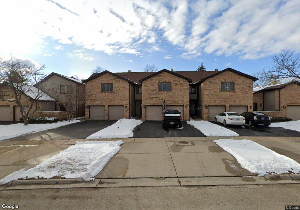
1684 Pebble Beach Dr Unit 2 Hoffman Estates, IL 60169
South Hoffman Estates NeighborhoodEstimated Value: $365,000 - $431,000
2
Beds
3
Baths
1,867
Sq Ft
$206/Sq Ft
Est. Value
About This Home
This home is located at 1684 Pebble Beach Dr Unit 2, Hoffman Estates, IL 60169 and is currently estimated at $384,799, approximately $206 per square foot. 1684 Pebble Beach Dr Unit 2 is a home located in Cook County with nearby schools including Neil Armstrong Elementary School, Dwight D Eisenhower Junior High School, and Hoffman Estates High School.
Ownership History
Date
Name
Owned For
Owner Type
Purchase Details
Closed on
Oct 19, 2017
Sold by
Mossman Nova
Bought by
Fecarotta Robert A and Fecarotta Mari T
Current Estimated Value
Home Financials for this Owner
Home Financials are based on the most recent Mortgage that was taken out on this home.
Original Mortgage
$189,000
Outstanding Balance
$156,941
Interest Rate
3.87%
Mortgage Type
New Conventional
Estimated Equity
$227,858
Purchase Details
Closed on
Sep 27, 1995
Sold by
Copeland Charles R and Walters Diana D
Bought by
Hossman Fredrick R and Hossman Nova D
Home Financials for this Owner
Home Financials are based on the most recent Mortgage that was taken out on this home.
Original Mortgage
$145,143
Interest Rate
7.68%
Mortgage Type
FHA
Create a Home Valuation Report for This Property
The Home Valuation Report is an in-depth analysis detailing your home's value as well as a comparison with similar homes in the area
Home Values in the Area
Average Home Value in this Area
Purchase History
| Date | Buyer | Sale Price | Title Company |
|---|---|---|---|
| Fecarotta Robert A | $210,000 | Precision Title | |
| Hossman Fredrick R | $167,000 | -- |
Source: Public Records
Mortgage History
| Date | Status | Borrower | Loan Amount |
|---|---|---|---|
| Open | Fecarotta Robert A | $189,000 | |
| Previous Owner | Hossman Fredrick R | $145,143 |
Source: Public Records
Tax History
| Year | Tax Paid | Tax Assessment Tax Assessment Total Assessment is a certain percentage of the fair market value that is determined by local assessors to be the total taxable value of land and additions on the property. | Land | Improvement |
|---|---|---|---|---|
| 2025 | $6,711 | $35,000 | $2,480 | $32,520 |
| 2024 | $6,711 | $28,500 | $4,500 | $24,000 |
| 2023 | $6,432 | $28,500 | $4,500 | $24,000 |
| 2022 | $6,432 | $28,500 | $4,500 | $24,000 |
| 2021 | $3,833 | $17,435 | $1,953 | $15,482 |
| 2020 | $5,705 | $17,435 | $1,953 | $15,482 |
| 2019 | $5,672 | $19,373 | $1,953 | $17,420 |
| 2018 | $6,325 | $19,397 | $1,705 | $17,692 |
| 2017 | $5,131 | $19,397 | $1,705 | $17,692 |
| 2016 | $5,035 | $19,397 | $1,705 | $17,692 |
| 2015 | $5,742 | $20,500 | $1,488 | $19,012 |
| 2014 | $5,658 | $20,500 | $1,488 | $19,012 |
| 2013 | $5,494 | $20,500 | $1,488 | $19,012 |
Source: Public Records
Map
Nearby Homes
- 1975 Leiter Way Unit 12002
- 1987 Leiter Way Unit 11003
- 1982 Leiter Way Unit 13004
- 1985 Leiter Way Unit 1102
- 1988 Leiter Way Unit 13001
- 1979 Leiter Way Unit 12004
- 1981 Leiter Way Unit 12005
- 1994 Leiter Way Unit 14003
- 1977 Leiter Way Unit 12003
- 1986 Leiter Way Unit 13002
- 1989 Leiter Way Unit 11004
- 1500 Robin Cir Unit 314
- 1103 Southbridge Ln
- 1708 Southbridge Ct
- 1365 Newcastle Ln
- 1335 Blair Ln
- 1776 Bristol Walk Unit 1776
- 1760 Bristol Walk Unit F
- 1587 Brookside Dr
- 1769 Sessions Walk Unit C
- 1686 Pebble Beach Dr
- 1682 Pebble Beach Dr
- 1688 Pebble Beach Dr
- 1680 Pebble Beach Dr Unit 2
- 1690 Pebble Beach Dr
- 1658 Pebble Beach Dr
- 1656 Pebble Beach Dr Unit 3
- 1692 Pebble Beach Dr
- 1652 Pebble Beach Dr
- 1654 Pebble Beach Dr Unit 3
- 1694 Pebble Beach Dr Unit 2
- 1650 Pebble Beach Dr Unit 3
- 1685 Pebble Beach Dr
- 1648 Pebble Beach Dr
- 1687 Pebble Beach Dr
- 1696 Pebble Beach Dr
- 1689 Pebble Beach Dr Unit 2
- 1683 Pebble Beach Dr
- 1683 Pebble Beach Dr Unit 1683
- 1675 Pebble Beach Dr
Your Personal Tour Guide
Ask me questions while you tour the home.