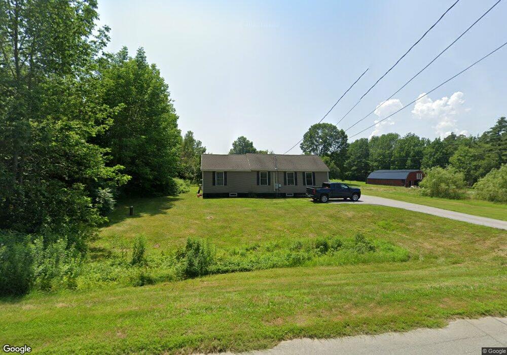
1684 Union St Bangor, ME 04401
Capehart NeighborhoodEstimated Value: $230,054 - $293,000
3
Beds
2
Baths
1,034
Sq Ft
$248/Sq Ft
Est. Value
About This Home
This home is located at 1684 Union St, Bangor, ME 04401 and is currently estimated at $256,514, approximately $248 per square foot. 1684 Union St is a home located in Penobscot County with nearby schools including Downeast School, Fairmount School, and James F. Doughty School.
Ownership History
Date
Name
Owned For
Owner Type
Purchase Details
Closed on
Aug 3, 2015
Sold by
Morrison Lewis M and Morrison Amy L
Bought by
Cooper Whitney E and Cooper Adam J
Current Estimated Value
Home Financials for this Owner
Home Financials are based on the most recent Mortgage that was taken out on this home.
Original Mortgage
$152,192
Outstanding Balance
$119,453
Interest Rate
3.97%
Mortgage Type
FHA
Estimated Equity
$137,061
Purchase Details
Closed on
Dec 3, 2014
Sold by
King Mildred B Est
Bought by
Morrison Lewis M and Morrison Amy L
Home Financials for this Owner
Home Financials are based on the most recent Mortgage that was taken out on this home.
Original Mortgage
$61,125
Interest Rate
3.93%
Mortgage Type
New Conventional
Create a Home Valuation Report for This Property
The Home Valuation Report is an in-depth analysis detailing your home's value as well as a comparison with similar homes in the area
Home Values in the Area
Average Home Value in this Area
Purchase History
| Date | Buyer | Sale Price | Title Company |
|---|---|---|---|
| Cooper Whitney E | -- | -- | |
| Morrison Lewis M | -- | -- |
Source: Public Records
Mortgage History
| Date | Status | Borrower | Loan Amount |
|---|---|---|---|
| Open | Cooper Whitney E | $152,192 | |
| Previous Owner | Morrison Lewis M | $61,125 |
Source: Public Records
Tax History
| Year | Tax Paid | Tax Assessment Tax Assessment Total Assessment is a certain percentage of the fair market value that is determined by local assessors to be the total taxable value of land and additions on the property. | Land | Improvement |
|---|---|---|---|---|
| 2024 | $2,987 | $161,000 | $42,200 | $118,800 |
| 2023 | $2,700 | $141,000 | $39,800 | $101,200 |
| 2022 | $2,581 | $126,500 | $39,800 | $86,700 |
| 2021 | $2,475 | $111,000 | $36,900 | $74,100 |
| 2020 | $2,401 | $103,500 | $35,100 | $68,400 |
| 2019 | $2,321 | $100,900 | $35,100 | $65,800 |
| 2018 | $2,265 | $98,700 | $36,800 | $61,900 |
| 2017 | $2,208 | $97,900 | $36,800 | $61,100 |
| 2016 | $2,144 | $95,300 | $36,800 | $58,500 |
| 2015 | $1,245 | $56,700 | $31,000 | $25,700 |
| 2014 | $802 | $36,800 | $27,900 | $8,900 |
| 2013 | $1,379 | $66,300 | $36,800 | $29,500 |
Source: Public Records
Map
Nearby Homes
- 132 Sunny Hollow Place
- 42 Yankee Ave
- 26 Knoll Crest Dr
- 30 Yankee Ave
- 76 Knoll Crest Dr
- 42 Sugarloaf Ln
- 1343 Ohio St Unit 20
- 1677 Ohio St
- 1192 Ohio St
- 1677 Ohio Res St
- 1765 Ohio St
- 70 Shepherd Dr
- 850 Ohio St
- 1176 Kenduskeag Ave
- 826 Ohio St Unit 6
- 2094 Glenwood Ave
- 2101 Ohio St
- 153 Finson Rd
- 564 Kenduskeag Ave
- 539 Kenduskeag Ave Unit B3
Your Personal Tour Guide
Ask me questions while you tour the home.