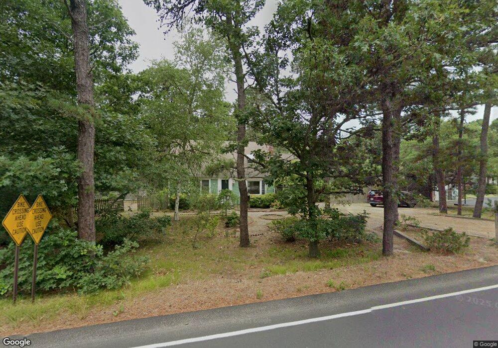
1685 Bridge Rd Eastham, MA 02642
Estimated Value: $752,043 - $836,000
3
Beds
2
Baths
1,396
Sq Ft
$580/Sq Ft
Est. Value
About This Home
This home is located at 1685 Bridge Rd, Eastham, MA 02642 and is currently estimated at $809,011, approximately $579 per square foot. 1685 Bridge Rd is a home located in Barnstable County with nearby schools including Eastham Elementary School, Nauset Regional Middle School, and Nauset Regional High School.
Ownership History
Date
Name
Owned For
Owner Type
Purchase Details
Closed on
Jun 3, 2011
Sold by
Champely Clancy
Bought by
Gallant Clifford
Current Estimated Value
Purchase Details
Closed on
Apr 26, 2002
Sold by
Petitt James A and Petitt Susan M
Bought by
Champely Clancy
Home Financials for this Owner
Home Financials are based on the most recent Mortgage that was taken out on this home.
Original Mortgage
$47,000
Interest Rate
7.05%
Mortgage Type
Purchase Money Mortgage
Purchase Details
Closed on
Apr 15, 1994
Sold by
Pettitt Mary L
Bought by
Petitt James A
Create a Home Valuation Report for This Property
The Home Valuation Report is an in-depth analysis detailing your home's value as well as a comparison with similar homes in the area
Home Values in the Area
Average Home Value in this Area
Purchase History
| Date | Buyer | Sale Price | Title Company |
|---|---|---|---|
| Gallant Clifford | $415,000 | -- | |
| Champely Clancy | $265,000 | -- | |
| Petitt James A | $65,000 | -- |
Source: Public Records
Mortgage History
| Date | Status | Borrower | Loan Amount |
|---|---|---|---|
| Previous Owner | Petitt James A | $47,000 | |
| Previous Owner | Petitt James A | $110,000 | |
| Previous Owner | Petitt James A | $35,000 | |
| Previous Owner | Petitt James A | $65,000 |
Source: Public Records
Tax History
| Year | Tax Paid | Tax Assessment Tax Assessment Total Assessment is a certain percentage of the fair market value that is determined by local assessors to be the total taxable value of land and additions on the property. | Land | Improvement |
|---|---|---|---|---|
| 2025 | $4,991 | $647,400 | $264,300 | $383,100 |
| 2024 | $4,438 | $633,100 | $256,600 | $376,500 |
| 2023 | $3,923 | $541,900 | $213,900 | $328,000 |
| 2022 | $3,646 | $424,900 | $190,900 | $234,000 |
| 2021 | $3,569 | $388,800 | $173,600 | $215,200 |
| 2020 | $3,301 | $378,600 | $177,100 | $201,500 |
| 2019 | $3,034 | $367,700 | $172,000 | $195,700 |
| 2018 | $3,000 | $359,300 | $167,000 | $192,300 |
| 2017 | $2,782 | $352,200 | $163,700 | $188,500 |
| 2016 | $2,732 | $367,200 | $181,900 | $185,300 |
| 2015 | $2,558 | $360,300 | $178,300 | $182,000 |
Source: Public Records
Map
Nearby Homes
- 55 Grandfathers Way
- 330 Hay Rd
- 2705 State Hwy
- 2705 State Hwy Unit 1-8
- 1061 State Hwy Unit 4
- 1061 State Hwy Unit 1061
- 10 Cartway N
- 25 Twin Rocks Dr
- 20 Kittiwake Ln
- 20 Billingsgate Ave
- 600 Kingsbury Beach Rd
- 300 School House Rd
- 82 Old Orchard Rd
- 70 Deerfield Ln
- 46 Freeman Ln
- 320 State Hwy
- 40 Bayview Rd
- 315 Candlewood Dr
- 25 Forrest Ave
- 343 Tonset Rd
- 1725 Bridge Rd
- 100 Jennie Clark Rd
- 110 Jennie Clark Rd
- 1735 Bridge Rd
- 90 Jennie Clark Rd
- 1670 Bridge Rd
- 1720 Bridge Rd
- 1700 Bridge Rd
- 20 Crosby Village Rd
- 85 Jennie Clark Rd
- 105 Crosby Village Rd
- 80 Jennie Clark Rd
- 1755 Bridge Rd
- 1585 Bridge Rd
- 10 Smith Farm Rd
- 855 Hay Rd
- 75 Jennie Clark Rd
- 100 Crosby Village Rd
- 135 Crosby Village Rd
- 20 Smith Farm Rd
Your Personal Tour Guide
Ask me questions while you tour the home.