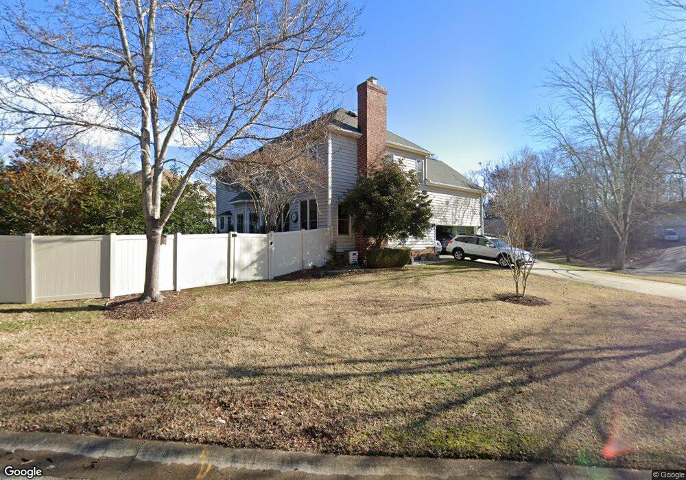
1685 Caille Ct Fort Mill, SC 29708
Gold Hill NeighborhoodEstimated Value: $616,000 - $645,882
--
Bed
1
Bath
3,052
Sq Ft
$206/Sq Ft
Est. Value
About This Home
This home is located at 1685 Caille Ct, Fort Mill, SC 29708 and is currently estimated at $629,971, approximately $206 per square foot. 1685 Caille Ct is a home located in York County with nearby schools including Springfield Elementary School, Springfield Middle School, and Nation Ford High School.
Ownership History
Date
Name
Owned For
Owner Type
Purchase Details
Closed on
Apr 11, 2025
Sold by
Rossman Mark B and Rossman Nancy L
Bought by
Rossman Family Living Trust and Rossman
Current Estimated Value
Purchase Details
Closed on
Nov 1, 2018
Sold by
Rossman Mark B and Rossman Nancy L
Bought by
Rossman Mark B and Rossman Nancy L
Home Financials for this Owner
Home Financials are based on the most recent Mortgage that was taken out on this home.
Original Mortgage
$100,000
Interest Rate
4.7%
Mortgage Type
Credit Line Revolving
Create a Home Valuation Report for This Property
The Home Valuation Report is an in-depth analysis detailing your home's value as well as a comparison with similar homes in the area
Home Values in the Area
Average Home Value in this Area
Purchase History
| Date | Buyer | Sale Price | Title Company |
|---|---|---|---|
| Rossman Family Living Trust | -- | None Listed On Document | |
| Rossman Family Living Trust | -- | None Listed On Document | |
| Rossman Mark B | -- | None Available |
Source: Public Records
Mortgage History
| Date | Status | Borrower | Loan Amount |
|---|---|---|---|
| Previous Owner | Rossman Mark B | $100,000 |
Source: Public Records
Tax History Compared to Growth
Tax History
| Year | Tax Paid | Tax Assessment Tax Assessment Total Assessment is a certain percentage of the fair market value that is determined by local assessors to be the total taxable value of land and additions on the property. | Land | Improvement |
|---|---|---|---|---|
| 2024 | $2,602 | $14,743 | $2,657 | $12,086 |
| 2023 | $2,523 | $14,743 | $2,657 | $12,086 |
| 2022 | $2,500 | $14,743 | $2,657 | $12,086 |
| 2021 | -- | $14,743 | $2,657 | $12,086 |
| 2020 | $2,685 | $14,743 | $0 | $0 |
| 2019 | $2,681 | $12,820 | $0 | $0 |
| 2018 | $2,831 | $12,820 | $0 | $0 |
| 2017 | $2,338 | $11,220 | $0 | $0 |
| 2016 | $2,308 | $11,220 | $0 | $0 |
| 2014 | $1,512 | $11,220 | $2,000 | $9,220 |
| 2013 | $1,512 | $10,600 | $2,080 | $8,520 |
Source: Public Records
Map
Nearby Homes
- 3559 Nestling Ln
- 3400 Pleasant Rd
- 903 Furman Ct
- 878 Treasure Ct
- 525 Hunters Dance Rd
- 518 Hunters Dance Rd
- 463 Hunters Dance Rd
- 1326 Clifflure Ln
- 01 Lurecliff Place
- 646 Quicksilver Trail
- 1281 Lurecliff Place
- 315 River Clay Rd
- 148 Council House Rd
- 421 Cranborne Chase
- 916 Knightsbridge Rd
- 343 Gringley Hill Rd
- 657 Chase Ct
- 263 River Clay Rd
- 505 Whitehead Ct
- 543 Saint George Rd
- 1682 Caille Ct
- 1694 Caille Ct
- 3522 Nestling Ln
- 3571 Nestling Ln
- 3527 Nestling Ln
- 1666 Caille Ct
- 3583 Nestling Ln
- 3510 Nestling Ln
- 3515 Nestling Ln
- 1665 Caille Ct
- 1654 Caille Ct
- 3591 Nestling Ln
- 3495 Nestling Ln
- 3492 Nestling Ln
- 1650 Mary Ellen Dr
- 3491 Peacock Run
- 1646 Caille Ct
- 3592 Nestling Ln
- 3480 Nestling Ln
- 3599 Nestling Ln