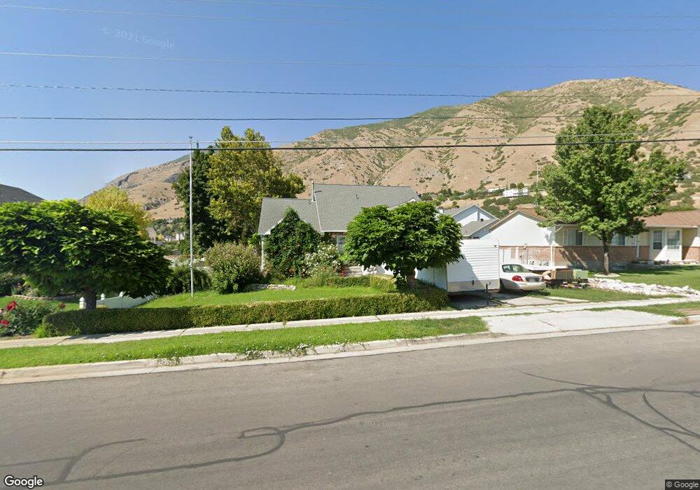
1685 E 400 S Springville, UT 84663
Estimated Value: $544,276 - $610,000
4
Beds
4
Baths
2,100
Sq Ft
$268/Sq Ft
Est. Value
About This Home
This home is located at 1685 E 400 S, Springville, UT 84663 and is currently estimated at $561,819, approximately $267 per square foot. 1685 E 400 S is a home located in Utah County with nearby schools including Art City School, Springville Junior High School, and Springville High School.
Ownership History
Date
Name
Owned For
Owner Type
Purchase Details
Closed on
Dec 1, 2023
Sold by
Krum Gary
Bought by
A And D Properties Llc
Current Estimated Value
Purchase Details
Closed on
Apr 16, 1996
Sold by
Cook Val Gene and Cook Collette B
Bought by
Krum Gary and Krum Cheryl
Home Financials for this Owner
Home Financials are based on the most recent Mortgage that was taken out on this home.
Original Mortgage
$142,400
Interest Rate
7.8%
Create a Home Valuation Report for This Property
The Home Valuation Report is an in-depth analysis detailing your home's value as well as a comparison with similar homes in the area
Home Values in the Area
Average Home Value in this Area
Purchase History
| Date | Buyer | Sale Price | Title Company |
|---|---|---|---|
| A And D Properties Llc | -- | First American Title Insurance | |
| Krum Gary | -- | -- |
Source: Public Records
Mortgage History
| Date | Status | Borrower | Loan Amount |
|---|---|---|---|
| Previous Owner | Krum Gary | $142,400 |
Source: Public Records
Tax History Compared to Growth
Tax History
| Year | Tax Paid | Tax Assessment Tax Assessment Total Assessment is a certain percentage of the fair market value that is determined by local assessors to be the total taxable value of land and additions on the property. | Land | Improvement |
|---|---|---|---|---|
| 2025 | $2,704 | $287,980 | $184,300 | $339,300 |
| 2024 | $2,704 | $276,980 | $0 | $0 |
| 2023 | $2,687 | $275,550 | $0 | $0 |
| 2022 | $3,149 | $317,130 | $0 | $0 |
| 2021 | $2,767 | $433,700 | $127,900 | $305,800 |
| 2020 | $2,575 | $391,300 | $102,300 | $289,000 |
| 2019 | $2,285 | $353,600 | $102,300 | $251,300 |
| 2018 | $2,321 | $342,600 | $91,300 | $251,300 |
| 2017 | $2,301 | $180,400 | $0 | $0 |
| 2016 | $2,044 | $157,135 | $0 | $0 |
| 2015 | $1,800 | $141,460 | $0 | $0 |
| 2014 | $1,627 | $126,995 | $0 | $0 |
Source: Public Records
Map
Nearby Homes
- 1653 E 300 S
- 314 S 1850 E
- 1783 E Spring Oaks Dr N Unit 12 & 1
- 61 E 750 S Unit 2
- 66 E 750 S Unit 23
- 645 S Red Devil Dr
- 687 S 2080 E
- 59 E 775 S Unit 21
- 51 E 775 S Unit 20
- 2554 E 350 S Unit 4
- 2295 E 700 S Unit 18
- 1220 E 225 N
- 1206 E 1150 S
- 926 E 250 N
- 325 N 1040 St E Unit 26
- 2541 Stonebury Loop Rd
- 1020 W 2000 N
- 649 Swenson Ave Unit 4
- 645 Swenson Ave Unit 3
- 968 E 440 N