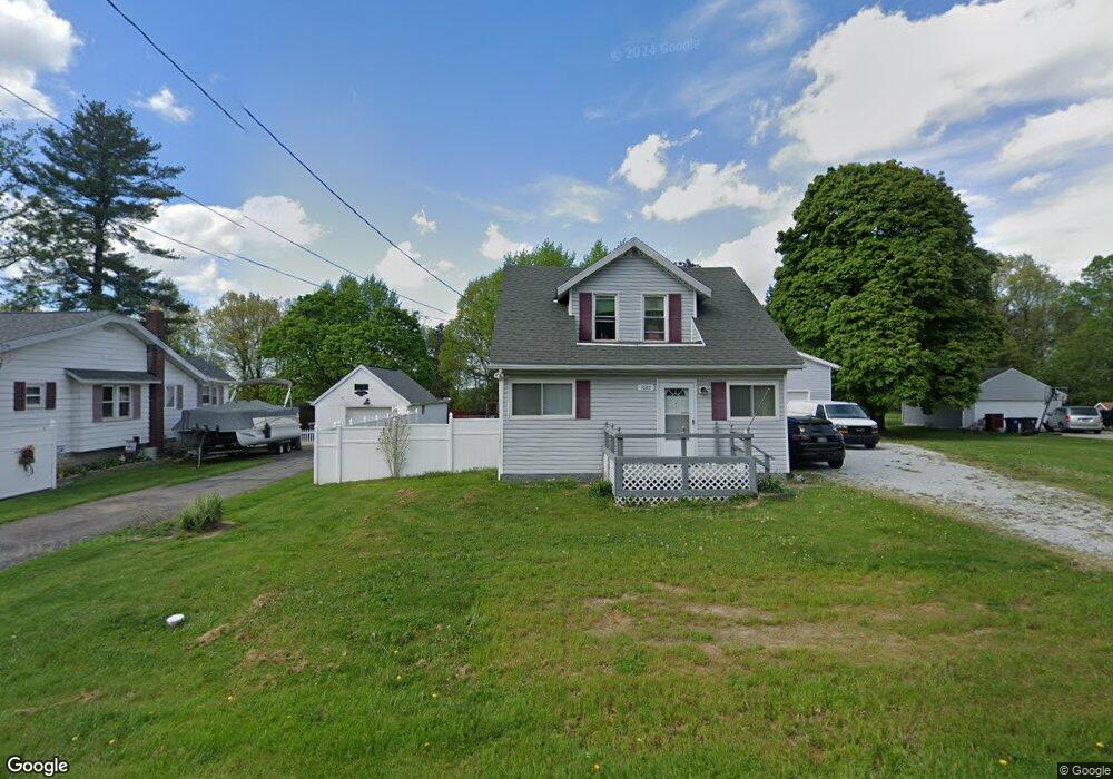
1685 Faye Rd Akron, OH 44306
Ellet NeighborhoodEstimated Value: $186,000 - $206,371
3
Beds
1
Bath
1,008
Sq Ft
$196/Sq Ft
Est. Value
About This Home
This home is located at 1685 Faye Rd, Akron, OH 44306 and is currently estimated at $197,343, approximately $195 per square foot. 1685 Faye Rd is a home located in Summit County with nearby schools including Ellet High School, Summit Academy Akron Elementary School, and Eagle Elementary.
Ownership History
Date
Name
Owned For
Owner Type
Purchase Details
Closed on
Jul 3, 2021
Sold by
Dell Barney O and Dell Kathleen O
Bought by
Lee Bcarton and Stahl Jennifer Lynn
Current Estimated Value
Purchase Details
Closed on
May 31, 2019
Sold by
Bowman Barney O
Bought by
Bowman Barney O and Bowman Kathleen M
Purchase Details
Closed on
Jun 19, 2017
Sold by
Bowman Sue E
Bought by
Bowman Barney O
Purchase Details
Closed on
May 14, 2010
Sold by
Ramsey Joyce
Bought by
Bowman Barney O and Bowman Sue
Home Financials for this Owner
Home Financials are based on the most recent Mortgage that was taken out on this home.
Original Mortgage
$36,100
Interest Rate
5.16%
Mortgage Type
New Conventional
Purchase Details
Closed on
Jan 23, 2008
Sold by
Estate Of Ronald G Ramsey
Bought by
Ramsey Joyce
Create a Home Valuation Report for This Property
The Home Valuation Report is an in-depth analysis detailing your home's value as well as a comparison with similar homes in the area
Home Values in the Area
Average Home Value in this Area
Purchase History
| Date | Buyer | Sale Price | Title Company |
|---|---|---|---|
| Lee Bcarton | -- | None Available | |
| Bowman Barney O | -- | None Available | |
| Bowman Barney O | -- | None Available | |
| Bowman Barney O | $38,000 | Title Direct | |
| Ramsey Joyce | -- | Attorney |
Source: Public Records
Mortgage History
| Date | Status | Borrower | Loan Amount |
|---|---|---|---|
| Previous Owner | Bowman Barney O | $36,100 |
Source: Public Records
Tax History Compared to Growth
Tax History
| Year | Tax Paid | Tax Assessment Tax Assessment Total Assessment is a certain percentage of the fair market value that is determined by local assessors to be the total taxable value of land and additions on the property. | Land | Improvement |
|---|---|---|---|---|
| 2025 | $3,241 | $59,567 | $14,039 | $45,528 |
| 2024 | $3,241 | $59,567 | $14,039 | $45,528 |
| 2023 | $3,241 | $59,567 | $14,039 | $45,528 |
| 2022 | $2,875 | $41,206 | $9,485 | $31,721 |
| 2021 | $2,878 | $41,206 | $9,485 | $31,721 |
| 2020 | $2,836 | $41,210 | $9,490 | $31,720 |
| 2019 | $2,616 | $34,320 | $8,510 | $25,810 |
| 2018 | $2,125 | $27,750 | $8,510 | $19,240 |
| 2017 | $2,157 | $27,750 | $8,510 | $19,240 |
| 2016 | $2,159 | $27,750 | $8,510 | $19,240 |
| 2015 | $2,157 | $27,750 | $8,510 | $19,240 |
| 2014 | $2,141 | $27,750 | $8,510 | $19,240 |
| 2013 | $2,195 | $29,150 | $8,510 | $20,640 |
Source: Public Records
Map
Nearby Homes
- 1575 Faye Rd
- 1545 Woods Rd
- 1649 Betz Dr
- 1658 Betz Dr
- 1674 Betz Dr
- 1841 Edwards Dr
- 1333 Derbydale Rd
- VL Hilbish Ave
- 1899 Edwards Dr
- 2060 Beach Dr
- 1511 Acoma Dr
- 1422 Slagle Dr
- 1043 Krumroy Rd
- 2077 Coleman Ave
- VL Lakeside Dr
- V/L Lakeside Dr
- 2305 E Waterloo Rd
- 1140 Palmetto Ave
- 1224 Lindsay Ave
- 604 Gibbs Rd Unit 606