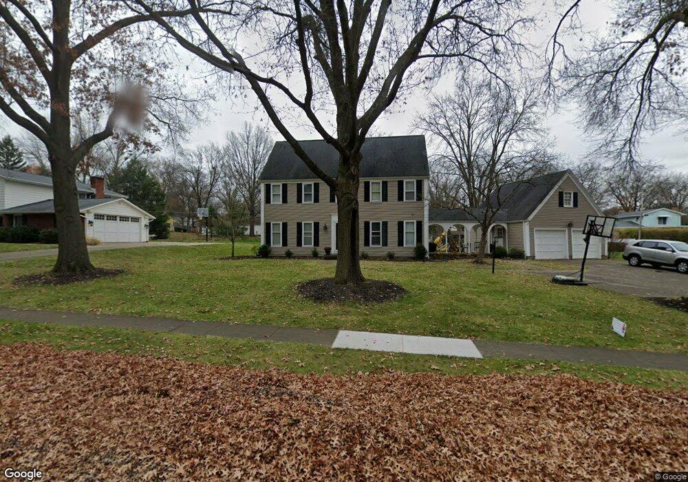
1685 Saunders Dr Wooster, OH 44691
Estimated Value: $345,175 - $410,000
4
Beds
3
Baths
2,432
Sq Ft
$161/Sq Ft
Est. Value
About This Home
This home is located at 1685 Saunders Dr, Wooster, OH 44691 and is currently estimated at $390,544, approximately $160 per square foot. 1685 Saunders Dr is a home located in Wayne County with nearby schools including Parkview Elementary School, Edgewood Middle School, and Wooster High School.
Ownership History
Date
Name
Owned For
Owner Type
Purchase Details
Closed on
Oct 11, 2014
Sold by
Smith Brian M and Smith Angela J
Bought by
Buckwalter Seth W and Buckwalter Elizabeth J
Current Estimated Value
Home Financials for this Owner
Home Financials are based on the most recent Mortgage that was taken out on this home.
Original Mortgage
$165,000
Interest Rate
4.09%
Mortgage Type
New Conventional
Purchase Details
Closed on
Jun 18, 2008
Sold by
Tranovich Sharon E and Tranovich Mark
Bought by
Smith Brian M and Smith Angela J
Home Financials for this Owner
Home Financials are based on the most recent Mortgage that was taken out on this home.
Original Mortgage
$190,018
Interest Rate
6.05%
Mortgage Type
FHA
Create a Home Valuation Report for This Property
The Home Valuation Report is an in-depth analysis detailing your home's value as well as a comparison with similar homes in the area
Home Values in the Area
Average Home Value in this Area
Purchase History
| Date | Buyer | Sale Price | Title Company |
|---|---|---|---|
| Buckwalter Seth W | $209,000 | Attorney | |
| Smith Brian M | $180,000 | Attorney |
Source: Public Records
Mortgage History
| Date | Status | Borrower | Loan Amount |
|---|---|---|---|
| Previous Owner | Buckwalter Seth W | $165,000 | |
| Previous Owner | Smith Brian M | $190,018 |
Source: Public Records
Tax History Compared to Growth
Tax History
| Year | Tax Paid | Tax Assessment Tax Assessment Total Assessment is a certain percentage of the fair market value that is determined by local assessors to be the total taxable value of land and additions on the property. | Land | Improvement |
|---|---|---|---|---|
| 2024 | $4,144 | $99,930 | $20,200 | $79,730 |
| 2023 | $4,144 | $99,930 | $20,200 | $79,730 |
| 2022 | $3,942 | $75,710 | $15,310 | $60,400 |
| 2021 | $4,067 | $75,710 | $15,310 | $60,400 |
| 2020 | $3,855 | $75,710 | $15,310 | $60,400 |
| 2019 | $3,475 | $65,540 | $15,310 | $50,230 |
| 2018 | $3,485 | $65,540 | $15,310 | $50,230 |
| 2017 | $3,465 | $65,540 | $15,310 | $50,230 |
| 2016 | $3,626 | $63,140 | $15,310 | $47,830 |
| 2015 | $3,560 | $63,140 | $15,310 | $47,830 |
| 2014 | $3,562 | $63,140 | $15,310 | $47,830 |
| 2013 | $3,309 | $58,020 | $15,340 | $42,680 |
Source: Public Records
Map
Nearby Homes
- 1587 Saunders Dr
- 1694 Arthur Dr
- 596 Meadow Ln
- 629 Meadow Ln
- 1544 Eden
- 1468 Christmas Run Blvd
- 0 Eden
- 1960 Autumn Run
- 577 Memory Ln
- 2117 Canterbury Ln
- 2143 Canterbury Ln
- 211 Oakley Rd
- 941 Woodmere Dr
- 1951 Saddle Brook Cir Unit 1951
- 1100 Nelson Ave
- 1123 Quinby Ave
- 1047 Ashwood Dr
- 317 Ihrig Ave
- 576 Catalina Ave
- 536 Catalina Blvd
- 1701 Saunders Dr
- 1675 Saunders Dr
- 1698 Morgan St
- 1717 Saunders Dr
- 1690 Saunders Dr
- 1665 Saunders Dr
- 1680 Morgan St
- 1718 Morgan St
- 1670 Morgan St
- 1670 Saunders Dr
- 1706 Saunders Dr
- 1734 Morgan St
- 1651 Saunders Dr
- 1658 Saunders Dr
- 1658 Morgan St
- 1743 Saunders Dr
- 1740 Saunders Dr
- 1677 Morgan St
- 1715 Morgan St
- 1637 Saunders Dr