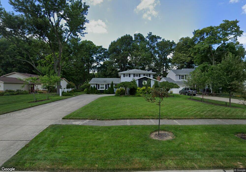
16850 Pheasant Trail Place Strongsville, OH 44136
Estimated Value: $305,325 - $354,000
4
Beds
2
Baths
1,874
Sq Ft
$176/Sq Ft
Est. Value
About This Home
This home is located at 16850 Pheasant Trail Place, Strongsville, OH 44136 and is currently estimated at $329,081, approximately $175 per square foot. 16850 Pheasant Trail Place is a home located in Cuyahoga County with nearby schools including Strongsville High School and Sts Joseph & John Interparochial School.
Ownership History
Date
Name
Owned For
Owner Type
Purchase Details
Closed on
Aug 29, 2011
Sold by
Duncan Allen V and Duncan Judith A
Bought by
Vargo Robert S and Vargo Donna L
Current Estimated Value
Home Financials for this Owner
Home Financials are based on the most recent Mortgage that was taken out on this home.
Original Mortgage
$120,000
Interest Rate
4.59%
Mortgage Type
Seller Take Back
Purchase Details
Closed on
Mar 8, 1989
Sold by
Anderson Mark E
Bought by
Duncan Allen
Purchase Details
Closed on
Jul 20, 1987
Sold by
Dubas Bohdan Z
Bought by
Anderson Mark E
Purchase Details
Closed on
Apr 2, 1985
Sold by
Dubas Bohdan Z
Bought by
Dubas Bohdan Z Aka Bohdan
Purchase Details
Closed on
Sep 16, 1975
Sold by
Mullins Gary L and Mullins Mary L
Bought by
Dubas Bohdan Z
Purchase Details
Closed on
Jan 1, 1975
Bought by
Mullins Gary L and Mullins Mary L
Create a Home Valuation Report for This Property
The Home Valuation Report is an in-depth analysis detailing your home's value as well as a comparison with similar homes in the area
Home Values in the Area
Average Home Value in this Area
Purchase History
| Date | Buyer | Sale Price | Title Company |
|---|---|---|---|
| Vargo Robert S | $142,000 | Common Law Title | |
| Duncan Allen | $112,000 | -- | |
| Anderson Mark E | $98,000 | -- | |
| Dubas Bohdan Z Aka Bohdan | -- | -- | |
| Dubas Bohdan Z | $55,600 | -- | |
| Mullins Gary L | -- | -- |
Source: Public Records
Mortgage History
| Date | Status | Borrower | Loan Amount |
|---|---|---|---|
| Closed | Vargo Robert S | $120,000 |
Source: Public Records
Tax History Compared to Growth
Tax History
| Year | Tax Paid | Tax Assessment Tax Assessment Total Assessment is a certain percentage of the fair market value that is determined by local assessors to be the total taxable value of land and additions on the property. | Land | Improvement |
|---|---|---|---|---|
| 2024 | $4,135 | $88,060 | $20,125 | $67,935 |
| 2023 | $4,094 | $65,390 | $18,590 | $46,800 |
| 2022 | $4,065 | $65,380 | $18,590 | $46,800 |
| 2021 | $4,033 | $65,380 | $18,590 | $46,800 |
| 2020 | $3,736 | $53,590 | $15,230 | $38,360 |
| 2019 | $3,626 | $153,100 | $43,500 | $109,600 |
| 2018 | $3,199 | $53,590 | $15,230 | $38,360 |
| 2017 | $3,165 | $47,710 | $12,250 | $35,460 |
| 2016 | $3,139 | $47,710 | $12,250 | $35,460 |
| 2015 | $6,911 | $47,710 | $12,250 | $35,460 |
| 2014 | $6,911 | $47,710 | $12,250 | $35,460 |
Source: Public Records
Map
Nearby Homes
- 16650 Lanier Ave
- 16969 Antler Ln
- 17029 Eagles Nest Cir
- 16450 Howe Rd
- 17159 Turkey Meadow Ln
- 17069 Partridge Dr
- 0 Shurmer Rd Unit 5108190
- 17682 Drake Rd
- 18162 Fawn Cir
- 16486 S Red Rock Dr
- 18294 Drake Rd
- 17130 Golden Star Dr
- 14826 Lenox Dr
- 14703 Lenox Dr Unit 103
- 18630 Shurmer Rd
- 17934 Cambridge Oval
- 18229 Howe Rd
- 18411 Yorktown Oval
- 19297 Lauren Way
- 0 Mill Hollow Ln Unit 5069608
- 16884 Pheasant Trail Place
- 16818 Pheasant Trail Place
- 16914 Pheasant Trail Place
- 16979 S Meadows Cir
- 16979 S Meadows Cir
- 16987 S Meadows Cir
- 16790 Pheasant Trail Place
- 16995 S Meadows Cir
- 16971 S Meadows Cir
- 16851 Pheasant Trail
- 16952 Pheasant Trail
- 16952 Pheasant Trail Place
- 16851 Pheasant Trail Place
- 16770 Pheasant Trail Place
- 16885 Pheasant Trail Place
- 16819 Pheasant Trail Place
- 16911 Pheasant Trail Place
- 16777 Pheasant Trail Place
- 16976 Pheasant Trail Place
- 17003 S Meadows Cir