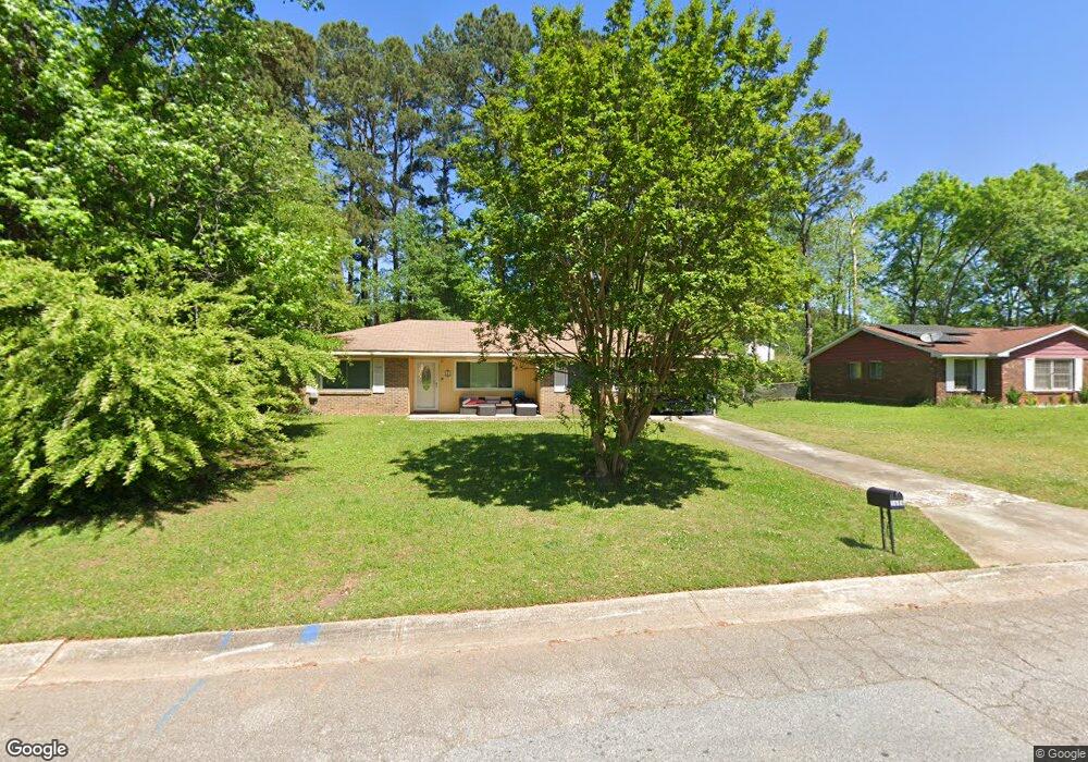
1686 Pheasant Dr Jonesboro, GA 30238
Estimated Value: $192,812 - $266,000
3
Beds
2
Baths
1,173
Sq Ft
$196/Sq Ft
Est. Value
About This Home
This home is located at 1686 Pheasant Dr, Jonesboro, GA 30238 and is currently estimated at $229,406, approximately $195 per square foot. 1686 Pheasant Dr is a home located in Clayton County with nearby schools including Kemp Primary School, Kemp Elementary School, and Lovejoy Middle School.
Ownership History
Date
Name
Owned For
Owner Type
Purchase Details
Closed on
Oct 2, 2023
Sold by
Johnson Lakeisha Natisse
Bought by
Johnson Lakeisha
Current Estimated Value
Home Financials for this Owner
Home Financials are based on the most recent Mortgage that was taken out on this home.
Original Mortgage
$137,362
Outstanding Balance
$134,691
Interest Rate
7.18%
Mortgage Type
FHA
Estimated Equity
$94,715
Purchase Details
Closed on
Apr 23, 2004
Sold by
Quinn Gladys L
Bought by
Johnson Lakeisha N
Home Financials for this Owner
Home Financials are based on the most recent Mortgage that was taken out on this home.
Original Mortgage
$88,609
Interest Rate
5.89%
Mortgage Type
VA
Create a Home Valuation Report for This Property
The Home Valuation Report is an in-depth analysis detailing your home's value as well as a comparison with similar homes in the area
Home Values in the Area
Average Home Value in this Area
Purchase History
| Date | Buyer | Sale Price | Title Company |
|---|---|---|---|
| Johnson Lakeisha | $137,362 | -- | |
| Johnson Lakeisha N | $90,000 | -- |
Source: Public Records
Mortgage History
| Date | Status | Borrower | Loan Amount |
|---|---|---|---|
| Open | Johnson Lakeisha | $137,362 | |
| Previous Owner | Johnson Lakeisha N | $88,609 |
Source: Public Records
Tax History Compared to Growth
Tax History
| Year | Tax Paid | Tax Assessment Tax Assessment Total Assessment is a certain percentage of the fair market value that is determined by local assessors to be the total taxable value of land and additions on the property. | Land | Improvement |
|---|---|---|---|---|
| 2024 | $2,011 | $61,560 | $7,200 | $54,360 |
| 2023 | $1,036 | $56,680 | $7,200 | $49,480 |
| 2022 | $1,284 | $42,720 | $7,200 | $35,520 |
| 2021 | $967 | $34,480 | $7,200 | $27,280 |
| 2020 | $758 | $28,960 | $7,200 | $21,760 |
| 2019 | $693 | $27,076 | $5,600 | $21,476 |
| 2018 | $462 | $21,380 | $5,600 | $15,780 |
| 2017 | $407 | $20,010 | $5,600 | $14,410 |
| 2016 | $492 | $22,090 | $5,600 | $16,490 |
| 2015 | $494 | $0 | $0 | $0 |
| 2014 | $363 | $19,103 | $5,600 | $13,503 |
Source: Public Records
Map
Nearby Homes
- 1739 Cardinal Rd
- 1685 Kinglet Rd
- 1683 Spoonbill Rd
- 1741 Portwest Way
- 10959 Thrasher Rd
- 1646 Flicker Rd
- 1590 Flicker Rd
- 10448 Tara Pointe Dr
- 11005 Regents Ct
- 10996 Shannon Cir
- 10413 Trellis Ln Unit (LOT 33)
- 10429 Trellis Ln
- 10413 Trellis Ln
- 10425 Trellis Ln Unit (LOT 30)
- 10429 Trellis Ln Unit (LOT 29)
- 1486 Carriage Ln
- 1438 Starling Ct
- 11045 Knotty Pine Place
- 10453 Trellis Ln
- 10453 Trellis Ln Unit (LOT 28)
- 1684 Pheasant Dr
- 1688 Pheasant Dr
- 1703 Cardinal Rd
- 1709 Cardinal Rd
- 1682 Pheasant Dr
- 1715 Cardinal Rd
- 1690 Pheasant Dr
- 1689 Pheasant Dr
- 1697 Cardinal Rd
- 1691 Pheasant Dr
- 1687 Pheasant Dr
- 1723 Cardinal Rd
- 1693 Pheasant Dr
- 1680 Pheasant Dr
- 1689 Cardinal Rd
- 1731 Cardinal Rd
- 1695 Pheasant Dr
- 1683 Pheasant Dr
- 1678 Pheasant Dr
- 1690 Kinglet Rd