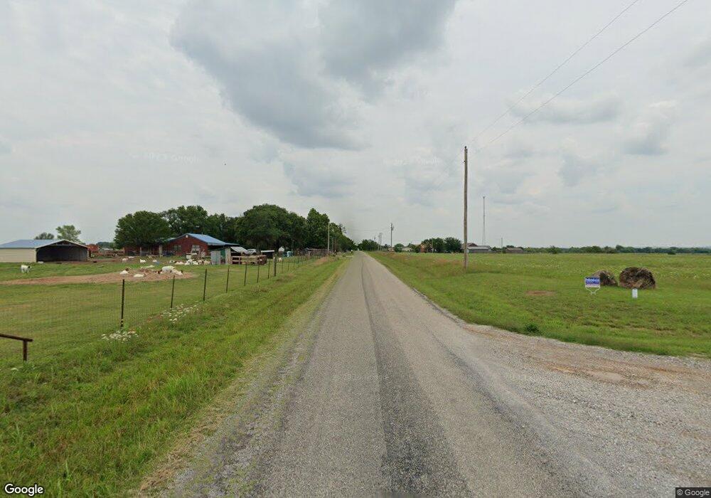
168664 Miller Ave Duncan, OK 73533
Estimated Value: $241,328 - $303,000
3
Beds
2
Baths
1,876
Sq Ft
$146/Sq Ft
Est. Value
About This Home
This home is located at 168664 Miller Ave, Duncan, OK 73533 and is currently estimated at $274,082, approximately $146 per square foot. 168664 Miller Ave is a home with nearby schools including Central High High School.
Ownership History
Date
Name
Owned For
Owner Type
Purchase Details
Closed on
Feb 25, 2025
Sold by
M E And Ginger Perry Trust and Tichenor Vicki Lynn
Bought by
Steven Maurice Perry Trust
Current Estimated Value
Purchase Details
Closed on
Nov 6, 2015
Sold by
Nelson Ryan C and Nelson Jillian
Bought by
The M E And Binger Perry Trust
Purchase Details
Closed on
Aug 20, 2012
Sold by
Parris Donnie
Bought by
Nelson Ryan C and Nelson Jillian
Home Financials for this Owner
Home Financials are based on the most recent Mortgage that was taken out on this home.
Original Mortgage
$169,846
Interest Rate
3.57%
Mortgage Type
FHA
Create a Home Valuation Report for This Property
The Home Valuation Report is an in-depth analysis detailing your home's value as well as a comparison with similar homes in the area
Home Values in the Area
Average Home Value in this Area
Purchase History
| Date | Buyer | Sale Price | Title Company |
|---|---|---|---|
| Steven Maurice Perry Trust | -- | None Listed On Document | |
| Steven Maurice Perry Trust | -- | None Listed On Document | |
| The M E And Binger Perry Trust | $165,000 | None Available | |
| Nelson Ryan C | $173,000 | None Available |
Source: Public Records
Mortgage History
| Date | Status | Borrower | Loan Amount |
|---|---|---|---|
| Previous Owner | Nelson Ryan C | $169,846 |
Source: Public Records
Tax History Compared to Growth
Tax History
| Year | Tax Paid | Tax Assessment Tax Assessment Total Assessment is a certain percentage of the fair market value that is determined by local assessors to be the total taxable value of land and additions on the property. | Land | Improvement |
|---|---|---|---|---|
| 2024 | $1,745 | $17,546 | $721 | $16,825 |
| 2023 | $1,745 | $17,547 | $805 | $16,742 |
| 2022 | $1,745 | $17,547 | $795 | $16,752 |
| 2021 | $1,750 | $17,547 | $860 | $16,687 |
| 2020 | $1,725 | $17,547 | $874 | $16,673 |
| 2019 | $1,717 | $17,547 | $923 | $16,624 |
| 2018 | $1,743 | $17,547 | $1,000 | $16,547 |
| 2017 | $1,762 | $18,116 | $1,000 | $17,116 |
| 2016 | $1,903 | $18,409 | $1,000 | $17,409 |
| 2015 | $9 | $19,286 | $1,923 | $17,363 |
| 2014 | $9 | $19,286 | $1,923 | $17,363 |
Source: Public Records
Map
Nearby Homes
- ???? Miller Ave
- ???? Carl Dr
- 168658 168658 Carl Dr
- 168592 168592 Carl Dr
- TBD 9 Mile Rd
- to be determined SE 210th St
- 167201 167201 9 Mile Rd
- 166914 Rd
- 166518 9-Mile Rd
- 101 SE 210th St
- 18405 SE Lee Blvd
- 15907 SE Woodlawn Rd
- 273244 Caddo Rd
- 2320 2320 Ne Bethel Rd
- 20603 SE Lee Blvd
- 163573 7 Mile Rd
- 14805 SE Woodlawn Rd
- B3L9 Prospectors Ridge Dr
- B4 L11 Prospectors Ridge Dr
- 172789 Trail Side Dr
- 13 Miller Ave
- 168640 Miller Dr
- 168640 Miller Ave
- 000 Miller Dr
- 0 Miller Dr
- 168608 Miller Ave
- 168607 Carl Dr
- 168639 Carl Dr
- 168665 Carl Dr
- 168664 Carl Dr
- 168585 Carl Dr
- 168586 Carl Dr
- 0 Carl Dr
- 168642 Carl Dr
- 0 Miller Ave Unit 1028348
- 168608 Carl Dr
- 168800 9 Mile Rd
- 168600 9 Mile Rd
- 3 Acres Tbd168723 2736 Rd
- 168733 N 2736 Rd
