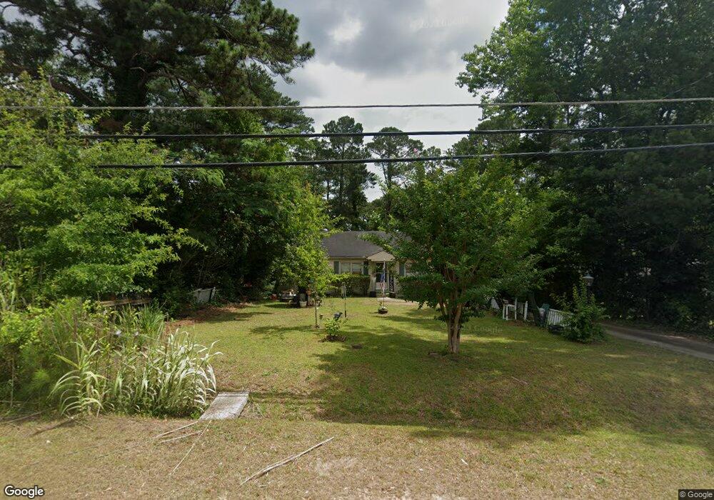
1687 Upper River Rd Macon, GA 31211
Estimated Value: $76,424 - $124,000
3
Beds
1
Bath
1,116
Sq Ft
$94/Sq Ft
Est. Value
About This Home
This home is located at 1687 Upper River Rd, Macon, GA 31211 and is currently estimated at $105,356, approximately $94 per square foot. 1687 Upper River Rd is a home located in Bibb County with nearby schools including Martin Luther King Jr. Elementary School, Appling Middle School, and Northeast High School.
Ownership History
Date
Name
Owned For
Owner Type
Purchase Details
Closed on
Apr 20, 2006
Sold by
Underwood Anne and Perkins Charles D
Bought by
Taylor Lashonda
Current Estimated Value
Home Financials for this Owner
Home Financials are based on the most recent Mortgage that was taken out on this home.
Original Mortgage
$76,310
Outstanding Balance
$43,483
Interest Rate
6.31%
Mortgage Type
New Conventional
Estimated Equity
$61,873
Purchase Details
Closed on
May 25, 2004
Create a Home Valuation Report for This Property
The Home Valuation Report is an in-depth analysis detailing your home's value as well as a comparison with similar homes in the area
Purchase History
| Date | Buyer | Sale Price | Title Company |
|---|---|---|---|
| Taylor Lashonda | $76,310 | None Avilebel | |
| -- | -- | -- |
Source: Public Records
Mortgage History
| Date | Status | Borrower | Loan Amount |
|---|---|---|---|
| Open | Taylor Lashonda | $76,310 |
Source: Public Records
Tax History
| Year | Tax Paid | Tax Assessment Tax Assessment Total Assessment is a certain percentage of the fair market value that is determined by local assessors to be the total taxable value of land and additions on the property. | Land | Improvement |
|---|---|---|---|---|
| 2025 | $481 | $26,557 | $2,418 | $24,139 |
| 2024 | $437 | $24,211 | $1,860 | $22,351 |
| 2023 | $510 | $24,211 | $1,860 | $22,351 |
| 2022 | $644 | $25,595 | $3,618 | $21,977 |
| 2021 | $386 | $17,170 | $3,230 | $13,940 |
| 2020 | $395 | $17,170 | $3,230 | $13,940 |
| 2019 | $398 | $17,170 | $3,230 | $13,940 |
| 2018 | $790 | $17,170 | $3,230 | $13,940 |
| 2017 | $381 | $17,170 | $3,230 | $13,940 |
| 2016 | $352 | $17,171 | $3,230 | $13,940 |
| 2015 | $498 | $17,171 | $3,230 | $13,940 |
| 2014 | $624 | $17,171 | $3,230 | $13,940 |
Source: Public Records
Map
Nearby Homes
- 1715 Foster Place
- 1735 Foster Place
- 1746 Hamilton Dr
- 1987 Long Ridge Dr
- 1976 Long Ridge Dr
- 1971 Long Ridge Dr
- 1972 Wood Valley Rd
- 1954 Wood Valley Rd
- 1978 Wood Valley Rd
- 1898 Wood Valley Rd
- 1949 Deerwood Place
- 1485 Lone Oak Dr
- 1825 Flintwood Dr
- 1916 Flintwood Dr
- 1154 Davis Cir
- 1174 Davis St E
- 1435 Twin Pines Dr
- 1868 Waverland Dr
- 1158 Jackson Springs Rd
- 1049 Boulevard
- 1685 Upper River Rd
- 1697 Upper River Rd
- 0 Upper River Rd Unit 8064575
- 0 Upper River Rd Unit M162020
- 1681 Upper River Rd
- 1678 Long Ridge Dr
- 1709 Upper River Rd
- 1702 Long Ridge Dr
- 1677 Upper River Rd
- 1690 Upper River Rd
- 1670 Long Ridge Dr
- 1696 Upper River Rd
- 1710 Long Ridge Dr
- 1673 Upper River Rd
- 1805 Wood Valley Rd
- 1662 Long Ridge Dr
- 1710 Upper River Rd
- 1677 Engle Dr
- 1817 Wood Valley Rd
- 1669 Upper River Rd
Your Personal Tour Guide
Ask me questions while you tour the home.