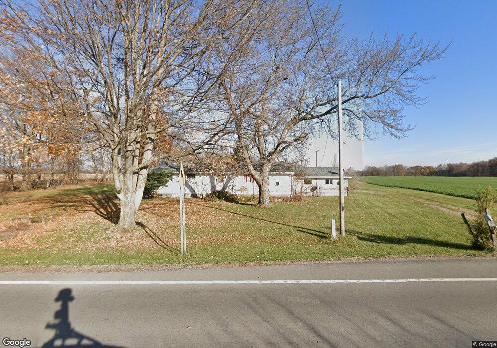
16882 State Route 117 Waynesfield, OH 45896
Estimated Value: $120,286 - $226,000
3
Beds
1
Bath
1,508
Sq Ft
$109/Sq Ft
Est. Value
About This Home
This home is located at 16882 State Route 117, Waynesfield, OH 45896 and is currently estimated at $164,322, approximately $108 per square foot. 16882 State Route 117 is a home located in Hardin County with nearby schools including Upper Scioto Valley Elementary School, Upper Scioto Valley Middle School, and Upper Scioto Valley High School.
Ownership History
Date
Name
Owned For
Owner Type
Purchase Details
Closed on
Oct 1, 1999
Bought by
Boutwell Grover D
Current Estimated Value
Purchase Details
Closed on
Mar 7, 1994
Bought by
Jordan Todd and Jordan Vonda
Purchase Details
Closed on
Aug 31, 1993
Bought by
Coburn Sherman R and Coburn Paxto
Purchase Details
Closed on
Mar 3, 1988
Create a Home Valuation Report for This Property
The Home Valuation Report is an in-depth analysis detailing your home's value as well as a comparison with similar homes in the area
Home Values in the Area
Average Home Value in this Area
Purchase History
| Date | Buyer | Sale Price | Title Company |
|---|---|---|---|
| Boutwell Grover D | $65,000 | -- | |
| Jordan Todd | -- | -- | |
| Coburn Sherman R | -- | -- | |
| -- | $36,900 | -- |
Source: Public Records
Tax History Compared to Growth
Tax History
| Year | Tax Paid | Tax Assessment Tax Assessment Total Assessment is a certain percentage of the fair market value that is determined by local assessors to be the total taxable value of land and additions on the property. | Land | Improvement |
|---|---|---|---|---|
| 2024 | $686 | $27,470 | $7,000 | $20,470 |
| 2023 | $686 | $27,470 | $7,000 | $20,470 |
| 2022 | $731 | $26,170 | $5,460 | $20,710 |
| 2021 | $770 | $26,170 | $5,460 | $20,710 |
| 2020 | $780 | $26,170 | $5,460 | $20,710 |
| 2019 | $587 | $22,820 | $5,250 | $17,570 |
| 2018 | $590 | $22,820 | $5,250 | $17,570 |
| 2017 | $550 | $22,820 | $5,250 | $17,570 |
| 2016 | $496 | $21,550 | $4,730 | $16,820 |
| 2015 | $761 | $21,550 | $4,730 | $16,820 |
| 2014 | $496 | $21,550 | $4,730 | $16,820 |
| 2013 | $522 | $22,310 | $4,730 | $17,580 |
Source: Public Records
Map
Nearby Homes
- 16949 Township Road 39
- 2444 County Road 200
- 16161 Ash Ave
- 14918 Township Road 55
- 16235 Maple Ave
- 15527 State Route 235
- 16074 Buckeye Ave
- 15858 Hickory Ave
- 15848 Barnes Dr
- 11262 Northlake Dr
- 11455 Oak St
- 10998 Township Road 293
- 11377 Township Rd 266 Unit 66
- 11377 Township Rd 266 Unit 30
- 11377 Township Rd 266 Unit 59
- 11377 Township Road 266 Unit 3
- 11377 Township Road 266 Unit 59
- 11377 Township Road 266 Unit 99
- 11377 Township Road 266 Unit 77
- 11377 Township Road 266 Unit 34
- 16869 State Route 117
- 16953 State Route 117
- 16805 State Route 117
- 1475 Township Road 180
- 1399 Township Road 180
- 1337 Township Road 180
- 17235 State Route 117
- 11195 Township Road 293 # 415
- 16250 State Route 235
- 867 Tr 180
- XXX Sr 117
- 16098 Sr 235 N #3 Unit 3
- 17226 State Route 235
- 1694 State Route 67
- 1488 State Route 67
- XXX State Route
- 16108 State Route 235
- 17704 Ohio 117
- 17704 Ohio 117