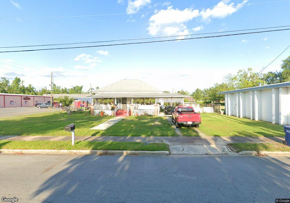
16883 NE Pear St Blountstown, FL 32424
Estimated Value: $123,000 - $151,000
--
Bed
--
Bath
1,734
Sq Ft
$78/Sq Ft
Est. Value
About This Home
This home is located at 16883 NE Pear St, Blountstown, FL 32424 and is currently estimated at $135,310, approximately $78 per square foot. 16883 NE Pear St is a home located in Calhoun County.
Ownership History
Date
Name
Owned For
Owner Type
Purchase Details
Closed on
Jan 12, 2024
Sold by
Stewart Delilah and Stewart Allen
Bought by
Stewart Delilah
Current Estimated Value
Purchase Details
Closed on
Sep 18, 2018
Sold by
Segar Aline and Hall Joseph L
Bought by
Stewart Allen and Stewart Delilah
Purchase Details
Closed on
Jul 26, 2010
Sold by
Segar Aline and Segar William E
Bought by
Segar Aline H and Hall Joseph L
Purchase Details
Closed on
Oct 9, 2006
Sold by
Atkins Janie E
Bought by
Segar Aline and Segar William E
Create a Home Valuation Report for This Property
The Home Valuation Report is an in-depth analysis detailing your home's value as well as a comparison with similar homes in the area
Home Values in the Area
Average Home Value in this Area
Purchase History
| Date | Buyer | Sale Price | Title Company |
|---|---|---|---|
| Stewart Delilah | $100 | None Listed On Document | |
| Stewart Delilah | $100 | None Listed On Document | |
| Stewart Allen | $70,000 | Calhoun Liberty Abstract Co | |
| Segar Aline H | -- | None Available | |
| Segar Aline | -- | None Available |
Source: Public Records
Tax History Compared to Growth
Tax History
| Year | Tax Paid | Tax Assessment Tax Assessment Total Assessment is a certain percentage of the fair market value that is determined by local assessors to be the total taxable value of land and additions on the property. | Land | Improvement |
|---|---|---|---|---|
| 2024 | -- | $25,322 | -- | -- |
| 2023 | -- | $24,584 | $0 | $0 |
| 2022 | $0 | $23,868 | $0 | $0 |
| 2021 | $0 | $23,173 | $0 | $0 |
| 2020 | $0 | $22,853 | $0 | $0 |
| 2019 | $0 | $25,229 | $0 | $0 |
| 2018 | $0 | $24,717 | $0 | $0 |
| 2017 | $0 | $24,209 | $0 | $0 |
| 2016 | -- | $23,711 | $0 | $0 |
| 2015 | -- | $23,546 | $0 | $0 |
| 2014 | -- | $23,359 | $0 | $0 |
Source: Public Records
Map
Nearby Homes
- XX2 Tupelo Ave
- 20777 SE Fannin Ave
- TBD Florida 71
- 16619 SW Gaskin St
- 16500 SE Pear St
- 16590 Gaskin St
- 25541 Pennington Ave
- 20994 SE Martin Luther King Ave
- 517 Gadsden St
- 20077 W Central Ave
- 0 Florida 71 Unit Lots 46 & 47 657795
- 16302 SW Mimosa St
- 20158 NW Evans Ave
- 19974 SW Sherry Ave
- TBD Sr 20 W and 10th St
- 17517 NE Teresa Terrace St
- XXX Cooper St
- TBD Chipola Rd
- 20163 Marie Ave
- 16079 SE Janet St
- 16870 NE Pear St
- 16919 NE Pear St
- 16880 NE Pear St
- 20684 Pear St
- 252 Central Ave Unit 252
- 17313 Main St N
- 17245 Main St N
- 248 E Central Ave Unit 1
- 20634 Central Ave E
- 17353 Main St N
- 0 Florida 20
- 15313 Florida 20
- 00 Florida 20
- 00 Florida 71
- 1 X Unit F
- 17282 Main St N
- 20707 Central Ave E
- 20707 Central Ave E
- 20707 Central Ave E
- 20705 W Central Ave