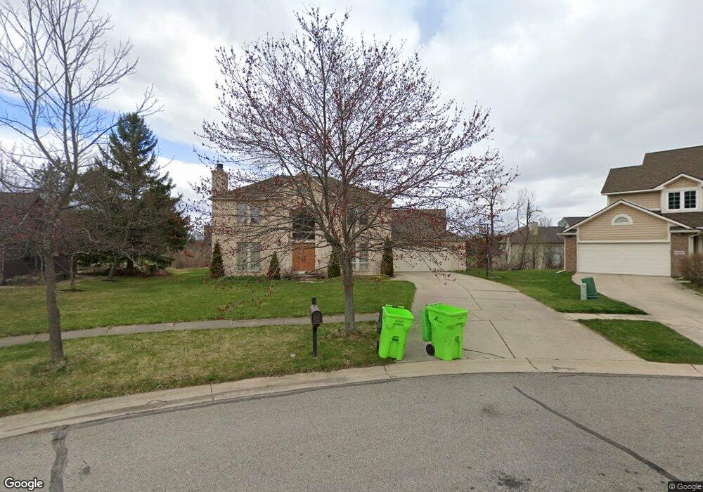
1689 Butterweed Ct Unit 90 Ann Arbor, MI 48103
Estimated Value: $609,761 - $634,000
3
Beds
3
Baths
2,210
Sq Ft
$281/Sq Ft
Est. Value
About This Home
This home is located at 1689 Butterweed Ct Unit 90, Ann Arbor, MI 48103 and is currently estimated at $621,940, approximately $281 per square foot. 1689 Butterweed Ct Unit 90 is a home located in Washtenaw County with nearby schools including Dicken Elementary School, Slauson Middle School, and Pioneer High School.
Ownership History
Date
Name
Owned For
Owner Type
Purchase Details
Closed on
Oct 31, 2005
Sold by
Cendant Mobility Government Financial Se
Bought by
Li Guangyu and Deng Lan
Current Estimated Value
Home Financials for this Owner
Home Financials are based on the most recent Mortgage that was taken out on this home.
Original Mortgage
$230,000
Outstanding Balance
$128,473
Interest Rate
6.36%
Mortgage Type
Fannie Mae Freddie Mac
Estimated Equity
$493,467
Purchase Details
Closed on
May 1, 2005
Sold by
Monroe Michael H and Monroe Susan E
Bought by
Cendant Mobility Government Financial Se
Create a Home Valuation Report for This Property
The Home Valuation Report is an in-depth analysis detailing your home's value as well as a comparison with similar homes in the area
Home Values in the Area
Average Home Value in this Area
Purchase History
| Date | Buyer | Sale Price | Title Company |
|---|---|---|---|
| Li Guangyu | $333,000 | Fatic | |
| Cendant Mobility Government Financial Se | $365,000 | Fatic |
Source: Public Records
Mortgage History
| Date | Status | Borrower | Loan Amount |
|---|---|---|---|
| Open | Li Guangyu | $230,000 |
Source: Public Records
Tax History Compared to Growth
Tax History
| Year | Tax Paid | Tax Assessment Tax Assessment Total Assessment is a certain percentage of the fair market value that is determined by local assessors to be the total taxable value of land and additions on the property. | Land | Improvement |
|---|---|---|---|---|
| 2025 | $5,021 | $301,200 | $0 | $0 |
| 2024 | $4,901 | $296,800 | $0 | $0 |
| 2023 | $4,709 | $274,800 | $0 | $0 |
| 2022 | $6,592 | $243,900 | $0 | $0 |
| 2021 | $6,268 | $238,500 | $0 | $0 |
| 2020 | $6,782 | $234,100 | $0 | $0 |
| 2019 | $6,305 | $221,200 | $221,200 | $0 |
| 2018 | $6,161 | $200,200 | $0 | $0 |
| 2017 | $5,965 | $197,800 | $0 | $0 |
| 2016 | $3,914 | $153,903 | $0 | $0 |
| 2015 | -- | $137,890 | $0 | $0 |
| 2014 | -- | $133,582 | $0 | $0 |
| 2013 | -- | $133,582 | $0 | $0 |
Source: Public Records
Map
Nearby Homes
- 1860 Chicory Ridge
- 1419 N Bay Dr Unit 73
- 1929 Harley Dr
- 1343 Timmins Dr Unit 8
- 1261 Joyce Ln Unit 4
- 1599 Scio Ridge Rd
- 1255 Joyce Ln Unit 1
- 1008 W Summerfield Glen Cir
- 1041 E Summerfield Glen Cir
- 2126 Pauline Blvd Unit 104
- 2124 Pauline Blvd Unit 307
- 922 W Summerfield Glen Cir Unit 110
- 1225 S Maple Rd Unit 307
- 921 E Summerfield Glen Cir Unit 29
- 1235 S Maple Rd Unit 101
- 1235 S Maple Rd Unit 302
- 2120 Pauline Blvd Unit 305
- 1265 S Maple Rd Unit 207
- 2155 Pauline Ct
- 2127 Pauline Ct
- 1695 Butterweed Ct Unit 91
- 1683 Butterweed Ct
- 1662 Chicory Ridge
- 1648 Chicory Ridge
- 1676 Chicory Ridge
- 1663 Snowberry Ridge Rd
- 1701 Butterweed Ct Unit 92
- 1698 Chicory Ridge
- 1649 Snowberry Ridge Rd
- 1714 Chicory Ridge
- 1707 Butterweed Ct
- 1719 Butterweed Ct Unit 95
- 1713 Butterweed Ct
- 1732 Chicory Ridge
- 1686 Snowberry Ridge Rd
- 1657 Wake Robin Ct
- 1672 Snowberry Ridge Rd
- 1700 Snowberry Ridge Rd Unit 61
- 1748 Chicory Ridge
- 1658 Snowberry Ridge Rd Unit 64