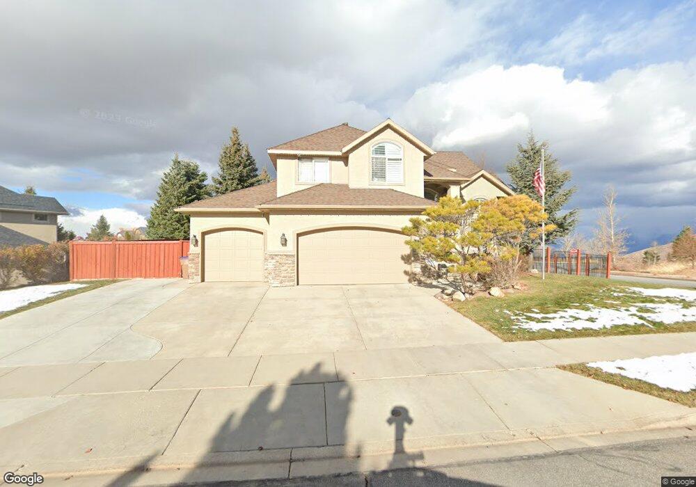
1689 E Amber Crest Ln Draper, UT 84020
Estimated Value: $917,582 - $992,000
5
Beds
4
Baths
4,063
Sq Ft
$233/Sq Ft
Est. Value
About This Home
This home is located at 1689 E Amber Crest Ln, Draper, UT 84020 and is currently estimated at $945,861, approximately $232 per square foot. 1689 E Amber Crest Ln is a home located in Utah County with nearby schools including Ridgeline Elementary School, Timberline Middle School, and Lone Peak High School.
Ownership History
Date
Name
Owned For
Owner Type
Purchase Details
Closed on
May 16, 2022
Sold by
Abrahamson Family Trust
Bought by
Abrahamson Family Trust
Current Estimated Value
Home Financials for this Owner
Home Financials are based on the most recent Mortgage that was taken out on this home.
Original Mortgage
$700,000
Outstanding Balance
$665,281
Interest Rate
5.3%
Mortgage Type
Balloon
Estimated Equity
$280,580
Purchase Details
Closed on
Nov 22, 2019
Sold by
Abrahamson Guy and Abrahamson Julie
Bought by
Abrahamson Guy and Abrahamson Julie
Home Financials for this Owner
Home Financials are based on the most recent Mortgage that was taken out on this home.
Original Mortgage
$444,000
Interest Rate
3.6%
Mortgage Type
New Conventional
Purchase Details
Closed on
Sep 17, 2018
Sold by
Abrahamson Guy and Abrahamson Julie
Bought by
Abrahamson Guy A and Abrahamson Julie S
Home Financials for this Owner
Home Financials are based on the most recent Mortgage that was taken out on this home.
Original Mortgage
$440,000
Interest Rate
5.99%
Mortgage Type
Adjustable Rate Mortgage/ARM
Purchase Details
Closed on
Aug 7, 2018
Sold by
Brookfield Relocation Inc
Bought by
Abrahamson Guy and Abrahamson Julie
Home Financials for this Owner
Home Financials are based on the most recent Mortgage that was taken out on this home.
Original Mortgage
$440,000
Interest Rate
5.99%
Mortgage Type
Adjustable Rate Mortgage/ARM
Purchase Details
Closed on
Aug 3, 2018
Sold by
Stoke Darrell L
Bought by
Brookfield Relocation Inc
Home Financials for this Owner
Home Financials are based on the most recent Mortgage that was taken out on this home.
Original Mortgage
$440,000
Interest Rate
5.99%
Mortgage Type
Adjustable Rate Mortgage/ARM
Purchase Details
Closed on
Mar 10, 2011
Sold by
Grider Jerry and Grider Deborah
Bought by
Stoke Darrell L
Home Financials for this Owner
Home Financials are based on the most recent Mortgage that was taken out on this home.
Original Mortgage
$397,970
Interest Rate
3.79%
Mortgage Type
New Conventional
Purchase Details
Closed on
Sep 24, 2010
Sold by
Kolb Joel E and Kolb Joanne C
Bought by
Grider Jerry and Grider Deborah
Home Financials for this Owner
Home Financials are based on the most recent Mortgage that was taken out on this home.
Original Mortgage
$466,570
Interest Rate
4.28%
Mortgage Type
VA
Create a Home Valuation Report for This Property
The Home Valuation Report is an in-depth analysis detailing your home's value as well as a comparison with similar homes in the area
Home Values in the Area
Average Home Value in this Area
Purchase History
| Date | Buyer | Sale Price | Title Company |
|---|---|---|---|
| Abrahamson Family Trust | -- | New Title Company Name | |
| Abrahamson Guy | -- | Accommodation | |
| Abrahamson Guy | -- | Wasatch Title Ins Agcy Llc | |
| Abrahamson Guy A | -- | None Available | |
| Abrahamson Guy | -- | First American Title | |
| Brookfield Relocation Inc | -- | First American Title | |
| Stoke Darrell L | -- | Investors Title Insurance Co | |
| Grider Jerry | -- | Equity Title West Jordan |
Source: Public Records
Mortgage History
| Date | Status | Borrower | Loan Amount |
|---|---|---|---|
| Open | Abrahamson Family Trust | $700,000 | |
| Previous Owner | Abrahamson Guy | $444,000 | |
| Previous Owner | Abrahamson Guy | $440,000 | |
| Previous Owner | Stoke Darrell L | $397,970 | |
| Previous Owner | Grider Jerry | $466,570 |
Source: Public Records
Tax History
| Year | Tax Paid | Tax Assessment Tax Assessment Total Assessment is a certain percentage of the fair market value that is determined by local assessors to be the total taxable value of land and additions on the property. | Land | Improvement |
|---|---|---|---|---|
| 2025 | $3,900 | $418,880 | -- | -- |
| 2024 | $3,900 | $408,870 | $0 | $0 |
| 2023 | $3,717 | $419,870 | $0 | $0 |
| 2022 | $3,857 | $424,930 | $0 | $0 |
| 2021 | $3,394 | $585,900 | $220,100 | $365,800 |
| 2020 | $3,214 | $541,900 | $176,100 | $365,800 |
| 2019 | $2,978 | $520,800 | $176,100 | $344,700 |
| 2018 | $2,804 | $465,500 | $165,800 | $299,700 |
| 2017 | $2,766 | $244,420 | $0 | $0 |
| 2016 | $2,757 | $228,305 | $0 | $0 |
| 2015 | $2,901 | $226,435 | $0 | $0 |
| 2014 | $2,634 | $214,995 | $0 | $0 |
Source: Public Records
Map
Nearby Homes
- 1536 E Trail Crest Ct
- 1565 E Trail Crest Ct Unit 18
- 1468 E Trail Crest Ct
- 1492 E Meadow Bluff Ln Unit 48
- 1463 Meadow Bluff Ln Unit 66
- 1871 E Vista Ridge Ct
- 1459 E Meadow Bluff Ln
- 1907 Aspen Leaf Place
- 14849 S Saddle Leaf Ct
- 1263 E Wild Maple Ct
- 14767 S Invergarry Ct
- 1370 E Meadow Valley Dr
- 15219 Eagle Crest Dr Unit 141
- 2159 Bald Eagle Ct
- 2158 Bald Eagle Ct
- 2116 Falcon Ridge Dr
- 14798 S Glacial Peak Dr
- 15193 S Eagle Crest Dr Unit 141
- 14948 S Springtime Rd
- 14833 S Springtime Rd
- 1689 E Amber Crest Ln
- 1671 Amber Crest Ln
- 15111 Longbranch Dr
- 15111 S Longbranch Dr
- 15142 S Longbranch Dr
- 15142 S Longbranch Dr
- 1680 E Amber Crest Ln
- 1655 E Amber Crest Ln
- 1680 E Amber Crest Ln
- 15129 Longbranch Dr
- 15129 S Longbranch Dr
- 1670 Amber Crest Ln
- 15110 S Auburn Ridge Ln
- 15110 Auburn Ridge Ln
- 15154 S Longbranch Dr
- 1645 E Amber Crest Ln
- 1645 E Amber Crest Ln
- 15154 S Longbranch Dr
- 1654 Amber Crest Ln
- 15120 Auburn Ridge Ln
Your Personal Tour Guide
Ask me questions while you tour the home.