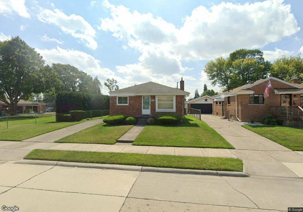
16892 Chesterfield Ave Eastpointe, MI 48021
Estimated Value: $147,764 - $197,000
2
Beds
1
Bath
967
Sq Ft
$178/Sq Ft
Est. Value
About This Home
This home is located at 16892 Chesterfield Ave, Eastpointe, MI 48021 and is currently estimated at $172,191, approximately $178 per square foot. 16892 Chesterfield Ave is a home located in Macomb County with nearby schools including Forest Park Elementary School, Eastpointe Middle School, and Reach Charter Academy.
Ownership History
Date
Name
Owned For
Owner Type
Purchase Details
Closed on
Jun 18, 2004
Sold by
Maniaci Grace L and Maniaci Leo I
Bought by
Franczek Gregory
Current Estimated Value
Create a Home Valuation Report for This Property
The Home Valuation Report is an in-depth analysis detailing your home's value as well as a comparison with similar homes in the area
Home Values in the Area
Average Home Value in this Area
Purchase History
| Date | Buyer | Sale Price | Title Company |
|---|---|---|---|
| Franczek Gregory | $127,000 | Metropolitan Title Company |
Source: Public Records
Tax History Compared to Growth
Tax History
| Year | Tax Paid | Tax Assessment Tax Assessment Total Assessment is a certain percentage of the fair market value that is determined by local assessors to be the total taxable value of land and additions on the property. | Land | Improvement |
|---|---|---|---|---|
| 2025 | $1,999 | $72,600 | $0 | $0 |
| 2024 | $1,879 | $68,800 | $0 | $0 |
| 2023 | $1,820 | $62,600 | $0 | $0 |
| 2022 | $1,888 | $53,200 | $0 | $0 |
| 2021 | $1,860 | $46,800 | $0 | $0 |
| 2020 | $1,776 | $42,900 | $0 | $0 |
| 2019 | $1,775 | $35,900 | $0 | $0 |
| 2018 | $1,825 | $32,270 | $0 | $0 |
| 2017 | $1,688 | $29,720 | $4,210 | $25,510 |
| 2016 | $1,674 | $29,720 | $0 | $0 |
| 2015 | $1,221 | $26,220 | $0 | $0 |
| 2013 | $1,335 | $25,740 | $0 | $0 |
Source: Public Records
Map
Nearby Homes
- 16850 May St
- 24656 Dwight Ave
- 24707 Saxony Ave
- 24860 Saxony Ave
- 17175 Bell Ave
- 17225 Bell Ave
- 24676 Lambrecht Ave
- 16619 Waterman Dr
- 17121 Wilson Ave
- 17174 Forest Ave
- 24267 Shakespeare Ave
- 24300 Melrose Ave
- 16923 Stephens Dr
- 24924 Tuscany Ave
- 24646 Tuscany Ave
- 24228 Melrose Ave
- 25124 Blair St
- 16106 Chesterfield Ave
- 16123 Bell Ave
- 17100 Stephens Dr
- 16882 Chesterfield Ave
- 16872 Chesterfield Ave
- 16923 Hauss Ave
- 24747 Cushing Ave
- 24737 Cushing Ave
- 16913 Hauss Ave Unit Bldg-Unit
- 16913 Hauss Ave
- 16913 Hauss Ave
- 16933 Hauss Ave
- 16903 Hauss Ave
- 16943 Hauss Ave
- 24803 Cushing Ave
- 16895 Chesterfield Ave
- 16887 Chesterfield Ave
- 16879 Chesterfield Ave
- 16869 Chesterfield Ave
- 24819 Cushing Ave
- 16953 Hauss Ave
- 16873 Hauss Ave