
Seller's Agent in 2025
Deb Kenney
Berkshire Hathaway HomeServices Robert Paul Properties
(508) 776-2048
1 in this area
65 Total Sales
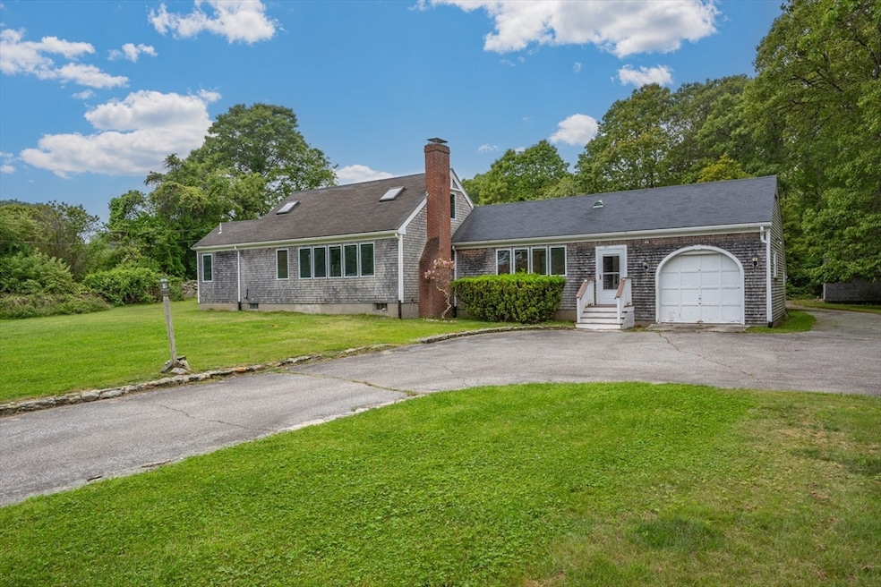
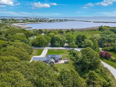
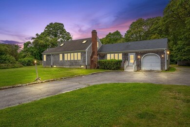
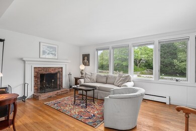
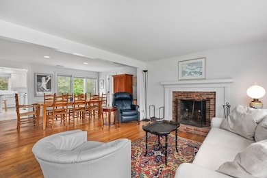
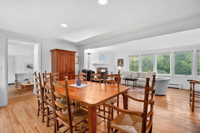
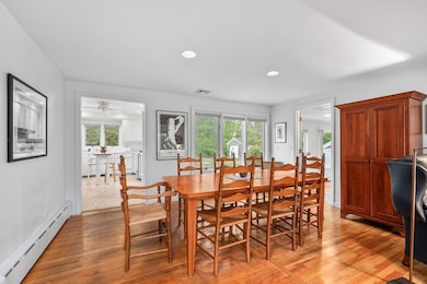
Welcome to this lovely home offering over 2,000 sq.ft. of living space, perfectly nestled on 1.4 picturesque acres in the highly desirable Acoaxet area of Westport. Step inside to find gleaming hardwood floors throughout,spacious family room with custom built-ins, inviting living room with fireplace with open dining area that flows into a light-filled kitchen. The first-floor primary suite offers privacy with full bath, while a versatile bonus room/den provides space for a home office or guests and centrally located full bath completes the main level. Upstairs, you’ll find two additional bedrooms and a third full bath. Expansive windows throughout the home bring the outside in, showcasing the serene grounds. Additional highlights include: upgraded septic system, expansive deck and patio, attached one-car garage, house generator, outbuilding for storage/work shop. Whether fulltime or seasonal residence, don't miss this rare opportunity to make this gem your own in Westports's finest!
Last Agent to Sell the Property
Berkshire Hathaway HomeServices Robert Paul Properties Listed on: 06/04/2025
| Date | Type | Sale Price | Title Company |
|---|---|---|---|
| Quit Claim Deed | $1,605,000 | -- | |
| Quit Claim Deed | $1,605,000 | -- | |
| Quit Claim Deed | $1,605,000 | -- | |
| Deed | $322,500 | -- | |
| Deed | $322,500 | -- |
| Date | Status | Loan Amount | Loan Type |
|---|---|---|---|
| Previous Owner | $31,500 | No Value Available | |
| Previous Owner | $80,000 | No Value Available |
| Date | Event | Price | List to Sale | Price per Sq Ft |
|---|---|---|---|---|
| 07/18/2025 07/18/25 | Sold | $1,605,000 | +7.4% | $790 / Sq Ft |
| 06/13/2025 06/13/25 | Pending | -- | -- | -- |
| 06/04/2025 06/04/25 | For Sale | $1,495,000 | -- | $736 / Sq Ft |
| Year | Tax Paid | Tax Assessment Tax Assessment Total Assessment is a certain percentage of the fair market value that is determined by local assessors to be the total taxable value of land and additions on the property. | Land | Improvement |
|---|---|---|---|---|
| 2025 | $9,125 | $1,224,800 | $866,200 | $358,600 |
| 2024 | $8,921 | $1,154,100 | $802,700 | $351,400 |
| 2023 | $8,983 | $1,100,900 | $764,500 | $336,400 |
| 2022 | $8,458 | $1,050,500 | $764,500 | $286,000 |
| 2021 | $8,458 | $981,200 | $695,200 | $286,000 |
| 2020 | $7,622 | $904,100 | $667,400 | $236,700 |
| 2019 | $7,408 | $895,800 | $667,400 | $228,400 |
| 2018 | $5,051 | $902,500 | $695,200 | $207,300 |
| 2017 | $7,176 | $900,400 | $690,200 | $210,200 |
| 2016 | $7,061 | $892,700 | $690,200 | $202,500 |
| 2015 | $6,504 | $820,200 | $625,200 | $195,000 |
Seller's Agent in 2025
Deb Kenney
Berkshire Hathaway HomeServices Robert Paul Properties
(508) 776-2048
1 in this area
65 Total Sales
Buyer's Agent in 2025
Jennifer DaPonte
Berkshire Hathaway HomeServices Robert Paul Properties
(774) 526-0984
3 in this area
121 Total Sales
Source: MLS Property Information Network (MLS PIN)
MLS Number: 73385196
APN: WPOR-000088-000000-000049
Disclaimer: Certain information contained herein is derived from information provided by parties other than Homes.com. All information provided is deemed reliable, but is not guaranteed to be accurate and should be independently verified.
![]() The property listing data and information, or the Images, set forth herein were provided to MLS Property Information Network, Inc. from third party sources, including sellers, lessors and public records, and were compiled by MLS Property Information Network, Inc. The property listing data and information, and the Images, are for the personal, non-commercial use of consumers having a good faith interest in purchasing or leasing listed properties of the type displayed to them and may not be used for any purpose other than to identify prospective properties which such consumers may have a good faith interest in purchasing or leasing. MLS Property Information Network, Inc. and its subscribers disclaim any and all representations and warranties as to the accuracy of the property listing data and information, or as to the accuracy of any of the Images, set forth herein.
The property listing data and information, or the Images, set forth herein were provided to MLS Property Information Network, Inc. from third party sources, including sellers, lessors and public records, and were compiled by MLS Property Information Network, Inc. The property listing data and information, and the Images, are for the personal, non-commercial use of consumers having a good faith interest in purchasing or leasing listed properties of the type displayed to them and may not be used for any purpose other than to identify prospective properties which such consumers may have a good faith interest in purchasing or leasing. MLS Property Information Network, Inc. and its subscribers disclaim any and all representations and warranties as to the accuracy of the property listing data and information, or as to the accuracy of any of the Images, set forth herein.