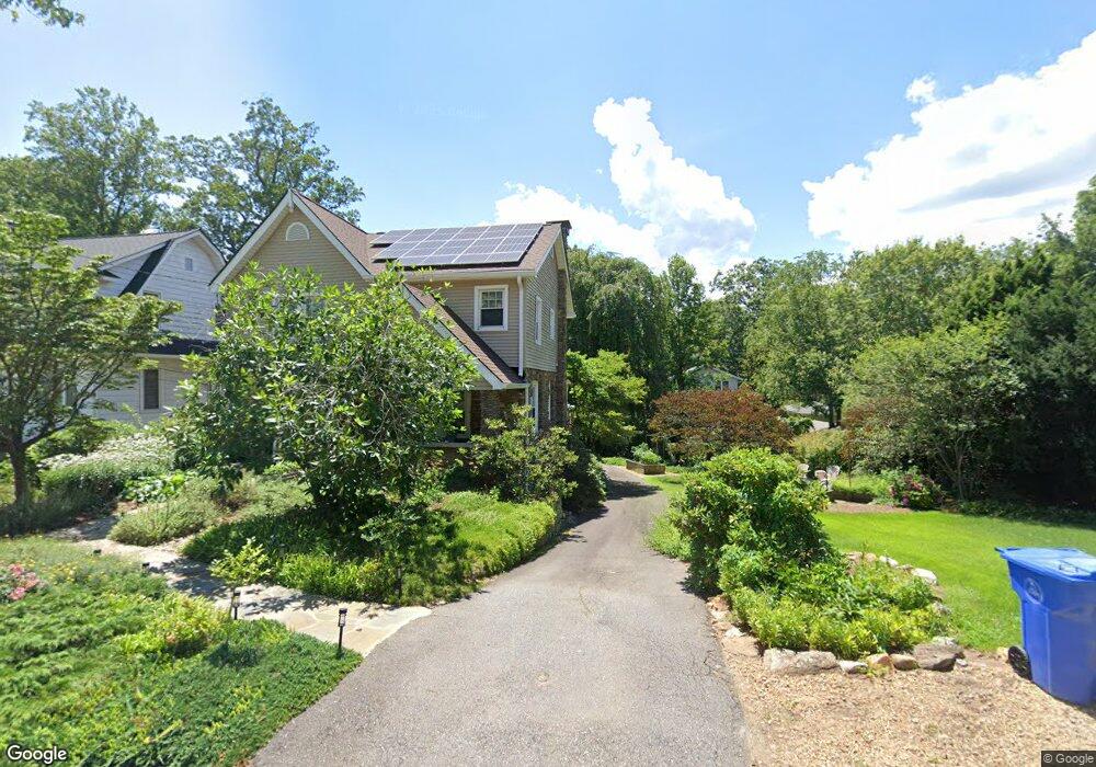
169 Brucemont Cir Asheville, NC 28806
West Asheville NeighborhoodEstimated Value: $526,000 - $737,000
3
Beds
3
Baths
1,980
Sq Ft
$342/Sq Ft
Est. Value
About This Home
This home is located at 169 Brucemont Cir, Asheville, NC 28806 and is currently estimated at $677,987, approximately $342 per square foot. 169 Brucemont Cir is a home located in Buncombe County with nearby schools including Hall Fletcher Elementary, Isaac Dickson Elementary, and Ira B Jones Elementary.
Ownership History
Date
Name
Owned For
Owner Type
Purchase Details
Closed on
Oct 4, 2001
Sold by
Cecil Development Group Inc
Bought by
Berkey David
Current Estimated Value
Home Financials for this Owner
Home Financials are based on the most recent Mortgage that was taken out on this home.
Original Mortgage
$340,000
Interest Rate
6.89%
Purchase Details
Closed on
Jan 7, 2000
Sold by
Adams Steven R and Adams Vivian R
Bought by
Berkey David A
Purchase Details
Closed on
May 14, 1999
Sold by
Skadberg Vookles Charles H and Skadberg Vookles Frances
Bought by
Berkey David A
Create a Home Valuation Report for This Property
The Home Valuation Report is an in-depth analysis detailing your home's value as well as a comparison with similar homes in the area
Home Values in the Area
Average Home Value in this Area
Purchase History
| Date | Buyer | Sale Price | Title Company |
|---|---|---|---|
| Berkey David | $305,500 | -- | |
| Berkey David A | $175,000 | -- | |
| Berkey David A | $130,000 | -- |
Source: Public Records
Mortgage History
| Date | Status | Borrower | Loan Amount |
|---|---|---|---|
| Closed | Berkey David | $340,000 |
Source: Public Records
Tax History Compared to Growth
Tax History
| Year | Tax Paid | Tax Assessment Tax Assessment Total Assessment is a certain percentage of the fair market value that is determined by local assessors to be the total taxable value of land and additions on the property. | Land | Improvement |
|---|---|---|---|---|
| 2025 | $4,614 | $446,600 | $105,800 | $340,800 |
| 2024 | $4,614 | $446,600 | $105,800 | $340,800 |
| 2023 | $4,614 | $440,400 | $105,800 | $334,600 |
| 2022 | $4,392 | $440,400 | $0 | $0 |
| 2021 | $4,392 | $440,400 | $0 | $0 |
| 2020 | $4,019 | $372,900 | $0 | $0 |
| 2019 | $4,019 | $372,900 | $0 | $0 |
Source: Public Records
Map
Nearby Homes
- 197 Brucemont Cir
- 74 Brucemont Cir
- 141 Louisiana Ave
- 60 Dorchester Ave
- 54 Louisiana Ave
- 55 Herron Ave
- 7 Mauricet Ln
- 27 Mauricet Ln
- 5 Orrinel Way
- 18 Jarrett St
- 31 Oakwood St
- 37 Bryant St
- 18 Sand Hill Rd
- 20 Cloyes St
- 30 Sand Hill Rd
- 52 Boyd Ave
- 113 Burton St
- 68 1/2 Nevada Ave
- 75 Nevada Ave
- 56 Brevard Rd
- 173 Brucemont Cir
- 167 Brucemont Cir
- 179 Brucemont Cir
- 113 Louisiana Ave
- 117 Louisiana Ave
- 183 Brucemont Cir
- 125 Louisiana Ave
- 168 Brucemont Cir
- 174 Brucemont Cir
- 105 Louisiana Ave
- 164 Brucemont Cir
- 163 Brucemont Cir
- 158 Brucemont Cir
- 180 Brucemont Cir
- 187 Brucemont Cir
- 133 Louisiana Ave
- 152 Brucemont Cir
- 97 Louisiana Ave
- 149 Brucemont Cir
- 193 Brucemont Cir